Elevation: 6,530 ft
Prominence: 340

This peak is not in the book. Published November 2024
Peak 6530 sits just south of Brush Creek Road (a well-maintained county road) in the Blackfoot Mountains. It towers above the powerful Blackfoot River and Morgan Bridge. It can be climbed from the northeast entirely on BLM land. USGS Dunn Basin

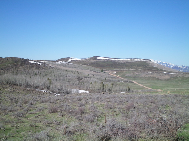
Peak 6530 (in the distance) as viewed from the east. The hump in dead center is the high point. Livingston Douglas Photo
Access
From Exit 116 (Sunnyside Road) on I-15 in Idaho Falls, drive east on Sunnyside Road to its end at a signed “T” junction with Bone Road. This junction is 9.1 miles east of Ammon Road. Turn right/south onto Bone Road and drive 8.5 miles south to a signed junction with Blackfoot Reservoir Road, 0.3 miles south of Bone. Turn right/west onto Blackfoot Reservoir Road. The road quickly bends left/south and begins its journey to Blackfoot Reservoir. Drive 15.7 miles on Blackfoot Reservoir Road to a signed junction with Paradise Road (labeled as Brush Creek Road on the USGS topo map) at Four Corners.
Turn right/southwest onto Paradise Road and drive 6.7 miles to asigned junction with Brush Creek Road. Go left/southwest then west on Brush Creek Road for 4.1 miles to a minor crest in the road just after a sharp right/northwest turn in the road. Park in a nice pullout on this road crest (6,270 feet and 43⁰03’43”N, 111⁰53’54”W).
A shorter way to reach this pullout is from Morgan Bridge on the Blackfoot River, just east of a road junction with Trail Creek Road. Drive about 2-1/2 miles east up Brush Creek Road from Morgan Bridge to reach the aforementioned road crest/pullout. Driving directions on how to reach Trail Creek Road from Wolverine Road and Blackfoot River Road (via US-91 south of Firth) is detailed under the access section for Peak 7026.
Alternate Access
If driving up from the south (i.e., ID-34), here are the driving directions. From ID-34 at the southeast corner of Blackfoot Reservoir, turn left/west onto [signed] China Cap Road and drive 4.0 miles to its end at a “T” junction with [signed] Government Dam Road. Turn right/north onto Government Dam Road and drive 17.3 miles to a major signed junction at the northwest corner of Blackfoot Reservoir.
Continue north on Blackfoot Reservoir Road (signed for Idaho Falls) and drive 4.8 miles to a signed junction with Paradise Road. Turn left/west onto Paradise Road and drive 6.7 miles to the aforementioned signed road junction with Brush Creek Road. Follow the above access information from there.
Northeast Face, Class 2
The Climb
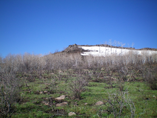
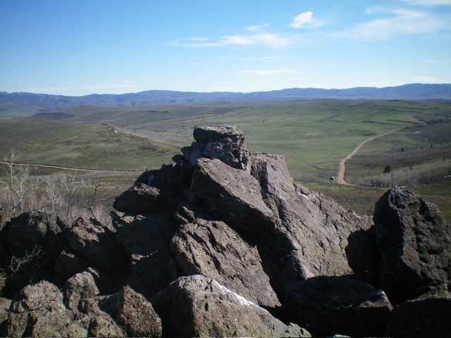
From the road crest/pullout, bushwhack southwest up through a patch of thick-ish trees then scramble southwest directly at the rocky high point, which is middle of three potential high points on the ridge. Coming at the ridge from the northeast, you will only see the two northernmost high points. Aim for the rocky hump to the left/south. There is another ridge hump even farther south on the ridge, but it is not visible on this climb from the northeast. The terrain is a bit charred from a fire. It has some brush and dead standing snags but the bushwhack is not too onerous. There is a nice cairn atop the summit.
Additional Resources
Regions: Blackfoot Mountains->SOUTHERN IDAHO
Mountain Range: Blackfoot Mountains
Longitude: -111.9018 Latitude: 43.0585

