Elevation: 6,667 ft
Prominence: 687

This peak is not in the book. Published December 2019
Peak 6667 is a ranked summit that lies southeast of Pine Mountain. It is hidden from view by Pine Mountain (and its south ridge) to the west. Peak 6667 sit at the head of the Huff Creek drainage. It is a gentle summit and is most easily climbed via its north ridge. USGS Fish Creek Reservoir

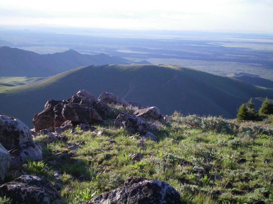
Gentle Peak 6667 (in the middle of the photo) as viewed from the summit of Pine Mountain. Livingston Douglas Photo
North Ridge, Class 2
Access
Same as for the west ridge of Pine Mountain. This route is the final leg of a traverse from Pine Mountain to Peak 6667.
The Climb
From the small saddle at the base of the north ridge, scramble southeast up through thick sagebrush to quickly reach the crest of the north ridge. The scrub is considerably thinner and shorter on the ridge. Scramble south up the rounded ridge on easy, short scrub. Skirt around a few rocky outcrops as you gain altitude. The summit area of Peak 6667 is elongated, flat, and open. There is a decent cairn on the high point, which is located at the southwest end of the narrow summit area.
West Face, Class 2
Access
Same as for the north ridge. This route is the next leg of a loop route that begins and ends on Fish Creek Road.
The Descent
From the summit, descend northwest on a minor shoulder. Leave this shoulder to descend left/southwest to the Huff Creek drainage below. The terrain on the west face is reasonable scrub and scree/gravel. Find an overgrown 2-track jeep road in the drainage and follow it downstream to an old, barely-visible road junction at the base of a gully that leads up to an obvious saddle on the south ridge of Pine Mountain. The next leg of this journey begins here.
Additional Resources
Regions: EASTERN IDAHO->Pioneer Mountains
Mountain Range: Pioneer Mountains
Longitude: -113.77259 Latitude: 43.40279