Elevation: 6,708 ft
Prominence: 328

This peak is not in the book. Published November 2019
Peak 6708 is the third of three ranked summits in the hills south of Rattlesnake Peak in the South Hawkins Creek Valley. It is located southwest of Peak 6910 and is entirely on private land. Be sure to obtain permission from the landowner before tackling this peak. Peak 6708 is double-humped. The southwest summit is the high point. USGS Dairy Creek

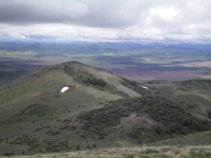
The summit of Peak 6708 as viewed from the top of Peak 6910. The forested hump in the lower right is Point 6550. The summit is left-of-center, farther away, and is mostly in open terrain. Livingston Douglas Photo
Northeast Face, Class 2
Access
Same as for the north ridge of Peak 6840. This is the final leg of a ridge traverse from Peak 6840 to Peak 6910 to Peak 6708.
The Climb
The climb begins at the connecting saddle with Peak 6910. From the saddle, scramble up through a short section of open scrub then bushwhack through a forest of aspens and mountain mahogany trees to skirt the southeast side of Point 6550. Continue southwest up the final face section of open scrub/grass. Near the top, work your way through mountain mahogany to reach the narrow, ridge-crest summit. The summit of Peak 6708 is a rocky high point with mountain mahogany mixed in with the narrow, rocky ridge rock. There was no summit cairn on top. Descend back to the saddle and climb the west face of Peak 6910 to return to your parked vehicle along FSR-039/South Fork Road.
Additional Resources
Regions: Bannock Range->SOUTHERN IDAHO
Mountain Range: Bannock Range
Longitude: -112.37629 Latitude: 42.47889