Elevation: 6,780 ft
Prominence: 320

This peak is not in the book. Published November 2022
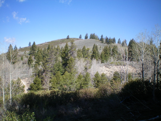
Peak 6780 is a seldom-climbed peak that is located on the north side of FSR-007 in the Soldier Mountains. It sits above Hearn Creek and is hidden by nearby peaks of similar height. It is most easily climbed from FSR-007, though there are ATV/Jeep Roads (some unmapped) that can get you to the base of the southeast ridge at a saddle and shorten the hike. USGS Deer Mountain
Access
Please refer to the Chimney Creek Road access page. From its well-signed “trailhead,” drive up Chimney Creek Road for 4.0 miles to a “T” junction. Turn left/west onto [unsigned] FSR-007 and drive 0.9 miles west to a gated closure. Park here (6,520 feet). GPS coordinates: 43⁰25’28”N, 115⁰02’43”W.
Southeast Ridge, Class 2
The Climb
From the road closure gate, cross the gate and hike briefly on FSR-007 then take two unsigned right turns onto 2-track roads (not shown on maps), the latter of which leads up to a ridge saddle just west of Point 6710. You can also reach this saddle by following the fence row from the road closure gate as it heads north to the saddle (this fence row is shown on the USGS topo map). However, this option requires a thick forest bushwhack, albeit a short one. I did the latter on my ascent and the former on my descent.
From the ridge saddle, descend north diagonally through a thick pine forest to reach a hidden ridge saddle at the base of the southeast ridge of Peak 6780. This second saddle is at 6,460 feet. It is impossible to see and difficult to find in the thick forest. Fortunately, if you come out a bit left or right of the saddle, there is a decent ATV/jeep road coming up to the saddle from the both sides so you may have a short walk to reach the saddle as I did. From Saddle #2, bushwhack northwest up through a mix of aspens and pines to reach open sagebrush. Higher up, bash through a wicked, thick section of willows to reach the open summit of Peak 6780. There is no summit cairn and no documentation of previous ascent.
Additional Resources
Regions: Soldier Mountains->WESTERN IDAHO
Mountain Range: Soldier Mountains
Longitude: -115.05089 Latitude: 43.43302
