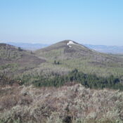
Elevation: 6,822 ft
Prominence: 362

This peak is not in the book. Published November 2024
Peak 6822 is one of several ranked summits in the northern ramparts of the Caribou Range. It sits above Meadow Creek to its north and Trail Creek to its south. This area is a mix of private and public land, so be careful. This climb is entirely on State of Idaho land. USGS Point Lookout
Access
From US-26 exactly 24.1 miles east of the Idaho Falls Caribou-Targhee National Forest Service Office, turn right/south onto [signed] Antelope Creek Road and reset your odometer. At 3.1 miles, go left at an unsigned junction. At 6.0 miles, go right at an unsigned junction. At 6.9 miles, go right/north at an unsigned “T” junction.
At 10.0 miles, the road reaches an unsigned junction with Trail Creek Road. Go left/south onto Trail Creek Road (a public access road through private land). At 11.8 miles, reach a minor, improvised pullout just after leaving private land at a bend in the road at a drainage. This pullout is at 6,300 feet and 43⁰27’25”N, 111⁰37’31”W. Antelope Creek Road is a badly rutted dirt road so be advised. Do not drive it in wet conditions.
Southwest Shoulder, Class 2
The Climb
From the improvised roadside pullout, bushwhack northeast up a face (which quickly becomes a shoulder) of thick-ish scrub, finding some gaps and patches of talus/scree to help expedite the ascent. Be sure to stay right/east of posted private land on the west side of the initial gully and Point 6525. There are also a few game trails/lanes in the scrub.
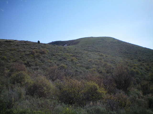
The shoulder bends left-ish/north to approach a ridge hump with a massive rock shelter on it. Angle diagonally right/northeast to skirt it and bushwhack through reasonable scrub to reach a ridge saddle after skirting another ridge hump. Find horizontal and/or diagonal game trails that lead to the saddle and skirt both ridge points. Once at this saddle, scramble east then northeast up easy, short scrub to reach the cairned summit.

The final push up the southwest shoulder. The summit is well left of center on the high ridgeline. Livingston Douglas Photo
Additional Resources
Regions: Caribou Range->SOUTHERN IDAHO
Mountain Range: Caribou Range
Longitude: -111.6183 Latitude: 43.4626

