Elevation: 6,826 ft
Prominence: 436

This peak is not in the book. Published November 2024
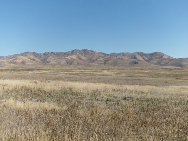
Peak 6826 sits atop a high ridge on the east side of the Portneuf Valley and directly south of Little Flat Canyon in the Chesterfield Range. This area is a mix of private and public land, so be careful. This climb is entirely on BLM land. USGS Hatch
Access
From US-30 east of Lava Hot Springs (at virtual MM378.5), drive up the [paved] Lund Highway to Bancroft. Leave the highway at Bancroft and head north up [paved] Chesterfield Road for several miles to a signed junction with Hatch Loop Road. Turn right/east onto Hatch Loop Road and drive 1.9 miles to a sharp left/north turn in the road and a signed junction with Little Flat Road. Go straight/east onto Little Flat Road and drive 1.6 miles to the BLM boundary at a wire cattle gate crossing. Park just inside the gate on BLM land in a nice parking area (5,780 feet and 42⁰48’31”N, 111⁰49’04”W). Little Flat Road is a decent county 2-track road to the BLM boundary where it turns into a dirt/mud 2-track that is a mess.
West Spur/Northwest Ridge, Class 2+
The Climb
From the parking area, head east along the left/north side of a fence row that separates BLM land from private ranch land. The fence row climbs up a steep face of thick scrub and eventually ends. After it ends, bushwhack right/south across and diagonally up grass/scrub to intercept the magnificent west spur. Follow this spur left/east up a mix of grass/scrub, rocky outcrops, and scattered mountain mahogany to quickly reach a junction with the northwest ridge.
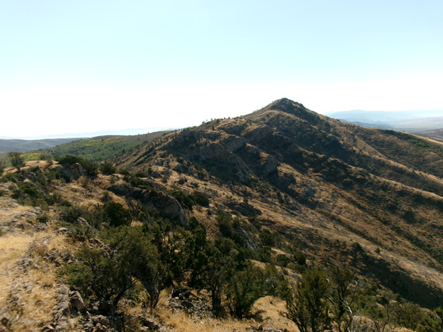
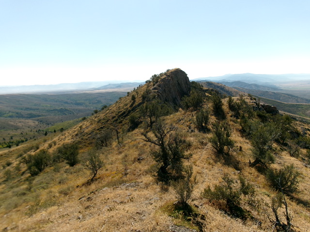
Follow the undulating, rocky ridge crest southeast in scrub and mountain mahogany up over several false summits to reach the final false summit. This is the official/measured high point of Peak 6826. Based on visuals and altimeter measurements, however, this is not the high point. The southeast summit is about 10 vertical feet higher. Descend about 20 feet from the northwest/official summit hump on a narrow, rocky ridgeline then climb up to the rocky southeast summit. There was no cairn on either summit, so I built a decent cairn atop the [higher] southeast summit.

The rock-and-scrub northwest ridge of Peak 6826. The summit is right of center. This was my ascent route. Livingston Douglas Photo
Northwest Ridge FULL, Class 3
The Descent
From the summit, return northwest down the ridge to its junction with the west spur. Head north-northwest down the [now-rounded] ridge crest to the valley floor in Little Flat Canyon. This is a steep, punishing bushwhack in thick brush, mountain mahogany, and steep, loose scree/gravel. It requires downclimbing of a few cliff bands (Class 3). The rounded ridge becomes more of a face as you approach the valley floor. Angle diagonally left/west as you approach Little Flat Canyon. Find cattle trails in the thick sagebrush to reach the 2-track road on the north side of the canyon. Follow the 2-track left/southwest back to the BLM boundary and parking area.
Additional Resources
Regions: Blackfoot Mountains->Chesterfield Range->SOUTHERN IDAHO
Mountain Range: Blackfoot Mountains
Longitude: -111.8017 Latitude: 42.7978

