Elevation: 6,830 ft
Prominence: 410

This peak is not in the book. Published November 2024
Peak 6830 is one of a few northern foothills of the Deep Creek Mountains. It sits above Cold Creek Canyon, Bowen Canyon, and Broad Mouth Canyon. This area is a mix of private and public land, so be careful. This climb is entirely on public land. USGS Indian Springs

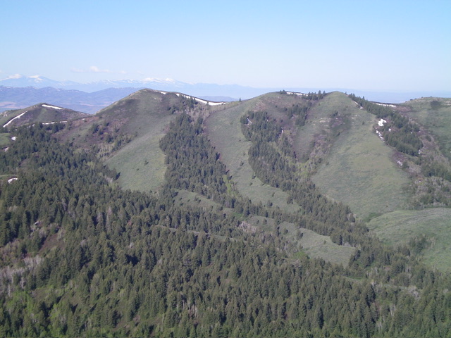
Peak 6830 (summit is left of center) and its east face and north ridge (skyline right of center) as viewed from Peak 6892. Livingston Douglas Photo
Access
From Exit 36 (signed for ID-37/Rockland) on I-86, go south on ID-37 and reset your odometer. At 1.4 miles, bear left onto [signed] Indian Springs Road. At 1.9 miles, turn left at a “T” junction with Cold Creek Road. At 5.9 miles, go straight at a signed junction to stay on Cold Creek Road. At 8.6 miles, reach a signed junction with Bowen Canyon Road (right). Go right/south onto Bowen Canyon Road and drive 0.4 miles to the end of the road at a corral and parking area. Park here (5,715 feet and 42⁰40’20”N, 112⁰47’05”W).
North Spur/East Ridge, Class 2
The Climb
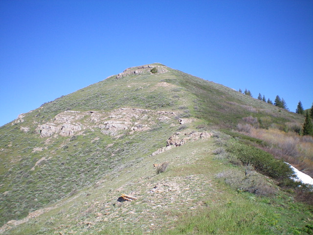
From the large parking area, head southwest past the horse corral and bushwhack southwest up through a thick forest of pines, aspens, and brush to reach the semi-open west side of the north spur ridge. It is not as open as the USGS map shows and the scrub is thick and tall. Regrettably, there are few gaps/lanes to help, but it goes. Bushwhack south up through a thick pine forest to reach Point 6440+, an open hump of grass and short scrub. Descend southwest off this hump to find a hidden saddle in a forested area. From this saddle, climb west up the open east ridge and follow it right/northwest to reach the open summit of Peak 6830.

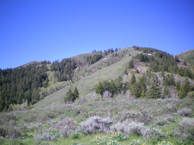
Looking back at the upper section of the northeast shoulder of Peak 6830. This was my descent route. The summit is left of center. Livingston Douglas Photo
Northeast Shoulder, Class 2
The Descent
From the summit, descend north on a high ridge to Point 6800+ and Point 6805. From there, descend northeast down an open shoulder in relatively easy terrain, though there are a few areas of thick-ish scrub. But there is a hidden nightmare awaiting you. Descend northeast down through a brutally thick patch of aspens and willows to reach an open hump at 6,100 feet.
From this ridge hump, descend northeast down through a dense forest of pines/aspens with thick understory—a most unpleasant experience. Descend east into an open, dry gully to escape the forested nightmare. This gully is magnificent. It is an easy mix of short grass and no trees and even has a wide cattle trail to expedite the descent. Follow this gully north (there is no jeep road in it as the USGS map suggests it has) and then do an open, easy grass ascent right/east up over an open shoulder to return to Bowen Canyon Road about 1/8 mile northwest of the parking area.
I don’t think that there is an easy, brush-free, forest-free way to climb this peak. Choose your poison. Look for a 2-track road coming south from Cold Creek Road (if access is permitted) to reach the north ridge and climb the less-brushy north ridge to the summit. That is a distinct possibility.
Additional Resources
Regions: Deep Creek Mountains->SOUTHERN IDAHO
Mountain Range: Deep Creek Mountains
