Elevation: 6,958 ft
Prominence: 378
This peak is not in the book. Published November 2020
Peak 6958 is one of four ranked summits on a ridgeline that separates Fall Creek from Pritchard Creek in the Caribou Range northwest of Palisades Reservoir. This climb is part of a four-peak adventure that includes Peak 6958, Peak 7100, Peak 7034, and Peak 6775. This is mostly open country but has patches of aspen forests to navigate. USGS Conant Valley
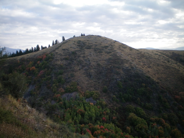
Peak 6958 as viewed from the southwest. Livingston Douglas Photo
Access
From US-26 north of Swan Valley, ID, turn right/south at a signed junction just before a bridge crossing of the Snake River a few miles west of the junction of US-26 and ID-31 in Swan Valley. This junction is signed for the Snake River Road and “Fall Creek Road 1 mile.” Drive 1.2 miles south on Snake River Road as it follows the west side of the Snake River and reaches a signed junction with Fall Creek Road/FSR-077. Turn right/west on Fall Creek Road and drive 2.9 miles west to an unsigned junction with an old mining road (FSR-003 on map) on the right/north side of the road. Park here (5,435 feet). This junction is at the base of the south spur of the southeast ridge of Peak 6958.
South Spur/Southeast Ridge, Class 2
The Climb
The old mining road is at the base of the south spur of the southeast ridge of Peak 6958. The terrain here is open scrub so the south spur is readily visible. It is magnificent. Leave the road and climb north up the steep crest of the south spur. The terrain is short field grass with a scree base that has some loose areas. It goes quickly. Reach the southeast ridge just below Point 6823. Some areas of thick sagebrush start popping up now. Hike northwest up over cairned Point 6823 then drop 105 vertical feet to a minor saddle. From this saddle, follow the weaving ridge north then northwest then west to reach the summit of Peak 6958. I rebuilt the flattened summit cairn.
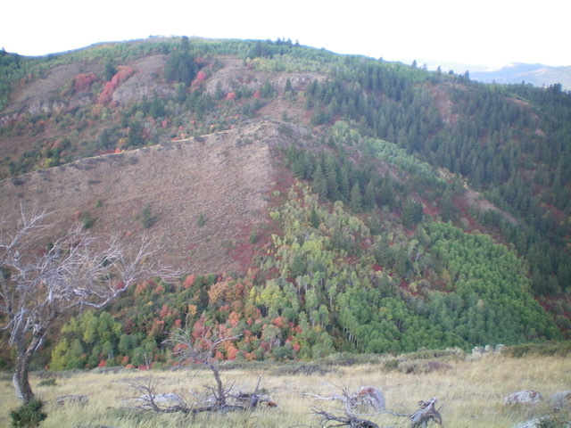
A look at the ridge traverse from Peak 6958 to Peak 7100 from the summit of Peak 6958. The summit of Peak 7100 is left of center behind a final patch of thick aspens. An intervening hump must be crossed first. Livingston Douglas Photo
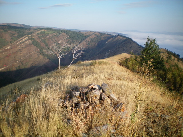
The rebuilt summit cairn atop Peak 6958. Livingston Douglas Photo
Southwest Face, Class 2
The Descent
In today’s four-peak adventure, the toughest ridge traverse is from Peak 6958 to Peak 7100. I hope you wore your hiking pants. From the summit of Peak 6958, descend southwest through thick brush and sagebrush to reach a dense patch of aspens in the 6,580-foot connecting saddle. This concludes the first leg of today’s four-peak journey. Peak 7100 is up next.
Additional Resources
Regions: Caribou Range->SOUTHERN IDAHO
Mountain Range: Caribou Range
Longitude: -111.43339 Latitude: 43.43509