Elevation: 7,020 ft
Prominence: 640
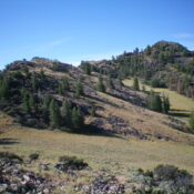
This peak is not in the book. Published December 2024
Peak 7020 is a rocky mess of boulders, ridge outcrops, mountain mahogany, and brush. It is a double-humped peak. The north summit is the high point. USGS Gooseberry Creek
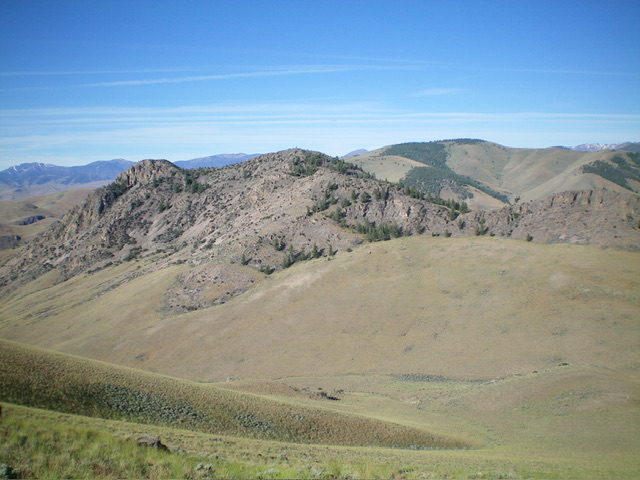
Double-humped Peak 7020 (left of center in mid-ground) as viewed from the northeast. The summit hump is just left of center. Livingston Douglas Photo
Access
Same as for Peak 6460. This is the third leg of a 3-peak adventure that includes Peak 6460, Peak 7161, and Peak 7020. It covers 7.5 miles with 3,100 feet of elevation gain round trip.
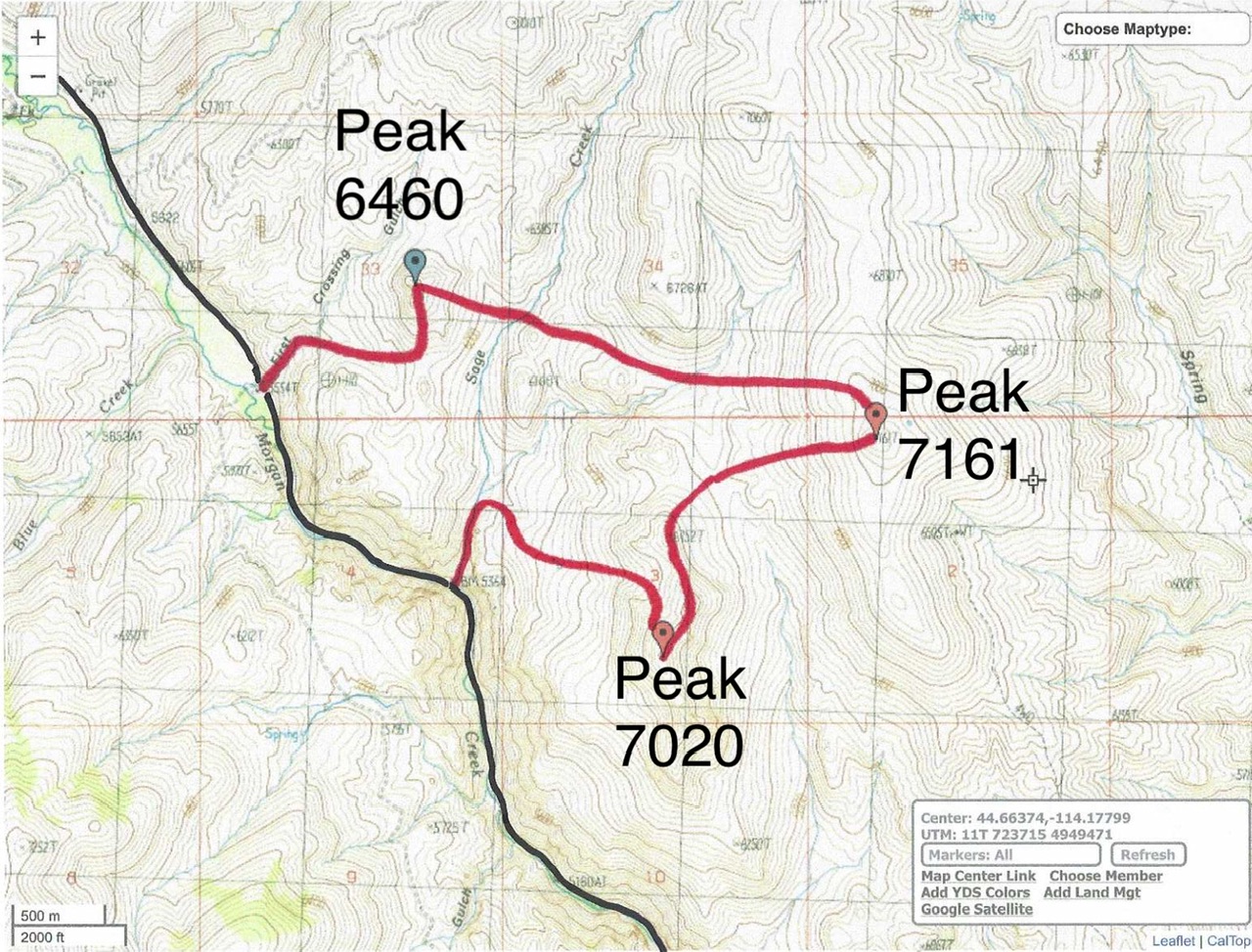
Livingston Douglas GPS Track for Peak 6460, Peak 7161, and Peak 7020. The black line is Morgan Creek Road.
North Ridge, Class 3
The Climb
From the 6,380-foot connecting saddle with Peak 7161, Peak 7020 looks rather ominous and it is unclear where the high point is. Indeed, when viewed from Peak 7161, it appears that the [lower] south summit is actually the high point, but it is not. From the connecting saddle, it may appear that Point 6752 is the high point, but it is not. Leave the short scrub and relative ease of the connecting saddle to begin the punishing climb to the top of this challenging peak.
Bushwhack southwest to reach the rounded, but thick, crest of the north ridge. The mix of mountain mahogany and ridge rock is tedious. The right/west side of the ridge crest seems to work best in reasonable scrub and rock. Skirt the left/west side of Point 6752 and drop 75 feet to a ridge saddle. The terrain now becomes much more challenging. From the saddle, skirt the right/west side of the first rocky ridge outcrop in easy field grass.
Scramble up grass to the rocky ridge crest and follow it up-and-down in boulders, ridge outcrops, brush, trees, and mountain mahogany to approach the summit area. Climb a steep section of face rock (Class 3) to reach easier terrain near the summit. The summit is a pine tree (or perhaps the ground boulders just south of it). I rebuilt the summit cairn atop the pine limbs and added more talus so that it is visible.
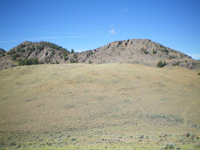
The east face of Peak 7020. The summit hump is left of center. The north ridge is the skyline. Livingston Douglas Photo
North Gully/West Face, Class 2
The Descent
From the summit, descend briefly north down a ridge of rock/trees then angle right-ish/northeast to find grassy fingers that lead from the rocky forest quickly down to massive, open, grassy slopes below via a wide gully that heads northwest then west. Cruise down this magnificent grass and angle northwest to find a way to access the Sage Creek drainage north of the ridge cliffs. I found a cattle pond in a forested meadow/side drainage that led left/northwest down to [dry] Sage Creek.
The Sage Creek drainage is thick with impenetrable trees and brush here, so stay above it on grass/scrub slopes on either side until the side slopes become too angled (or thick). Drop into the [now easier] dry creek bed and follow it south to Morgan Creek Road. Work around (or downclimb) several Class 3 dry waterfalls on the way to Morgan Creek Road. The drainage gets quite rocky and is very narrow. Once on Morgan Creek Road, hike about a mile northwest then north up it to the Morgan Creek Recreation Site and your parked vehicle.
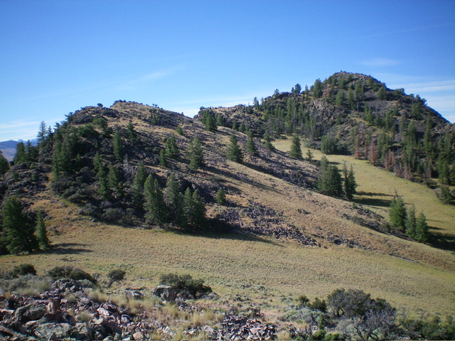
The upper section of the north ridge. The ridge is left of center and leads to the summit (right of center). This was my ascent route. Livingston Douglas Photo
Additional Resources
Regions: Eastern Salmon River Mountains->Salmon River Mountains->Southeast Corner Peaks->WESTERN IDAHO
Mountain Range: Eastern Salmon River Mountains
First Ascent Information:
- Other First Ascent: North Ridge
- Year: 2024
- Season: Summer
- Party: Livingston Douglas
Longitude: -114.2027 Latitude: 44.6552