Elevation: 7,026 ft
Prominence: 356

This peak is not in the book. The name was proposed by Rick Baugher. Published November 2024
Peak 7026 sits above the headwaters of both Spring Creek andTwentyfour Mile Creek in the Chesterfield Range. While the summit is on private land (according to LOJ’s Land Management Map), I encountered no signage or fencing to prohibit entry. This climb is almost entirely on State of Idaho Land. The Fort Hall Indian Reservation lies a short distance to the west. USGS Chesterfield Reservoir
Access
From the south end of Firth on US-91, drive 1.7 miles south on US-91 to [signed] East 600N. This is Wolverine Road, a well-maintained county road. Turn left/east onto paved Wolverine Road and reset your odometer. At 10.3 miles, reach a signed junction with Blackfoot River Road. Go right onto Blackfoot River Road and follow this winding gravel road (county-maintained) generally southeast for 13.6 miles to a signed junction with Trail Creek Road. Turn right/south onto Trail Creek Road and follow this meandering, up-and-down, gravel road (county-maintained) for 6.8 miles to its end at a “T” junction with Paradise Road.
Turn right/southwest onto Paradise Road and drive 0.3 miles to a signed junction with Lincoln Creek Road (also signed for Graves Creek Road). Go left/south onto Lincoln Creek Road and drive 2.4 miles to a signed junction with Graves Creek Road. Reset your odometer and turn right/south onto Graves Creek Road. At 1.7 miles, the road bends sharply right/northwest at a private ranch. At 3.3 miles, the road crests at a saddle and an unsigned road junction. Go left/south here onto a 2-track dirt road and drive 0.1 miles up the road to a large parking area and an unsigned road junction. Park here (6,110 feet and 43⁰00’43”N, 111⁰56’03”W).
Map Errors
There are numerous errors on the USGS topo map—roads mislabeled, other roads (or road segments) that do not exist, and some road segments missing. It’s very confusing. There is no National Forest map that covers this area. Rick Baugher’s trip report implies that this peak is entirely on public land if climbed from the north. However, LOJ’s Land Management Map shows the summit on private land.
North Ridge, Class 2
The Climb
From the parking area, there are two 2-track roads at this junction. The weaker 2-track road heads right/southwest up onto the ridge crest and follows the up-and-down crest to a 6,710-foot saddle just under, and north of, the summit. Rick Baugher rode his motorcycle on that “primitive 2-track” as he calls it. The better 2-track road heads straight south and follows the east side of the north ridge with almost no ups and downs (90 feet of extra elevation gain roundtrip). Follow this road instead or drive it if you wish. Hike south on this 2-track road for about 3-1/2 miles. The road is narrow and rutted in areas. It is often well below the ridge crest.
Leave the 2-track road where it reaches a crest at a fence row crossing/gate at about 6,670 feet. Go right/west here onto a weaker 2-track road that follows the right side of a fence row. The fence (and 2-track) head generally southwest then west up onto a bench of sorts. Leave the 2-track here (just before the fence row bends right-ish/northwest to intercept the 2-track ridge road) and cross to the south side of the fence row. Descend 85 vertical feet through sagebrush to reach a wide, gentle saddle in mostly open gravel.
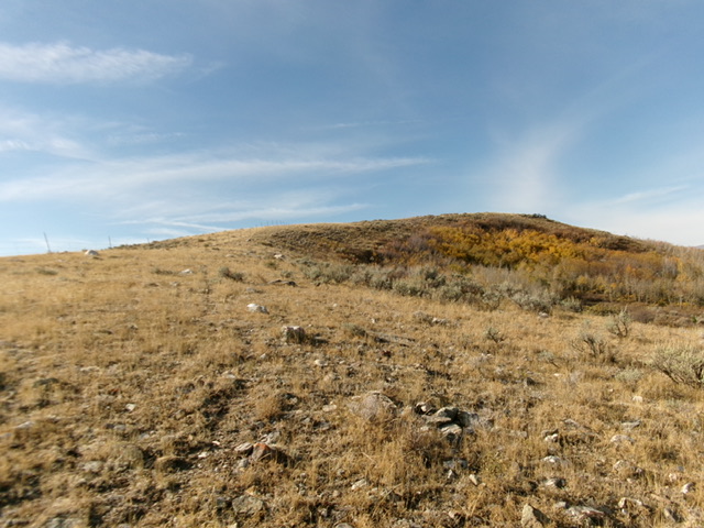
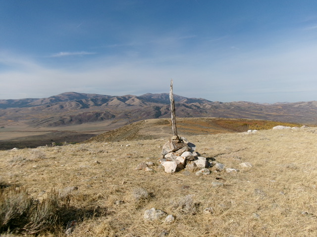
From this saddle, head southeast up through open patches of gravel/grass to avoid thick sagebrush and aspens on the right/west side of the face. Bushwhack right-ish/south through a short, thick patch of sagebrush (using a cattle trail) to reach the crest of the summit ridge and a fence row. Follow a cattle trail in open, easy scrub/dirt on the right/northwest side of the fence row to approach the summit cap. Bushwhack a short distance in easy scrub to reach the cairned, bare summit of Peak 7026.

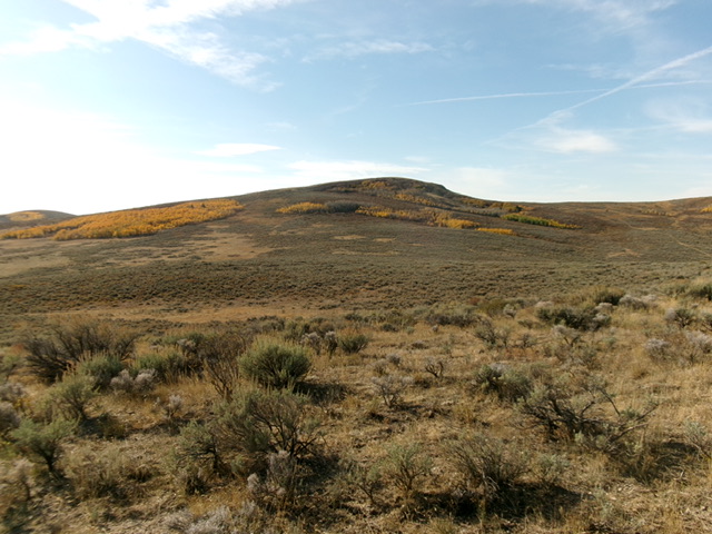
The final push up the northeast ridge to the summit. The summit hump is right of center. Livingston Douglas Photo
Additional Resources
Regions: Blackfoot Mountains->Chesterfield Range->SOUTHERN IDAHO
Mountain Range: Blackfoot Mountains
Longitude: -111.9401 Latitude: 42.9583

