Elevation: 7,105 ft
Prominence: 485

This peak is not in the book. This peak is on private land and is not open to the public. Published November 2024
Peak 7105 is one of several ranked summits in the northern ramparts of the Caribou Range. It sits at the headwaters of Deep Creek, Chicken Creek, and the North Fork of Meadow Creek. The summit is on fenced but unposted, private land. USGS Point Lookout

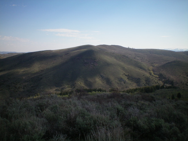
Peak 7105 (dead center in distance) as viewed from Peak 6822 to its southwest. Livingston Douglas Photo
Access
From US-26 exactly 24.1 miles east of the Idaho Falls Caribou-Targhee National Forest Service Office, turn right/south onto [signed] Antelope Creek Road and reset your odometer. At 3.1 miles, go left at an unsigned junction. At 6.0 miles, go right at an unsigned junction. At 6.9 miles, go right/north at an unsigned “T” junction.
At 7.6 miles, park at a sharp left/southwest bend in the road in the North Fork drainage. This bend is at 6,360 feet and 43⁰28’21”N, 111⁰35’44”W. Antelope Creek Road is a badly rutted dirt road so be advised. Do not drive it in wet conditions. This area is a mix of private and public land, so be careful. The summit of Peak 7105 is on private land but is not posted.
South Shoulder, Class 2
The Climb
From the road bend, bushwhack northwest up through some steep, thick brush, staying left/west of a patch of aspens. Continue northwest up the rounded shoulder, weaving through thick-ish sagebrush until the shoulder gains definition and a game trail emerges. Follow this game trail (and easier, more gapped/open areas of scrub on the ridge crest) until it disappears high up in the thick sagebrush just below the summit ridge.
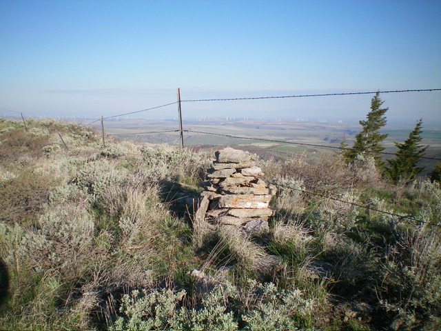
Work through a final face section of thick scrub to reach the easy [southwest] summit ridge and ridge fence. LOJ shows private land up here but I saw no indication of such. The fence row is generally tight and appears to be maintained so perhaps it is a private land boundary. Drop about 10 vertical feet to a minor saddle and continue to follow a cattle/use trail on the right/south side of the fence row all the way to the large summit cairn, which is just on the south side of the fence row.

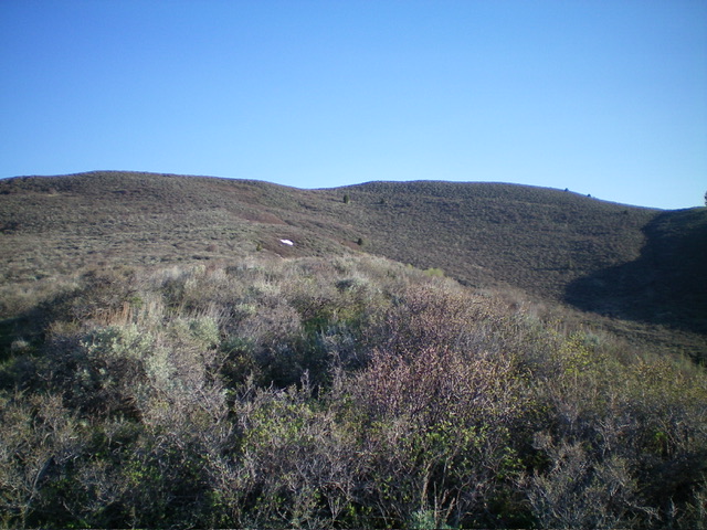
Looking up the brushy south shoulder at the summit ridge (skyline) and the summit hump (right of center). This was my ascent route. Livingston Douglas Photo
Additional Resources
Regions: Caribou Range->SOUTHERN IDAHO
Mountain Range: Caribou Range
Longitude: -111.5998 Latitude: 43.4832
