Elevation: 7,147 ft
Prominence: 367
This peak is not in the book. Published December 2024
Peak 7147 is a minor scrub hump on the east side of Aspen Creek in the Bannock Range south of Downey. It is a ranked bump on the north ridge of Peak 7514. This area is a mix of private and public land. This climb is entirely on BLM land. USGS Oxford
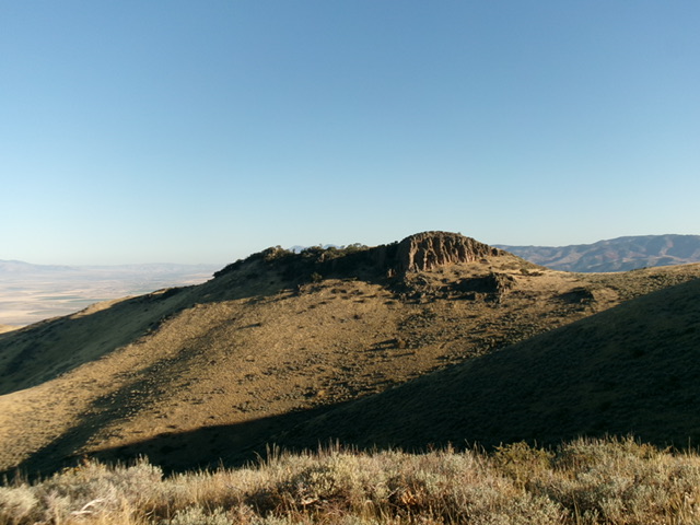
A beautiful rocky buttress on the northwest ridge of Peak 7147. Livingston Douglas Photo
Access
Lundgren Road (Cedar Knoll Road on the USGS topo map) is located just south of Downey on US-91, about 50 yards south of MM36. This junction is 0.6 miles south of the Old Malay Highway turnoff. From US-91, turn right/southwest onto [signed] Lundgren Road. The road heads southwest then south. At 5.2 miles, the well-graded county road becomes a narrow, rutted 2-track Forest Service road (FSR-050) that begins at a sharp left/east bend in the road. At 6.5 miles, reach the end of the road at a large parking area and the trailhead for FST-416 (an ATV trail). Park here (6,055 feet and 42⁰19’59”N, 112⁰06’13”W).
Map Errors
FSR-050 goes farther than the USGS topo map shows and it climbs up onto a flat shoulder area. FST-416 goes southeast uphill initially and then drops to Aspen Creek. This initial trail section is not shown on the USGS topo map. There is no jeep trail in Aspen Hollow following Aspen Creek (as the USGS topo map shows) but there is an ATV trail farther upstream.
Northwest Ridge, Class 2
The Climb
From the trailhead, hike briefly southeast on FST-416 to a crest on a shoulder crossing of sorts. The trail now descends right/southwest to Aspen Creek. Leave the trail on this crest and bushwhack southeast across a dry gully of thick sagebrush (cattle trails help here). Reach the toe of the northwest ridge on the right/south side of the gully. Climb southeast up the crest of the ridge in thick sagebrush (initially) then in easier grass and scrub higher up. Reach a flattish ridge section where the ridge bends left-ish/east and then rises to the north ridge.
Once on the high ridge, cruise south briefly to the summit in short grass and scrub. The summit of Peak 7147 had no summit cairn so I built a modest one with the few loose rocks that I could find. When descending from Peak 7147, be careful to descend the correct ridge. Stay out of the gully to the right/north and away from a west spur ridge (lower down) that descends to Aspen Creek and not to the ATV trail departure point on the shoulder crossing. This is all open terrain so visual navigation works quite well here.
The newly-built summit cairn atop Peak 7147, looking north. Livingston Douglas Photo :

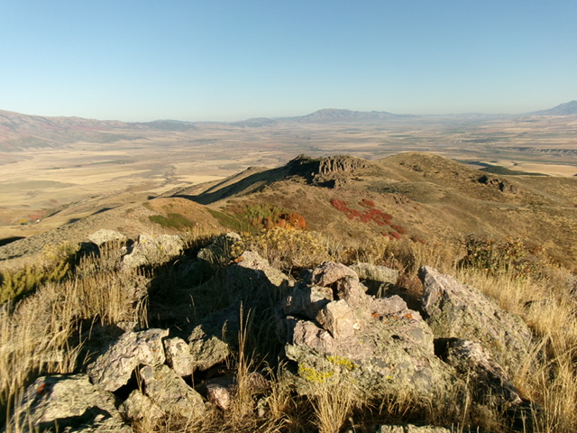
Summit view from atop Peak 7147 with Oxford Peak in the distance. Livingston Douglas Photo
Additional Resources
Regions: Bannock Range->SOUTHERN IDAHO
Mountain Range: Bannock Range
Longitude: -112.0883 Latitude: 42.3269