Elevation: 7,180 ft
Prominence: 320

This peak is not in the book. Published November 2024
Peak 7180 is one of the foothills of the White Knob Mountains. It is located south of Mackay on the south side of Cliff Creek. This area is a mix of private and public land, so be careful. USGS Big Blind Canyon
Access
From US-93 in Mackay, drive southwest on Main Street (which becomes Smelter Avenue). Cross the Big Lost River on a bridge. At 0.9 miles, reach an unsigned road fork. Go left/southeast here onto an unnamed “baseline” road. Drive southwest then south then southwest on this county road (that becomes a rough, primitive 2-track) for 1.5 miles to a fence corner and a wire gate. Park in a grassy pullout here (5,975 feet and 43⁰53’08”N, 113⁰36’00”W). Although not signed, the final section of this rough 2-track may be on private land but there are no signs prohibiting entry. This final section of road does not show up on any maps. It follows the right/west side of posted, fenced ranch land.
Your goal is to drive as close to (or up into) the Cliff Creek drainage to do this climb. The USGS topo map has numerous errors with regard to roads in this area, so don’t trust it. If you can find a road coming up into the Cliff Creek drainage from Houston (on US-93), take it. Contrary to the USGS topo map, I have not found such a road but I did find a jeep road in the Cliff Creek drainage and it must come from somewhere. The road that I drove up is supposed to connect to the Cliff Creek drainage but it does not. Both the USGS topo map and the Challis National Forest map show the county road continuing all the way to the Cliff Creek drainage but it does not. Posted, fenced private land blocks access and that road is simply gone.
North Ridge, Class 2
The Climb
From the parking area, cross to the south side of the cattle fence and briefly follow an old 2-track road south along the right/west side of a fence row to a fence corner. The road turns left/east here to follow the right/south side of the fence row. This 2-track road is not shown on maps but the fence row IS shown on the USGS topo map. From the fence corner, bushwhack southwest through sagebrush, heading directly at the mouth of Cliff Canyon and the toe of the [obvious] ascent shoulder (North Ridge).
After crossing a lengthy, gradually-inclined sagebrush slope (easy, gapped sagebrush), reach the jeep road in the Cliff Creek drainage. Follow this road southwest up Cliff Creek to an unsigned junction. Go left/southwest here to continue up Cliff Creek for another 0.2 miles then leave the road upon reaching the base of the north ridge. Leave the road, cross a cattle fence, and bushwhack southwest then south up the easy ridge in gapped sagebrush.
Stay right/west of the rounded ridge crest for the most direct line. At about 6,850 feet, drop 35 vertical feet off a ridge hump to a minor saddle. Continue southwest then south up the ridge, skirting the right/east side of a ridge hump at about 7,000 feet. Head southeast to the summit, dropping only 10 feet to a final saddle en route. The summit of Peak 7180 has triangulation posts and wiring but no summit cairn. There are a few large ground boulders that serve as the summit cairn.

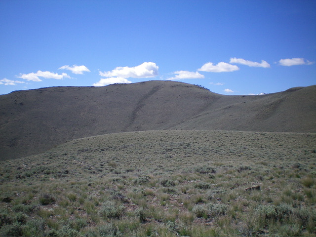
The summit hump of Peak 7180 (dead center). My ascent route climbs the ridgeline right of center to reach the top. Livingston Douglas Photo
Northwest Face, Class 2+
The Descent
From the summit, descend the north ridge to about 6,850 feet, where the ridge bends right/northeast. Leave the ridge here and descend directly northwest down a steep face to Cliff Creek. The terrain on this face is steep, loose scrub and scree. Once at Cliff Creek, follow the 2-track road back down to the mouth of the canyon and then leave the road to bushwhack northeast across the lengthy, but nicely-gapped, sagebrush field back to the fence corner and then to your parked vehicle nearby.
Additional Resources
Regions: EASTERN IDAHO->White Knob Mountains
Mountain Range: White Knob Mountains
Longitude: -113.6195 Latitude: 43.8608

