Elevation: 7,210 ft
Prominence: 268

This peak is not in the book. Published November 2024
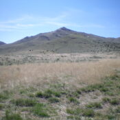
While not a ranked summit, Peak 7210 is a beautiful peak in the Arco Hills. Its northwest shoulder is a magnificent scramble and I highly recommend it. USGS Arco Hills
Access
From US-20 at the south end of Arco, turn right/east onto a paved side road (just north of Pickles Place) that leads to a frontage road near a local motel. Follow the frontage road as it bends right/southeast. At 0.3 miles from the highway, reach a signed junction for Arco Pass. Turn left/east onto a gravel/dirt road (this is Arco Pass Road). Reset your odometer here.
At 0.9 miles, reach a signed junction. Go left/north to stay on Arco Pass Road. At 4.5 miles, the road makes a sharp right/east turn at a corral. At 5.7 miles, reach a signed junction. Arco Pass Road goes left/north here. Go straight/east instead. At 6.7 miles, reach an unsigned junction with a weak 2-track road heading right/south. This is at a sharp left/northeast bend in the road and is just before a cattle guard crossing. Drive 0.1 mile south up the weak side road and park at a fence corner (and cistern). This parking spot is at 5,735 feet and 43⁰40’53”N, 113⁰12’41”W.
Northwest Shoulder/North Ridge, Class 2+
The Climb
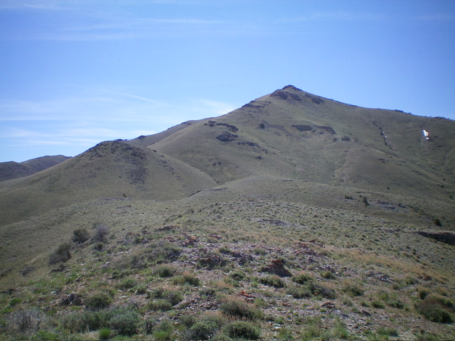
From the road junction, climb over the cattle fence and head south along the right/west side of a fence row that separates private land from BLM land. Upon reaching a fence corner at 5,840 feet, head left-ish/southeast on BLM land to reach the northwest shoulder. Bushwhack through reasonable scrub and quickly reach steeper terrain and shorter scrub. Once up on the crest of the northwest shoulder, work through a flattish section of ridge bumps. Descend 65 vertical feet to a saddle then continue southeast up the shoulder to reach a junction with the north ridge at a rocky ridge point (6,700 feet).
The final section of the northwest shoulder is steep but the short grass/scrub makes it an easy climb. Once on the north ridge, scramble south-southeast up a mix of easy grass and a few rocky outcrops. Move to the left/east side to skirt the outcrops on easy grass. Higher up, the ridge becomes a series of rocky outcrops and cliff bands. Climb straight up them on decent, firm rock (Class 2+). Reach a rocky false summit to see the cairned summit hump behind it. Drop 10 vertical feet to a minor saddle and continue up more grass and rock to reach the high point.
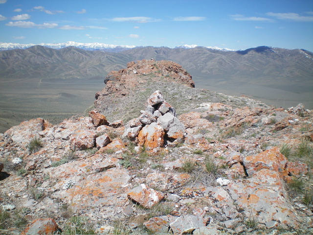
The false summit appears slightly lower, particularly when viewed from the true summit. However, my altimeter measures them at equal height. The false summit is west-northwest of the true summit and is about 100 feet away. Stand atop both just to be sure.

Peak 7210 as viewed from midway up the northwest shoulder. The north ridge is the left skyline and the summit is just right of center. Livingston Douglas Photo

The summit of Peak 7210, looking west-northwest at the [slightly-lower] false summit. Livingston Douglas Photo
Additional Resources
Regions: EASTERN IDAHO->Lost River Range
Mountain Range: Lost River Range
Longitude: -113.19370 Latitude: 43.66772
