Elevation: 7,295 ft
Prominence: 475
This peak is not in the book. The name was proposed by Rick Baugher. Published December 2024
Peak 7295 is an impressive, rocky peak that sits above the confluence of Left Fork Cherry Creek and Middle Fork Cherry Creek. It is most easily climbed directly from the Cherry Creek Trailhead to its southwest. Given the west and south exposure, the climbing routes from the popular trail FST-406 make this a relatively straightforward climb, albeit with some areas of very steep rock to avoid. USGS Oxford
Peak 7295 as viewed from the south. The summit is left of center. Livingston Douglas Photo
Access
Same as for Peak 7480. This is the second leg of a 2-peak adventure that includes Peak 7480 and Peak 7295. It covers 4.5 miles with 2,800 feet of elevation gain round trip.
Southeast Face, Class 2
The Climb
From FST-406 at the crossing of Left Fork Cherry Creek at about 6,150 feet, scramble northwest up open, steep field grass with some scattered scrub and loose underlying scree/gravel. Aim for a steep, grassy slope left of a large rocky buttress and right of a south ridge that comes up to meet the southwest ridge very high up. This is a slow grind in thick field grass and steep, loose scree/gravel—especially higher up. Once on the southwest ridge, follow the easy, semi-open ridge for a short distance to the summit with some scattered mountain mahogany to work around. The summit of Peak 7295 is in open sagebrush and has a modest cairn.
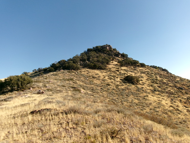
The rock-and-mahogany summit of Peak 7295 as viewed from high on the southwest ridge. This was my descent route. Livingston Douglas Photo

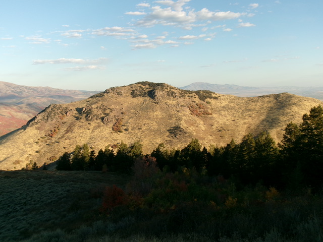
Peak 7295 (in mid-ground, right of center) as viewed from the northwest. Livingston Douglas Photo
Southwest Ridge, Class 2+
The Descent
From the summit, descend southwest then south on the mahogany-clad ridge, skirting rocky ridge outcrops and blocks on their right/northwest side in easier grass and scrub. After a few hundred feet of this rock/scrub downclimbing, emerge onto open field grass that is thick-ish with some underlying loose scree and some scattered ground boulders. The ridge is now heading directly at the side road that leads to the Cherry Creek campground. The final descent to Cherry Creek Road is in thick grass/scrub with loose scree on steep terrain. From below, the rock-and-mahogany summit cap of Peak 7295 looks ominous. Just stay left/northwest of the rocky ridge crest if ascending this route and grind it out.
Additional Resources
Regions: Bannock Range->SOUTHERN IDAHO
Mountain Range: Bannock Range
Longitude: -112.1245 Latitude: 42.3140