Elevation: 7,300 ft
Prominence: 400
This peak is not in the book. Published November 2023
Peak 7300 is the second-highest point on a high ridgeline that separates Agency Creek from Pattee Creek in the Beaverhead Mountains. Although the interpolated measurement is 7,300 feet, Peak 7300 measures at about 15 feet lower than the high point of Pattee Benchmark (7,307 feet) so it is actually at only 7,292 feet in elevation. The USGS topo map shows it at 7,280+ and the final contour line has very little land area above it, so the peak might not even reach 7,292 feet. USGS Agency Creek
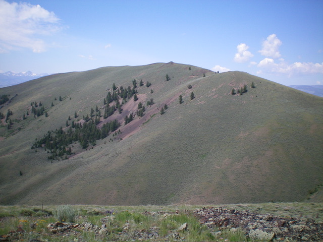
Peak 7300 as viewed from the east. Livingston Douglas Photo
Access
Same as for Pattee Benchmark. This is the second leg of a 2-peak adventure that includes Pattee Benchmark and Peak 7300. It covers 4.5 miles with 2,375 feet of elevation gain round trip.This route crosses a short section of unposted private land at the toe of the southeast ridge of Pattee Benchmark, which is the final section of the descent from Peak 7300 back to Agency Creek Road.
Map Errors
The USGS topo map shows a 4WD road that heads north then west all the way up to a 6,919-foot saddle just south of Pattee Benchmark and northeast of Peak 7300. However, this old road ends only a short distance above Agency Creek Road. The road begins on private land but quickly reaches BLM land. It is the road near which I parked along Agency Creek Road.
Northeast Ridge, Class 2
The Climb
From the 6,919-foot connecting saddle with Pattee Benchmark, scramble south then southwest up the ridge crest, following the short scrub left/east of a fence row and a very overgrown 2-track road to reach a rocky ridge point. This rocky point is NOT quite the high point, however. Continue south-southwest to the cairned, gentle hump that is the high point of Peak 7300.
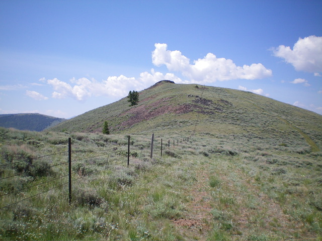
The summit hump of Peak 7300 as viewed from midway up the northeast ridge. Livingston Douglas Photo
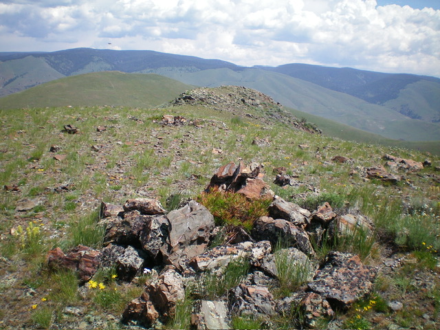
The summit of Peak 7300, looking northeast. Pattee Benchmark (7,302 feet) is the gentle hump left of center. Livingston Douglas Photo
East Face, Class 2
The Descent
From the summit, descend east down a relatively steep face of thick sagebrush and loose talus/scree. Find areas of open talus/scree to avoid the thick brush and reach an area of scattered pines lower down. Descend a forested shoulder then angle diagonally left/east to cross the massive dry gully that separates Peak 7300 from Pattee Benchmark.
From the gully, follow the overgrown roadbed of an old trail/mining road (visible as you descend from Peak 7300) that heads laterally across a face to reach the southeast ridge of Pattee Benchmark. This old roadbed is a tedious bushwhack as it is thick with sagebrush and only has a narrow footpath and/or angled, loose scree for footing. Once back on the crest of the southeast ridge, follow it back down to Agency Creek Road and your parked vehicle.
Additional Resources
Regions: Beaverhead Range->EASTERN IDAHO
Mountain Range: Beaverhead Range
Longitude: -113.5655 Latitude: 44.9671