Elevation: 7,410 ft
Prominence: 350

This peak is not in the book. Published November 2024
Peak 7410 and its nearby neighbor Peak 7370 sit on the north side of Green Canyon in the northern foothills of the Deep Creek Mountains on the west side of Arbon Valley. It is most easily climbed from the Green Canyon BLM Road, which is only suitable for ATVs. USGS Bannock Peak
Access
From Exit 52/Arbon Valley on I-86, drive south on [paved] Arbon Valley Road. At virtual MM23.6, reach a signed junction with South Mink Creek Road (left). Continue straight/south on Arbon Valley Road. At virtual MM24.9, reach a signed junction with England Road/4500S (right). Turn right/west onto England Road and reset your odometer. At 1.0 miles, reach a signed junction with Bailey Road. Continue straight/west on England Road. At 2.4 miles, reach the end of England Road at a parking area (42⁰32’48”N, 112⁰36’19”W).
The road now becomes a rutted, poorly-maintained BLM 2-track road (Green Canyon Road). At 3.2 miles, park alongside the rutted road in field grass (5,480 feet and 42⁰32’28”N, 112⁰37’08”W). If road conditions permit, continue another 0.3miles to the BLM boundary and a decent parking area. This is Green Canyon. This is the first leg of a 2-peak adventure that includes Peak 7410 and Peak 7370. It covers 8.5 miles with 2,250 feet of elevation gain round trip.
Southeast Shoulder, Class 3
The Climb
From the improvised parking pullout, hike about 0.3 miles west up Green Canyon on the 2-track BLM road to reach the BLM land boundary and a cattle fence crossing. Continue west up Green Canyon Road for about 2.7 miles to an area of open scrub on the right/north side of the road that leads directly up onto the southeast shoulder of Peak 7410. This spot is about 0.1 miles up from another open spot that requires a gully crossing to reach the shoulder.
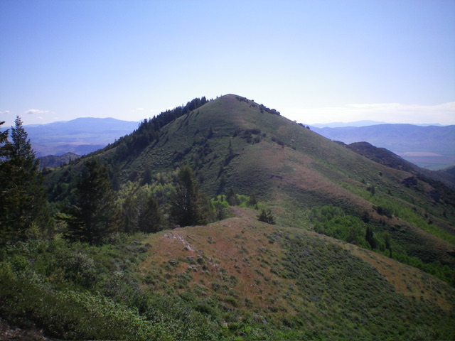
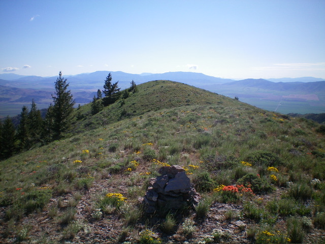
Leave the road and bushwhack north through steep scrub up onto the crest of the shoulder. Once on the shoulder, scramble up very steep scrub, scattered mountain mahogany, and ridge rock/blocks/strata to reach easier scrub high and an end to the trees and rock. Continue up the shoulder to the summit of Peak 7410. The summit is at the west end of a double-humped summit ridge crest.

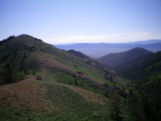
Peak 7410 (summit is at far left) and its steep southeast shoulder which descends diagonally right from the summit. This was my ascent route. Livingston Douglas Photos
West Ridge, Class 2
The Descent
From the summit, descend west down a ridge of scrub and mountain mahogany to the open grass/scrub connecting saddle with Peak 7370. This concludes the first leg of today’s 2-peak journey. Peak 7370 is up next.
Additional Resources
Regions: Deep Creek Mountains->SOUTHERN IDAHO
Mountain Range: Deep Creek Mountains
Longitude: -112.6757 Latitude: 42.5439

