Elevation: 7,420 ft
Prominence: 391
This peak is not in the book. Published November 2023
Peak 7420 is the high point on the north-south ridge that includes Dutchler Mountain. Yes, Peak 7420 is actually the high point of Dutchler Mountain. The shortest approach to Peak 7420 is from Squaw Creek Road which may only be drivable for ATVs and MCs. USGS Shoup
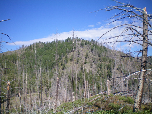
Peak 7420 as viewed from high on the southeast ridge. Livingston Douglas Photo
Access
From US-93 at North Fork, drive west on FSR-030/Salmon River Road for 16.3 miles to a signed junction with FSR-038/Spring Creek Road, just after passing the Spring Creek Campground on the left/south side of the road. Turn right/north onto FSR-038 and drive 2.1 miles to a signed junction FSR-042. Park at this junction (4,045 feet). FSR-042 is narrow and rutted with the possibility of treefall on or near the road. It is also rocky in sections and requires a 4WD vehicle with good tires.
Map Errors
There are many old roads (now mostly grassy road beds) that switchback up the west side of Dutchler Mountain. Most of these roads are not shown on any maps. The USGS topo map shows a jeep road heading left/northwest from FSR-042 at 4,960 feet. It no longer exists. The USGS topo map shows a jeep road heading left/west at 5,880 feet. It no longer exists.
The USGS topo map and Salmon National Forest map both show FST-146 skirting the south face of Peak 7420. I found no such trail and only found remnants of an old trail on a short portion of the southeast ridge. These trail remnants are now buried in willows and covered up by deadfall. The Salmon National Forest map shows FST-146 coming up from Squaw Creek Road and following the southeast ridge but I found that no such trail exists anymore.
South Spur/Southeast Ridge, Class 2
The Climb
From the road junction, hike (or drive) north-northeast up FSR-042 for about 1-3/4 miles to a sharp right turn at 4,980 feet where the road begins two LONG switchbacks. Leave the road here and bushwhack right/east up a steep, grassy shoulder (with some annoying deadfall) to intercept FSR-042 about 300 vertical feet higher. Follow FSR-042 north for about ½ mile to a sharp left/west turn in a narrow gully. Leave the road here and scramble northwest up a steep, grassy face (with some deadfall) to intercept FSR-042 just over 250 vertical feet higher.
Follow FSR-042 north for abut 0.4 miles to a gully crossing where the road now heads right/northeast (then east) to switchback its way up to the north ridge of Dutchler Mountain. Leave the road here for the final time. Bushwhack north then northeast up a steep, grassy shoulder with scattered pines (not too much deadfall) to reach the crest of the southeast ridge at about 6,720 feet. Follow the open ridge north over two ridge points then drop west 35 feet to a saddle.
Continue west up the ridge. It soon bends right/north then right/northeast to reach the small summit hump. The southeast ridge is a tedious mix of grass, willows, downed trees, ridge rock, and underlying talus/scree. It takes a lot of time to work through the willows and downed trees. There are only a few short sections of easy open grass/scrub to navigate. The summit hump is mostly forested. There were no signs of previous ascent so I built a summit cairn. There are nice, albeit partial, views from the summit.
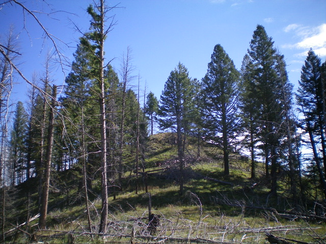
The elusive summit hump of Peak 7420. Livingston Douglas Photo
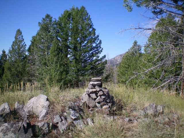
The summit of Peak 7420. Livingston Douglas Photo
Southeast Ridge/Southwest Spur FULL, Class 2+
The Descent
From the summit, return to the 6,720-foot entry point onto the southeast ridge. Descend southwest down a face to reach an open shoulder heading southwest. Move left-ish/south off this shoulder as you approach FSR-042, which you can see below. Once on FSR-042, follow it southwest all the way back to a sharp left/northeast bend. This bend is at the top of a steep, open, narrow ridge that heads due south directly to the initial road departure point, which is visible from the bend.
Shortcut the descent route by scrambling down this narrow ridge of steep grass and rocky outcrops. At the bottom of the ridge, cross a thick creek drainage left/east to reach an old grassy road bed that leads down to FSR-042 at the sharp bend. Follow FSR-042 for 1-3/4 miles back to its junction with FSR-023 and your parked vehicle.
Additional Resources
Regions: Bitterroot Mountains->NORTHERN IDAHO
Mountain Range: Bitterroot Mountains
Longitude: -114.2539 Latitude: 45.4669