Elevation: 7,496 ft
Prominence: 636

This peak is not in the book. The name was proposed by Rick Baugher. Published November 2024
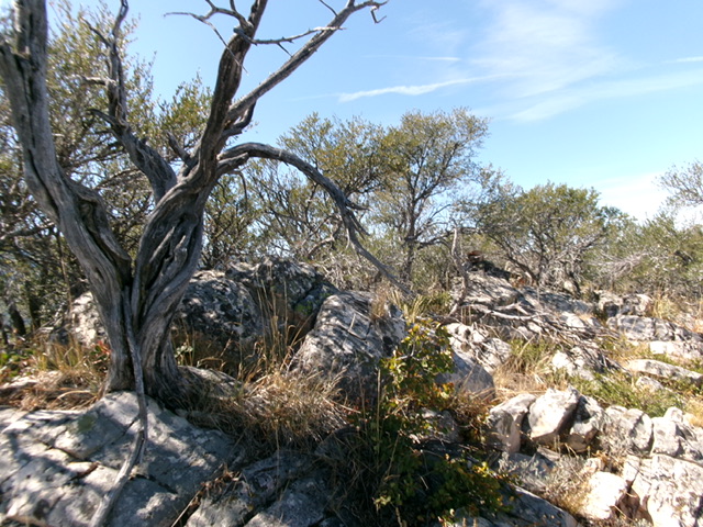
Peak 7496 towers over Beaver Basin to its south. Its summit area is a wicked mix of large boulders/blocks and thick mountain mahogany. The easiest route to the top is via its south face from Fish Creek Road to its southwest. This area is a mix of private and public land, so be careful. This climb is entirely on BLM land. USGS Sedgwick Peak

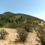
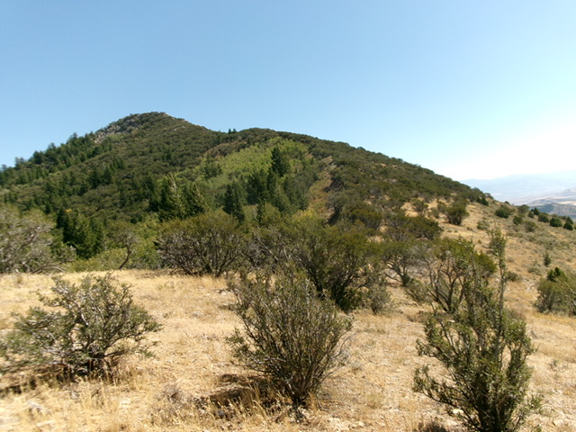
Peak 7496 (summit is left of center) and its torturous, boulder-and-mahogany west ridge (skyline right of center). This was my ascent route. Livingston Douglas Photo
Access
Same as for Peak 7473. This is the second leg of a 2-peak adventure that includes Peak 7473 and Peak 7496. It covers 4.0 miles with 1,650 feet of elevation gain round trip.
West Ridge, Class 3
The Climb
This ridge climb is murderous. It is arguably the most punishing rock-and-mahogany climb that I have ever done in the State of Idaho. I do not recommend it. Stick to the south face. From the 7,020-foot connecting saddle with Peak 7473, bushwhack southeast then east up a thick mess of mountain mahogany and ridge rock/boulders. Move on and off the narrow, mahogany-clad ridge crest as necessary. The ridge gets quite steep in sections and it is very hard to make progress through the mix of thick mahogany and boulders/blocks. High up, move to the left side of the ridge crest for some relief in an open slope of steep boulders.
Scramble up these boulders (Class 3) to reach the [lower] west summit (Point 7480+). Interestingly, this summit block/tower measures identical height to the official, measured east summit, according to my altimeter. From the west summit, descend to a ridge notch and the head of a south gully (which I would later use on the descent). From this notch, scramble east then southeast through a thick mix of boulders and mountain mahogany to reach the true/measured summit. Stay on the left/north side of the ridge crest for the easiest going. There are two high boulders which vie for the high point designation. One has a small summit cairn atop it. Stand atop both “just to be sure.”
South Face, Class 2+
The Descent
From the summit, return northwest then west to the ridge notch (Class 2+). On the way there, I climbed a block/tower northwest of the official/measured summit that may actually be the high point of Peak 7496. It measured five feet higher than any other point or block/tower on the summit ridge. Take that for what it’s worth. From the ridge notch, descend south in a gully on the south face. The gully terrain is reasonable mountain mahogany.
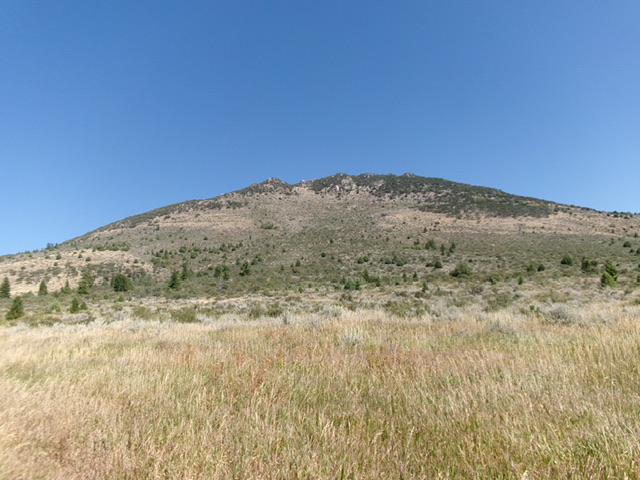
Continue down the gully to reach semi-open scrub with scattered mountain mahogany. Descend diagonally right/southwest down to about 7,020 feet. From there, contour right/northwest and up slightly to intercept the west ridge near the connecting saddle with Peak 7473. Drop to the saddle then retrace the southeast ridge route of Peak 7473 up to the unsigned road junction. Follow the 2-track southwest down to Fish Creek Road at the saddle and your parked vehicle. Due to posted, fenced private land, you cannot descend the south face all the way down to Beaver Dam Road.

Peak 7496 as viewed from Beaver Dam Road to its south. The south face was my descent route. Livingston Douglas Photo
Additional Resources
Regions: Fish Creek Range->Portneuf Range->SOUTHERN IDAHO
Mountain Range: Portneuf Range
First Ascent Information:
- Other First Ascent: West Ridge
- Year: 2024
- Season: Summer
- Party: Livingston Douglas
Longitude: -111.8810 Latitude: 42.5466
