Elevation: 7,580 ft
Prominence: 640
This peak is not in the book. Published November 2023
Peak 7580 is the high point on a north-south ridgeline that sits west of Morgan Creek. It sits at the head of both the First Spring Creek and Second Spring Creek drainages in the Eastern Salmon River Mountains. It is most easily reached from the Morgan Creek Recreation Site via an old 2-track road that follows the west side of the Morgan Creek all the way up to a saddle at 6,220 feet. From there, hike up an old 2-track up the east ridge to within 100 feet of the summit. USGS Gooseberry Creek
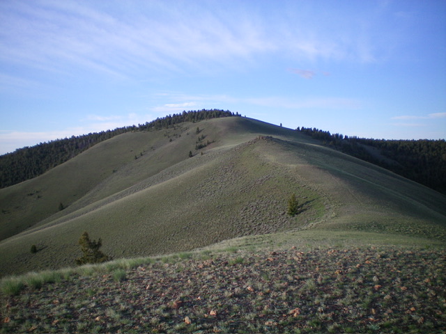
Peak 7580 as viewed from high on the north ridge. Livingston Douglas Photo
Access
The Morgan Creek Recreation Site (signed) is located 5.0 miles up [signed] Morgan Creek Road from US-93. Morgan Creek Road is located 8.0 miles northeast of Main Street in Challis on US-93. The recreation site is at 5,554 feet and has a bathroom and a few campsites. This is the first leg of a 2-peak adventure that includes Peak 7580 and Peak 7540. It covers 9.5 miles with 2,900 feet of elevation gain round trip.
Map Errors
Neither the USGS topo map nor the Salmon National Forest map show many of the drivable roads in the Peak 7580/Peak 7540 area. BLM has opened up a lot of old roads here and they are useful to hikers.
North Ridge, Class 2
The Climb
From the Morgan Creek Recreation Site, cross a split-log fence to reach the jeep road that crosses Morgan Creek on a good bridge. After crossing a cattle guard, continue up the road a short distance then leave it to cross a deep, dry gully at an opportune (less shallow) point. Once across the gully, scramble southwest up onto the north ridge of Peak 7580. Another option (which I did on the descent) is to leave the road immediately after crossing the cattle guard and scramble west up onto the toe of the north ridge at a rocky outcrop then scramble southwest in open sagebrush to reach the crest of the north ridge.
Once on the north ridge, scramble south-southwest then south up its [mostly] moderate slope in short scrub/grass and broken rock. This is very easy terrain. Scramble up over a rocky point early on. The summit hump of Peak 7580 is not visible until you reach the top of Point 7252. From there, it is still ¾ miles away. The summit hump is open terrain on its west side but is forested (pines and mountain mahogany) on its crest (including the high point) and east side.
Find an old 2-track road as you near the summit and follow it in open terrain to the summit area. Leave the road and wander east into the forest to find the high point. It’s not far from the road. I found a few pieces of talus (remnants of a previous cairn?) to build a summit cairn. The high point area is not too vast so I wandered around a bit to find a higher point but couldn’t. The forest is semi-open so it’s not too difficult to search around.
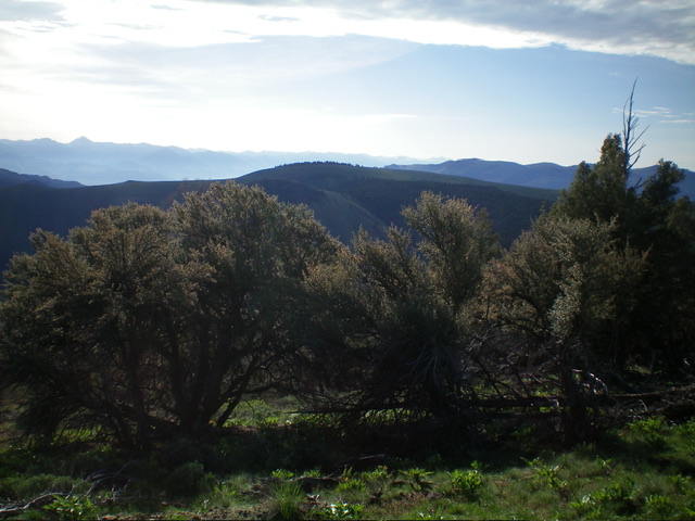
Peak 7580 (dead center) as viewed from Peak 7540 to its west. Livingston Douglas Photo
West Ridge, Class 1
The Descent
From the summit, follow a 2-track road (not shown on maps) briefly south-southeast to a 4-way junction. Go right/west and follow a decent jeep road (shown on the USGS topo map) west then northwest to a ridge saddle at 7,055 feet. This is the connecting saddle between Peak 7580 and Peak 7540. It concludes the first leg of today’s 2-peak adventure. Peak 7540 is up next.
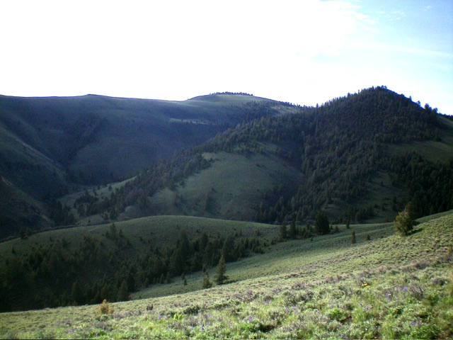
Peak 7580 (dead center) as viewed from the northwest. Livingston Douglas Photo
Additional Resources
Regions: Eastern Salmon River Mountains->Salmon River Mountains->Southeast Corner Peaks->WESTERN IDAHO
Mountain Range: Eastern Salmon River Mountains
Longitude: -114.2450 Latitude: 44.6371