Elevation: 7,713 ft
Prominence: 305

This peak is not in the book. The map elevation is 7,718 feet. Published December 2024
Thanks to LiDAR, Morgan Ridge is now a ranked summit. Morgan Ridge is a lengthy ridge that is located on the north side of Maple Creek. It is most easily climbed via its southwest ridge from FST-306. USGS Mapleton

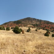
Looking up the upper section of the southwest ridge of Morgan Ridge. Point 7678 is on the ridge crest left of center. This was my ascent route. Livingston Douglas Photo
Access
Maple Creek Road is located on the east side of Franklin, ID. From the junction of US-91 and Main Street in Franklin, go east on Main Street. At 0.4 miles, Main Street turns L/N just before the entrance to a ranch. The street now becomes Maple Creek Road. At 1.1 mile, bear R at a “Y” junction (“Egg Farm” sign here). At 4.4 miles, the pavement ends at a large turnaround area. Go L here. At 6.6 miles, enter the Cache National Forest at a cattle guard. The road is now FSR-454. At 6.7 miles, the road ends at a large parking area for the Maple Creek Trailhead. The Maple Creek Trailhead is at 5,730 feet and 42⁰04’00”N, 111⁰42’30”W. FST-306 (an ATV trail) leaves from this trailhead.
Map Errors
The National Forest Map mis-positions the route of FST-306 after the footbridge crossing of Maple Creek. The trail actually heads straight/northeast up a steep face onto a shoulder and then bends left/northwest to reach the lower section of Morgan Ridge at Point 6270 (map). The USGS topo map also fails to show this trail segment. There is no trail (FST-302 on the National Forest map; “Jeep Trail” on the USGS topo map) going south up Indian Flat from FST-306 along Maple Creek.
West Face/Southwest Ridge, Class 2
The Climb
From the trailhead, hike east up FST-306 as it follows the south side of Maple Creek. The trail drops to cross to the north side of Maple Creek on a good footbridge. After crossing the footbridge, there is an unsigned trail junction. FST-306 continues straight/northeast up a steep hill. FST-310 goes right/southeast here to follow the north side of Maple Creek. Continue on FST-306 as it heads up onto a shoulder and then bends hard left/northwest in open terrain. The ATV trail is rocky and steep in this section.
This bend is located southwest of critical Point 7373 which is on the crest of the southwest ridge. There is a weak footpath that heads right/southeast from this bend. This is the trail segment that is shown on maps and connects to FST-310 farther up Maple Creek. Leave FST-306 here (or just above this bend) and bushwhack northeast up through field grass with annoying ground boulders and talus scattered about. The open field grass ends and the terrain becomes a mix of scattered junipers/mountain mahogany, patches of field grass, and patches of maple forest. Keep heading toward Point 7373 and angle diagonally left/northeast up the steepening slope. Avoid the thickest brush and patches of forest.
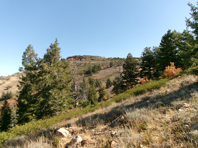
After reaching the base of the rocky ridge cliffs (i.e., the west face of Point 7373), head left/north along the base of the summit cliffs to reach much easier terrain and a side ridge heading right/east. This ridge skirts the right/south edge of thick brush and forest. Once on the crest of the southwest ridge (just north of Point 7373), descend 65 vertical feet to a gentle saddle in easy rock/talus. From the saddle, head northeast to a ridge crest. Bash through a short, thick patch of willows to gain the brush-and-forest ridge. Walk north briefly on a game trail in the willows then move to the right/east side of the ridge into open scrub. Scramble up some tedious boulders/talus and brush to reach the top of Point 7678 or skirt its southeast side and stay in open, easy scrub.
You might mistakenly think that this is the summit of Morgan Ridge, but it is not. It is, however, only 35 feet lower than the summit hump to the northeast and ½ mile away. The traverse down to a saddle and up to the summit hump is a difficult, steep, thick bushwhack in forest and brush. This bushwhack includes aspens, maples, some pines, lots of deadfall, and thick brush. There are a few ups and downs before crossing the forested saddle and reaching the easy, open scrub and rock of the summit hump.
Stay to the right/southeast of the ill-defined ridge crest in this descent to the connecting saddle. There is some open terrain there. To reach and cross the forested saddle, however, a difficult bushwhack is unavoidable. Once across the saddle, scramble up easy open terrain to the elusive high point of Morgan Ridge. There was no summit cairn so I built a decent one. There were signs of previous ascent, probably hunters.

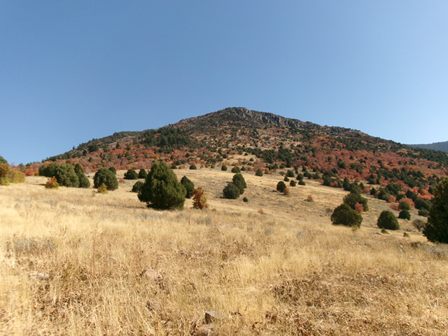
Point 7373 of Morgan Ridge (dead center) as viewed from the grassy departure point from FST-306. Stay in the center to avoid the thick maples on either side. Morgan Ridge is the skyline left of center. Livingston Douglas Photo

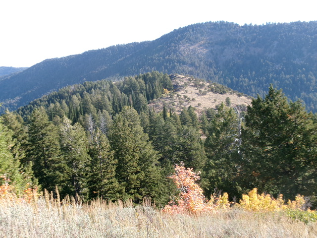
The elusive high point of Morgan Ridge (hump in mid-ground) as viewed from Point 7678 to its southwest. Livingston Douglas Photo
Additional Resources
Regions: Bear River Range->SOUTHERN IDAHO
Mountain Range: Bear River Range
Longitude: -111.6660 Latitude: 42.08244