Elevation: 7,715 ft
Prominence: 295
This peak is not in the book. Published November 2023
Peak 7715 is a sagebrush hump that is located on the northeast ridge of Peak 8290. It is due west of Darlington, ID. Peak 7715 is an easy scramble from a county road to its northeast. It can also be climbed in combination with nearby Peak 8290. This area is a mix of private and public land, so be careful. This climb is entirely on BLM land. USGS Big Blind Canyon
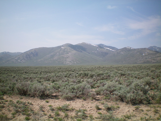
Peak 7715 (the middle of the three humps in center) as viewed from the north. Livingston Douglas Photo
Access
From US-93 at Darlington (south of Mackay), drive west on a 3700N (a good county road) for 3.2 miles to a sharp right/north bend in the road. Park at the bend in the road (where an old 2-track heads southwest directly to the mouth of the northeast gully of Peak 7715) or continue 0.3 miles north to another 2-track road that heads west toward the north ridge of Peak 7715. The latter junction is where I parked. It is at 5,820 feet and 43⁰49’03”N, 113⁰28’54”W. I wanted to be certain that I was on BLM land.
To reach the latter junction from farther north on US-93, leave US-93 at Leslie (17.8 miles north of Arco). Go south on Houston Road (signed incorrectly at “Huston Road”) and reset your odometer. At 3.6 miles, go left at a “T” junction. At 3.8 miles, go left at another “T” junction. At 6.3 miles, reach a junction with [unsigned] Sheep Canyon Road (right). Continue straight. At 7.5 miles, reach an unsigned junction with a 2-track road (right). This is the junction at 5,820 feet.
The shortest route to the top of Peak 7715 starts at the sharp bend in 3700N, which is NOT the route that I took. That route is also entirely on BLM land.
Map Errors
Neither of the aforementioned 2-track roads is shown on the USGS topo map but the county roads and Sheep Canyon Road are shown on the USGS map.
Northeast Ridge, Class 2+
The Climb
From the unsigned road junction (5,820 feet), hike west up the 2-track road for a short distance then leave it to bushwhack southwest up through relatively easy sagebrush, heading directly at the mouth of the obvious gully that splits the northeast face. After reaching the mouth of the gully (and a cattle-fenced area), skirt the right/north side of the fence to scramble up the ridge on the west side of the gully. Work up through some rocky ridge strata (Class 2+) to reach easy scrub higher up and, soon after that, the rocky summit of Point 7400+. The summit hump is now in view. Descend 55 vertical feet southwest to a minor saddle then continue southwest up easy scrub (with a base of shale scree/gravel) to the cairned summit.
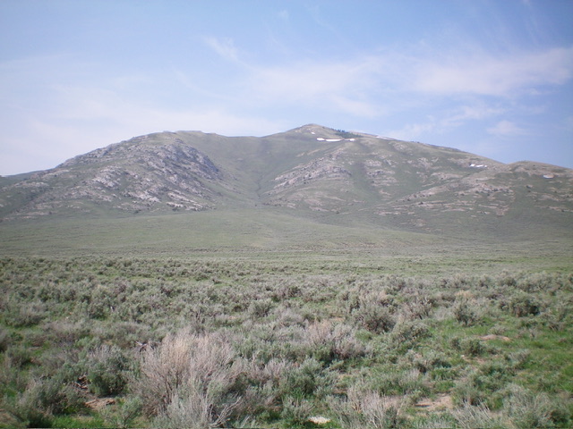
Peak 7715 as viewed from the start of the climb. The northeast gully (descent route) is just left of center. The ascent route climbs the ridge just right of the gully. The summit is not yet visible. Livingston Douglas Photo
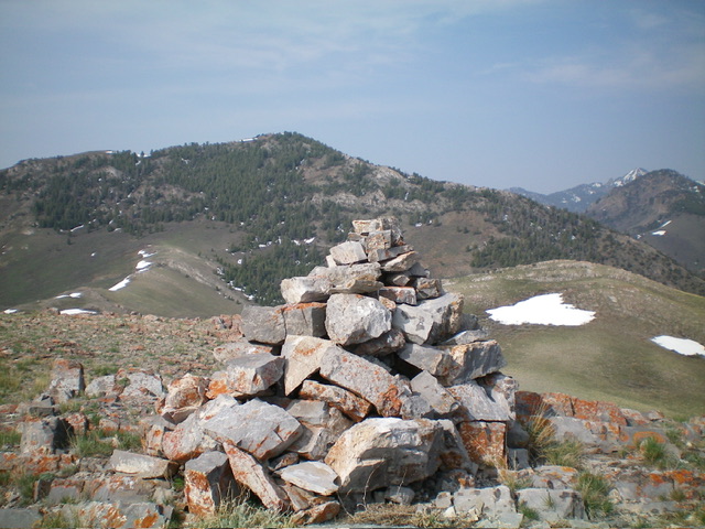
The large cairn atop Peak 7715 with Peak 8290 in the distance. Livingston Douglas Photo
Northeast Gully, Class 2
The Descent
From the summit, descend northeast to Point 7400+ then head east down a spur ridge in somewhat thicker sagebrush to a minor saddle. Leave the spur ridge and descend north into the northeast gully, staying on its right/east side to avoid thicker sagebrush in its center. Pick up a visible cattle trail about halfway down and follow it to the mouth of the gully. Bushwhack across a field of easy sagebrush and head northeast back to the road junction and your parked vehicle.
Additional Resources
Regions: EASTERN IDAHO->White Knob Mountains
Mountain Range: White Knob Mountains
Longitude: -113.5037 Latitude: 43.8012