Elevation: 7,715 ft
Prominence: 895

This peak is not in the book. Livingston Douglas provided the alternative route descriptions found below. Updated November 2018
Peak 7715 sits southwest of the many rock formations that make the City of Rocks so popular with rock climbers. USGS Almo
Northeast Slopes, Class 2
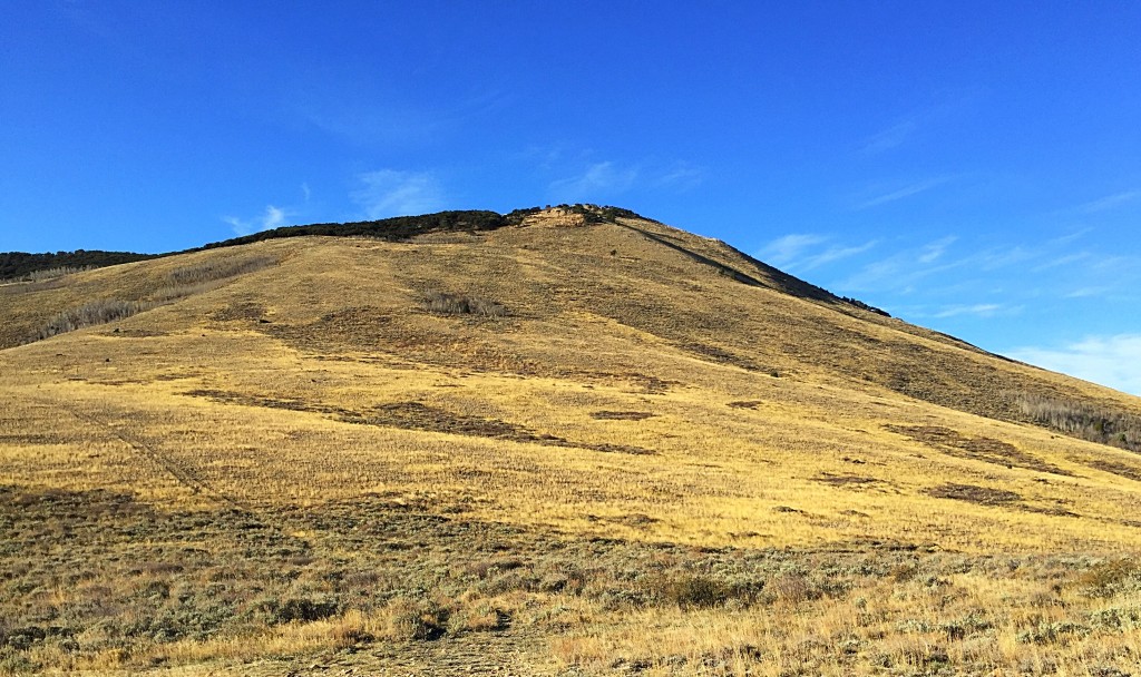
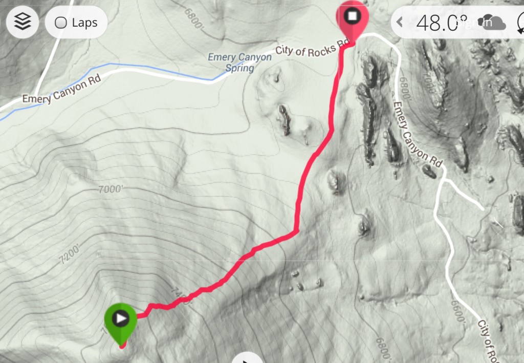
The peak is an easy climb from Emigrant Summit. There is good parking on the pass. It is open slopes all the way to the summit, which is 1.2 miles and 880 vertical feet above the pass. See the GPS track below. Also, see Livingston Douglas’ northeast face route description set out below. He descended this line.

This peak sits on the west edge of the City of Rocks National Reserve. The route climbs up the open slopes.


My GPS track
2018 Update by Livingston Douglas
Peak 7715 is a half-scrub, half-forested hump located just inside the west entrance to the City of Rocks National Reserve. It has a thick forest of mountain mahogany on its summit area as well as on its west ridge and southwest face. The easiest ascent is via the 6,830-foot saddle at the head of Emery Canyon up open desert scrub slopes on its northeast face. A more challenging route is via its north ridge from the junction of Emery Canyon Road and Logger Springs Road. Please note that the USGS topo map grossly mispositions Logger Springs Road near the 6,830-foot saddle. The road is actually located one drainage (and 0.7 miles) to the west and climbs up the east side of Point 7410.
North Ridge, Class 2
Access
From the junction of ID-77 and Elba Road/1950 South in Elba, drive 12.7 miles south on ID-77 (passing through Almo on the way) to a signed right/west turn for the City of Rocks National Reserve at 3075 South. This paved road is unofficially called the “City of Rocks Road.” Reset your odometer here.
At 2.0 miles, you reach the City of Rocks east entrance. At 4.1 miles, turn right to stay on the City of Rocks Road (“Bath Rock Campsites” sign here). At 6.6 miles, cross a 6,530-foot saddle. The road becomes Emery Canyon Road here and it begins its westward descent of Emery Canyon. From the saddle, continue west on the paved road and descend to a meadow. At 7.3 miles, reach a junction with Logger Springs Road (which, after entering the Sawtooth National Forest, becomes FSR-562). This road is signed for “Logger Springs.” Park about 100 yards west of this junction at the pullout at the City of Rocks west entrance. The elevation here is 6,625 feet.
The Climb
From the road junction, scramble south in open terrain/scrub up onto the rock-and-scrub north ridge. This ridge has scattered boulders on its ridge crest, making it easy to follow as you ascend. It also has embedded boulders/rock to keep the scrub from becoming a serious problem. Higher up, the ridge steepens and thicker scrub mixes in with the large boulders and rocky ridge outcrops. When you reach the north-to-south summit ridge, mountain mahogany appears on the ridge crest and to the right/west of the ridge crest. Stay just left/east of the ridge crest to skirt these prickly, unyielding trees.
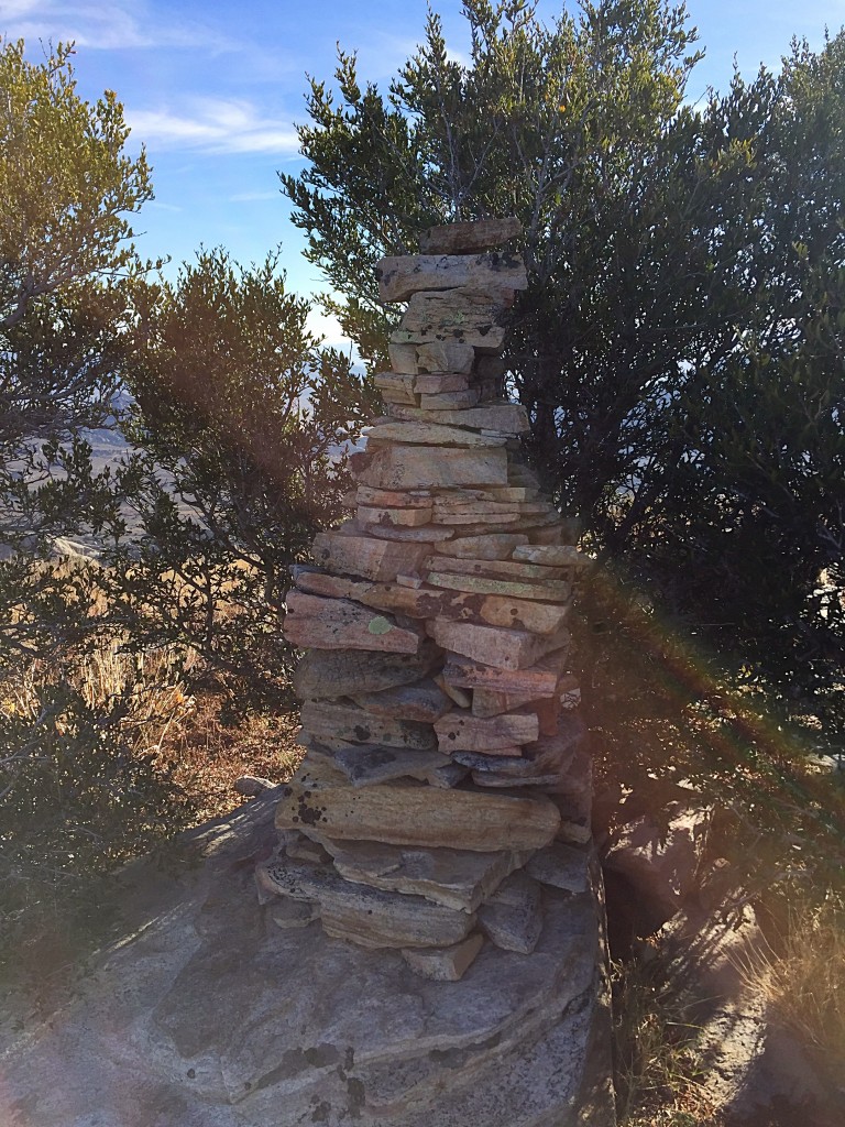
After about a 5-minute scramble south along the summit ridge crest (and a small amount of elevation gain), you reach the high point of Peak 7715—a MASSIVE ground boulder. There are two summit cairns nearby but nothing else. Thanks to the nearby mountain mahogany, the views are minimal.
Northeast Face, Class 2
Access
Same as for the north face/north ridge. If you plan to ascend and descend only the northeast face, park at the pullout area along Emery Canyon Road at the 6,530-foot saddle or drive to the rock climbers’ parking lot a bit farther south from the road.
The Descent
From the summit, descend north along the right/east side of the flat ridge crest for a couple of minutes. As soon as the terrain on the right/east side of the ridge crest opens up, leave the ridge and descend northeast in a mix of scattered mountain mahogany and desert scrub. As you descend, stay just left/north of the forest of mountain mahogany to your right/south. Aim for a gentle, wide saddle at the base of the northeast face at 6,860 feet. Keep angling right/northeast to remain on the “shoulder” of the northeast face and to reach the saddle.
You will soon reach grassy slopes (as opposed to desert scrub). Cruise down this open, easy terrain to reach the open saddle. Cross a cattle fence here and quickly find an old 2-track jeep road. Hike northeast along that road (which morphs into a better jeep road), skirting the right/east side of a minor hump as you progress. This jeep road leads to a parking lot at the base of a rock climbing area. Follow the access road back to the main road (Emery Canyon Road) at the 6,830-foot saddle. Hike westward down Emery Canyon Road for 0.7 miles to your parked vehicle at the west entrance.
Additional Resources
Regions: Albion Range->SOUTHERN IDAHO
Mountain Range: Albion Range
Year Climbed: 2015
First Ascent Information:
- Other First Ascent: North Ridge
- Year: 2018
- Season: Summer
- Party: Livingston Douglas
Longitude: -113.73969 Latitude: 42.07901