Elevation: 7,740 ft
Prominence: 340

This peak is not in the book. The unofficial name was suggested by Rick Baugher who climbed the peak in 2012. Published November 2024
Peak 7740 is one of three 7,000-foot, ranked summits that sit on a high ridge that separates South Fork Rainey Creek from North Fork Rainey Creek in the Snake River Range northeast of Swan Valley, Idaho. Peak 7740 is southwest of both Peak 7818 and Peak 7847. It is most easily climbed from the North Fork Rainey Creek but requires a difficult bushwhack. USGS Thompson Peak

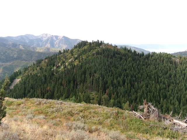
Peak 7740 as viewed from the northeast. The forested northeast ridge (my ascent route) is in dead center. Livingston Douglas Photo
Access
Same as for Peak 7847. This is the third leg of a 3-peak adventure that includes Peak 7847, Peak 7818, and Peak 7740. It covers 7.5 miles with 2,550 feet of elevation gain round trip.
Northeast Ridge, Class 2
The Climb
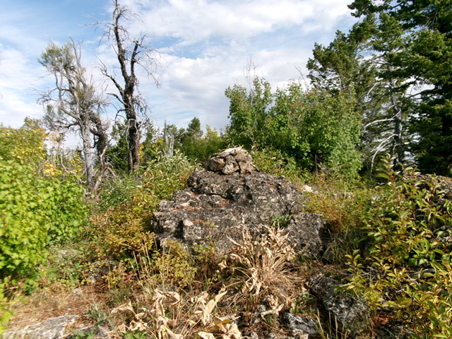
From the 7,360-foot connecting saddle with Peak 7818,bushwhack southwest up through a mix of dense pine forest, copious deadfall, thick brush, and patches of willows to reach a semi-open high ridge. Follow the narrow, but easy, ridge crest briefly left/south to reach the brush-and-boulder summit of Peak 7740. The high point is a willow-covered boulder next to the summit cairn.
Northwest Ridge, Class 2
The Descent
From the summit, descend north briefly on the high summit ridge. Head left/west-northwest then northwest down a ridge that is a mix of forest, rock, and brush (not fun) as it slowly descends toward the North Fork Rainey Creek drainage. Midway down, the ridge becomes a face and steepens. The forest bushwhack from here down to North Fork Rainey Creek is absolutely punishing. The pine forest is thick and has endless blowdown, brush, and willows. Lower down, move right-ish to reach a side gully. Follow this gully left/west-northwest to reach FST-089 on the east side of North Fork Rainey Creek.
Follow FST-089 north along North Fork Rainey Creek back to the trailhead parking area. This trail has not been maintained in many years. It is a narrow footpath that is insanely overgrown and is hard to follow. It crosses the creek several times. Pushing through the 7-foot willows to stay on the narrow path is tiresome. The trail gets a bit better upstream but it is still a great relief to finally reach a dispersed campsite just below the trailhead and a spur road up to the trailhead.
Additional Resources
Mountain Range: Big Hole and Snake River Mountains
Longitude: -111.1932 Latitude: 43.4996
