Elevation: 7,847 ft
Prominence: 687

This peak is not in the book. Published November 2024
Peak 7847 is one of three 7,000-foot, ranked summits that sit on a high ridge that separates South Fork Rainey Creek from North Fork Rainey Creek in the Snake River Range northeast of Swan Valley, Idaho. Peak 7818 and Peak 7740 lie southwest of Peak 7847 on the same high ridge. The easiest access to Peak 7847 is from the North Fork Rainey Creek Trail/FST-066. USGS Fourth of July Peak
Access
From ID-31 at Pine Creek Pass (virtual MM14.2), drive south then southeast up [signed] FSR-253 for 5.2 miles to the end of the road at the [signed] Upper Rainey Creek Trailhead/FST-066. This trailhead is at 6,520 feet and 43⁰31’34”N, 111⁰11’20”W. The North Fork Rainey Creek Trail/FST-089 leaves from the south end of this trailhead parking area. Unlike FST-066, [unsigned] FST-089 is not maintained, is badly overgrown, and is difficult to follow. This is the first leg of a 3-peak adventure that includes Peak 7847, Peak 7818, and Peak 7740. It covers 7.5 miles with 2,550 feet of elevation gain round trip.
The Approach, Class 1
From the Upper Rainey Creek Trailhead, follow the well-beaten trail (FST-066) as it heads up through a thick pine forest. The trail weaves around a bit and has some switchbacks, but it generally heads south-southeast initially. It bends left-ish/southeast and climbs over a shoulder. The trail then drops 90 vertical feet to cross a drainage. It then bends left-ish/east-southeast and climbs more steeply to reach a ridge crossing at a saddle. This saddle is at about 7,180 feet.
Northeast Ridge, Class 2
The Climb
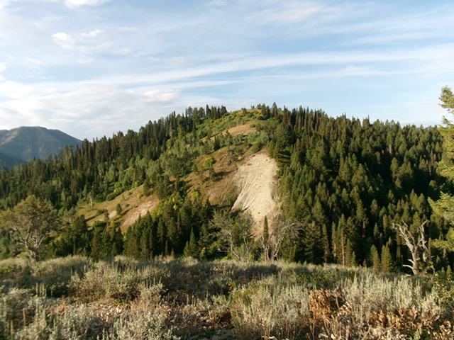
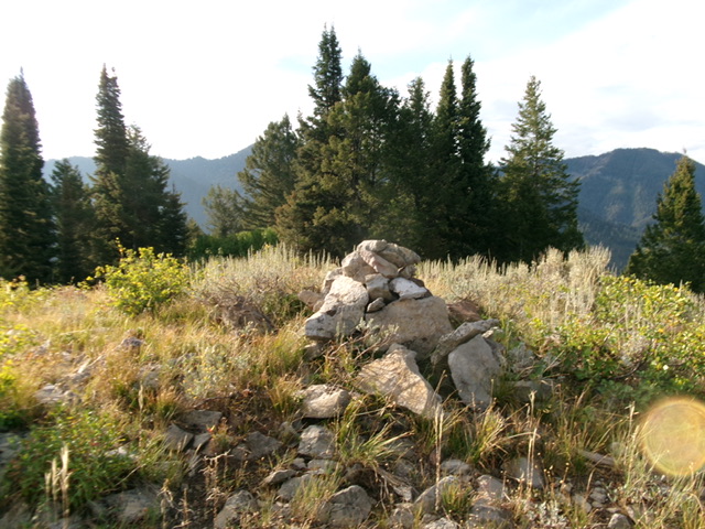
From the 7,180-foot ridge saddle, bushwhack west-southwest in semi-open terrain up through scrub and pine forest to reach the crest of the rounded northeast ridge. Follow the ridge left-ish/south-southwest up through similar terrain to the top of Point7636. This open, small point provides a great view of Peak 7847 to the southwest. From Point 7636, descend easy, open grass/scrub to a saddle at 7,480 feet. From the saddle, scramble right-ish/west up the ridge crest. It is initially narrow with forest on its right/west side and a steep, gravelly face on its left/east side. There is a trail (of sorts) and a gully to help you with this initial ridge section. Climb up through semi-open pine forest on the ridge crest (or on its left/east edge) to reach the summit of Peak 7847. The summit has a sizable cairn.

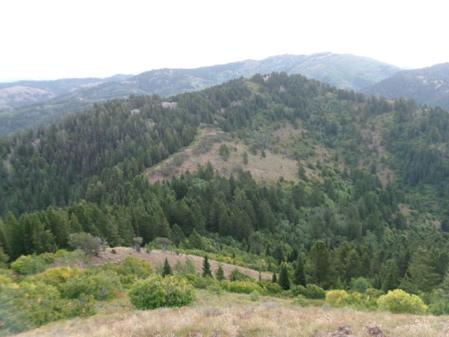
Peak 7847 as viewed from Peak 7818 to its west. The west ridge (left of center) was my descent route. Livingston Douglas Photo
West Ridge, Class 2
The Descent
From the summit, follow the thickly-forested ridge northwest to reach a very rocky ridge hump at 7680+. This hump is a pile of boulders and talus. It is easier to scramble up over this hump than to skirt its left/south side on angled boulders/talus in a thick forest with copious blowdown. Stay on open rock whenever possible. Follow the ridge crest southwest then west down to a saddle at 7,480 feet. This is the connecting saddle with Peak 7818. It concludes the first leg of today’s 3-peak journey. Peak 7818 is up next.
Additional Resources
Mountain Range: Big Hole and Snake River Mountains
Longitude: -111.1754 Latitude: 43.5069

