Elevation: 8,057 ft
Prominence: 477

This peak is not in the book. Published December 2024
Peak 8057 is a forested, pyramidal-shaped mountain that towers above the Yankee Fork of the Salmon River to its west. It separates the Silver Creek drainage from the Polecamp Creek drainage. Peak 8057 is most easily climbed via its east ridge from the Silver Creek Trail (FST-4168). USGS Sunbeam
Access
Same as for Peak 8785. This is the third leg of a 3-peak adventure that includes Peak 8785, Peak 8903, and Peak 8057. It covers 8.2 miles with 3,700 feet of elevation gain round trip.
East Ridge, Class 2
The Climb
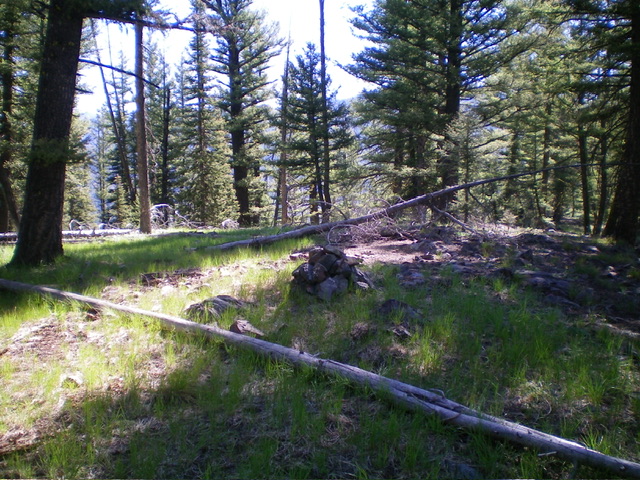
From the 7,580-foot connecting saddle with Peak 8903, scramble west up the semi-open, forested ridge using an on-and-off game trail. Skirt ridge pines and downed trees and climb up over a ridge hump at 7920+. Descend west for 40 vertical feet to a forested saddle that is a mess of downed timber. Once across the saddle, scramble west up a final ridge section, skirting ridge pines and blowdown by staying in easy grass/scrub. The semi-open summit of Peak 8057 showed no signs of previous ascent. I built a nice summit cairn atop the highest ground boulder in an open patch of the summit area.
Northwest Ridge, Class 2
The Descent
From the summit, descend west-northwest in reasonable pine forest to find a well-defined ridge heading northwest. Follow this steep ridge crest down through a pine forest on a decent game trail for much of it. Work around numerous ridge pines/blowdown, downed tree branches, and thick field grass using the game trail. There are a few steep-ish, loose ridge sections. Thankfully, there are no patches of steep talus/scree. As you approach the valley floor, the ridge loses its definition and becomes more of a face. Veer slightly left/west and bushwhack down a final section of field grass and forest to reach the 2-track road that leads to the Silver Creek trailhead. Follow the road for a short distance north to the trailhead and your parked vehicle.
Additional Resources
Regions: Eastern Salmon River Mountains->Salmon River Mountains->Southeast Corner Peaks->WESTERN IDAHO
Mountain Range: Eastern Salmon River Mountains
Longitude: -114.7008 Latitude: 44.3074
