Elevation: 8,141 ft
Prominence: 302

This peak is not in the book. The map elevation is 8,127 feet. Published December 2024
Peak 8141 sits on a ridgeline that separates Fred and Mary Draw from the North Fork Morgan Creek in the foothills of the Lemhi Range. It is most easily reached from the Morgan Creek drainage, if public access is allowed through the private land in the upper part of that drainage. USGS Ennis Gulch

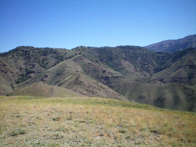
Peak 8141 (forested ridge in distance) as viewed from Peak 7326 to its south. The summit is well right of center. Livingston Douglas Photo
Access
From US-93 in Ellis, drive southeast on the [paved] Pahsimeroi Highway for 1.5 miles to a signed junction with the Ennis Gulch BLM Road. Reset your odometer at this junction. At 0.5 miles, go right/southeast at an unsigned junction to follow a fence row southward. At 0.9 miles, go left/northeast at an unsigned junction and leave the fence row. The road gets considerably rougher now and is rocky and badly rutted in spots. A 4WD vehicle with high clearance is required.
At 2.6 miles, reach an unsigned junction. Go straight here. At 2.8 miles, reach the mouth of Ennis Gulch. At 3.1 miles, go right at an unsigned junction. At 3.2 miles, park in a pullout area just before the road gets rocky, rutted, and rough. This pullout is at 5,510 feet and 44⁰40’25”N, 113⁰58’38”W. This is the first leg of a 2-peak adventure that includes Peak 8141 and Peak 7326. It covers 8.5 miles with 3,425 feet of elevation gain round trip.
West Spur/South Ridge, Class 2
The Climb
From the pullout in Ennis Gulch, hike northeast up the Ennis Gulch Jeep Road to an unsigned road junction at a fork in the canyon. Go right/east-northeast onto a weak 2-track and follow it to another fork in the canyon with a signed ATV Trail (FST-4241) heading straight/northeast up the left fork of the canyon. The trail sign is at the toe of the west spur. This trail is not shown on the USGS topo map. It may be possible to follow FST-4241 northeast up a narrow drainage and then climb east up to Point 7203 on the south ridge of Peak 8141, but I cannot be sure about that.
Do not follow the ATV trail northeast. Instead, go right-ish/east up a grassy, steep shoulder. This is the west spur of the south ridge. Follow this steep, but good, ridge east to approach Point 7200+ on the south ridge. Skirt its north side to reach the south ridge at a minor saddle. Scramble northeast then north up the narrow crest of the south ridge to rocky Point 7203 then drop slightly to a saddle. Continue north then northeast then north on a good elk trail on the left/west side of the ridge crest. Reach a saddle/notch in open terrain just west of Point 7923.
Head right/northeast on a good elk trail into the forest, skirting the left/west side of Point 7923. Continue north then northeast, without the help of a game trail, to reach the small, semi-open top of the west summit. There are lots of downed trees in this section of the climb. Scramble east along a semi-open ridge crest of grass and pines for about 0.4 miles to reach the forested summit hump. Contrary to the USGS topo map, the high point seems to be at the southeast end of the short ridgeline on which the summit rests. I built a cairn there. There were no signs of previous ascent. From the summit, return west then south down the lengthy ridge to reach the 7,020-foot connecting saddle with Peak 7326. This concludes the first leg of today’s 2-peak journey. Peak 7326 is up next.

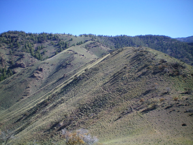
The undulating south ridge of Peak 8141 (right of center then center). This was my ascent route. Livingston Douglas Photo
Additional Resources
Regions: EASTERN IDAHO->Lemhi Range
Mountain Range: Lemhi Range
Longitude: -113.92957 Latitude: 44.6994
