Elevation: 8,398 ft
Prominence: 313

This peak is not in the book. Published November 2024
Peak 8398 is a rugged peak that is located in the foothills of the Beaverhead Mountains. It towers over Blue Dome and ID-28 to the west and Skull Canyon to the northwest. It presents a challenging scramble via its west ridge. Thanks to LiDAR measurements, Peak 8398 is now a ranked summit. USGS Copper Mountain

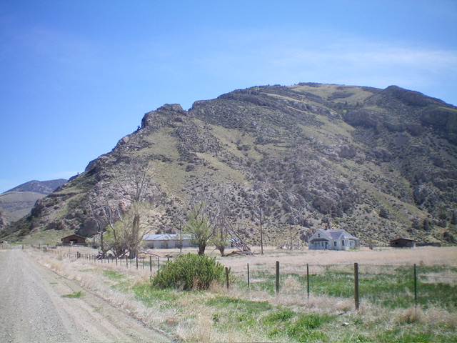
Peak 8398 is a big, rugged mountain that towers over Skull Canyon (at far left). The west ridge starts at lower left and climbs the skyline to right of center. The elusive summit hump is not visible from here. Livingston Douglas Photo
Access
Skull Canyon Road (signed) is located along ID-28 at Blue Dome at virtual MM45.7. Drive 0.4 miles northeast up Skull Canyon Road to reach BLM land. Park just inside the BLM cattle fence/gate. It is the second red cattle gate. This parking area is at 6,160 feet and 44⁰09’47”N, 112⁰54’27”W. Be careful to avoid the private ranch land to the west when you begin this climb. There is a split-rail fence that separates the BLM land from the private land. You cannot just climb up from the toe of the West Ridge since that lower section of the ridge is on private ranch land.
West Ridge, Class 3
The Climb
From the grassy parking area, scramble east up a diagonal footpath from the road to get past the initial cliff band then either (1) Climb right-ish up to the ridge crest just above the split-rail fence (my descent route) or (2) Follow a game trail northeast to gain some elevation and find a much higher break in the ridge cliffs to reach the ridge crest (my ascent route). Once on the crest of the west ridge, follow it steeply east, staying right/south of any ridge blocks/towers. Avoid the awful mix of thick mountain mahogany and ridge rock/boulders on the ridge crest by staying in angled grass/scrub below the rocky ridge crest.
Point 6840+ is the first major ridge problem. Skirt its south side (my descent route) or climb up it and then downclimb 100 feet on its south side (my ascent route). Point 7680+ presents problems too. Either climb up it then downclimb a gully of loose scree and mountain mahogany then a grass/scrub slope for a total of 165 vertical feet (my ascent route) or skirt below it and only climb 110 vertical feet on the westward descent on the ridge (my descent route).
From the ridge saddle just east of Point 7680+, scramble southeast up through a pine forest with rocky outcrops mixed in to reach another minor ridge top. From there, drop 40 vertical feet in semi-open ridge terrain to quickly reach another saddle. From this saddle, do an ascending traverse on the south side of Point 8264 to reach another high saddle at 8020+ feet. From this saddle, scramble southeast up a pine forest ridge with some open scrub areas on its right/south side to reach open Point 8377.
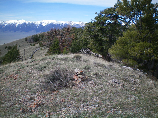
You might think that this is the summit (as I did), but IT IS NOT. The summit of Peak 8398 is northeast of this point and is 21 feet higher, according to LiDAR. From Point 8377, bushwhack northeast along the up-and-down, forest-and-scrub ridge crest (not difficult) to reach the true summit of Peak 8398. The connecting saddle between Point 8377 and Peak 8398 requires only a vertical drop of 30 feet. The open, ridgeline summit of Peak 8398 showed no signs of previous ascent so I built a summit cairn.
The mountain mahogany on this climb is unforgiving and brutal. In some areas, it is unavoidable. The side-hilling/contouring is angled and loose in areas and is tiresome. And I had one more peak to climb after this one.

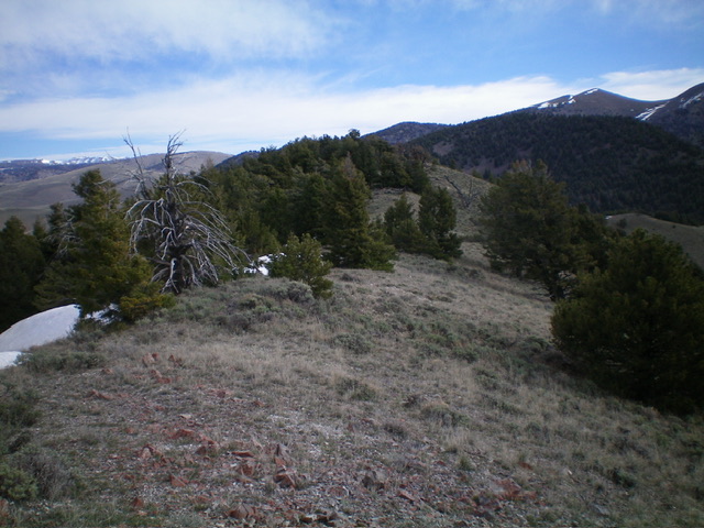
The summit hump of Peak 8398 as viewed from the summit ridge to its southwest. Livingston Douglas Photo
Additional Resources
Regions: Beaverhead Range->EASTERN IDAHO
Mountain Range: Beaverhead Range
First Ascent Information:
- First Ascent Year: 2024
- Season: Summer
- Route: West Ridge
- Party: Livingston Douglas
Longitude: -112.87124 Latitude: 44.16180
