Elevation: 8,562 ft
Prominence: 709

This peak is not in the book. The unofficial name was suggested by Rick Baugher who climbed the peak in 2006. Published November 2024
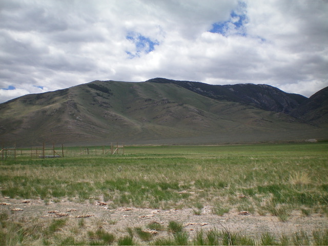
Peak 8562 is an impressive double-humped mountain that separates Hawley Canyon to its north from Deer Creek to its south. It can be climbed from the north, the south, or the west. The greatest challenge is probably driving the difficult mountain roads to get close to it. USGS Hawley Mountain

Peak 8562 as viewed from the northeast. The summit hump is the forested hump in the distance in dead center. Livingston Douglas Photo
Access
From ID-33 in Howe, drive northwest on the unsigned, paved Little Lost River Highway. At 24.0 miles, turn left/west onto a 2-track road and reset your odometer. At 0.1 miles, turn left/south onto another 2-track road. At 0.3 miles, turn right/west onto a weaker 2-track road that follows a fence row. At 0.8 miles, reach an unsigned “T” junction.
Turn right/north here and drive north then northwest on a 2-track road that heads up into Hawley Canyon. At 1.6 miles, reach a road fork. Go left/west here. At 2.4 miles, reach a nice pullout at the base of the north spur. Park here (6,120 feet and 44⁰05’25”N, 113⁰16’58”W). Hawley Canyon Road is narrow, overgrown, and has some serious ruts early on. A 4WD vehicle with high clearance is required.
North Spur/East Ridge, Class 2
The Climb
From the grassy roadside pullout, scramble south up the left/east edge of a rounded shoulder (the north spur) and work through a patch of gapped mountain mahogany early on. Scramble south then southwest then south up an open ridge of embedded scree, short grass/scrub, and a few rocky ridge outcrops. Skirt the right/west side of Point 7742 to reach the wide-open saddle (7,620 feet) at the base of the east ridge.
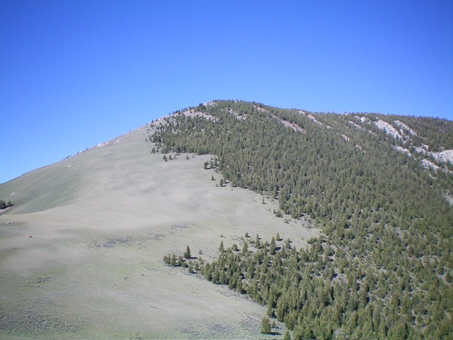
Climb up the left/south edge of the rounded ridge to stay in open scrub (initially) and scattered pines and blowdown (higher up). Angle right-ish/northwest in rockier terrain high up to reach the open summit area. There is a torn-down cairn (and post) on the south tip of the summit area. The high point is a protruding boulder about 30 feet away. I built a small cairn atop this boulder. There are two other possible high points: a rocky hump about 30 feet farther northwest and another open hump another 50 feet farther northwest. All three potential high points measured equally on my altimeter.
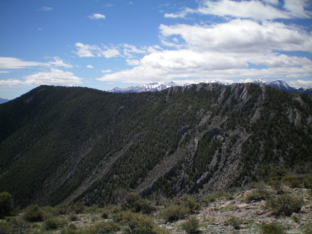
That being said, the first high point (upon which I built a cairn) is probably the official high point given how the USGS topo map positions the measured summit. When descending from the summit, be sure to get on the shoulder heading due north from Point 7742. Don’t get lured left/northwest down a different, longer shoulder. The ridge rock on the northwest ridge of Peak 8562 is ugly and narrow. A ridge traverse from Peak 8300 (my original plan) would be unwise if not impossible.

Looking up the east ridge of Peak 8562 from near the saddle. The summit is in dead center. This was my ascent route. Livingston Douglas Photo
Additional Resources
Regions: EASTERN IDAHO->Hawley Mountains->Lost River Range
Mountain Range: Lost River Range
Longitude: -113.29901 Latitude: 44.0730
