Elevation: 8,763 ft
Prominence: 303
This peak is not in the book. Published February 2025
Peak 8763 is a rather insignificant ridgeline hump that is overshadowed by Johnstone Peak (9,949 feet) to its northeast. Indeed, it is just a ridge hump (albeit a ranked one) on the long southwest ridge of Johnstone Peak. Peak 8763 is most easily climbed from the Parker Gulch Trail to its west. This climb is entirely on National Forest land. USGS Sun Valley
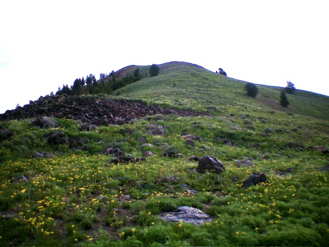
Looking up the summit ridge of Peak 8763. The summit hump is not yet in view. Livingston Douglas Photo
Access
From ID-75 exactly 1.5 miles south of First Street in Ketchum, (or 3.9 miles north of East Fork Road), turn right/east onto [signed] Elkhorn Road and drive 1.9 miles to a signed junction with Morning Star Road. Turn right/east onto Morning Star Road and drive 0.6 miles east then north to a signed junction with Parker Gulch Road. Turn right/east onto Parker Gulch Road and drive 2.1 miles to the road’s end at the Parker Gulch Trailhead (6,525 feet). GPS coordinates: 43⁰42’00”N, 114⁰17’01”W. Parker Gulch Road is only paved for the first 0.1-0.2 miles and it becomes a badly rutted, narrow dirt/mud mess (not advised in wet weather) as you near the trailhead.
West Gully/West Shoulder, Class 2
The Climb
From the trailhead parking area, walk about ½ mile up Parker Gulch Trail to a meadow with a prominent gully to the right/southeast. Leave the trail near the top of the meadow and bushwhack southeast then east up the dry, vegetation-filled gully to reach the base of the [obvious] west face of Peak 8763. Bushwhacking in the center of the gully seems to work best as the side-hilling is difficult and is often clogged with downed timber or very loose scree and brush. The gully bends left/north when it reaches the base of the west face.
Leave the gully here and bushwhack southwest up a magnificent, forested shoulder. This bushwhack is quite steep but goes well. The terrain is scattered pines with matted field grass (a bit slipper on the descent). The ridge eventually leaves the forest and climbs higher in open terrain. Reach the top of the shoulder in a flattish area at 8,420 feet. Follow the ridge crest left/northeast to the summit. This high ridge section is a mix of scrub, talus, scree, and rocky outcrops but presents no problems. The summit is a gentle hump and has a summit cairn.
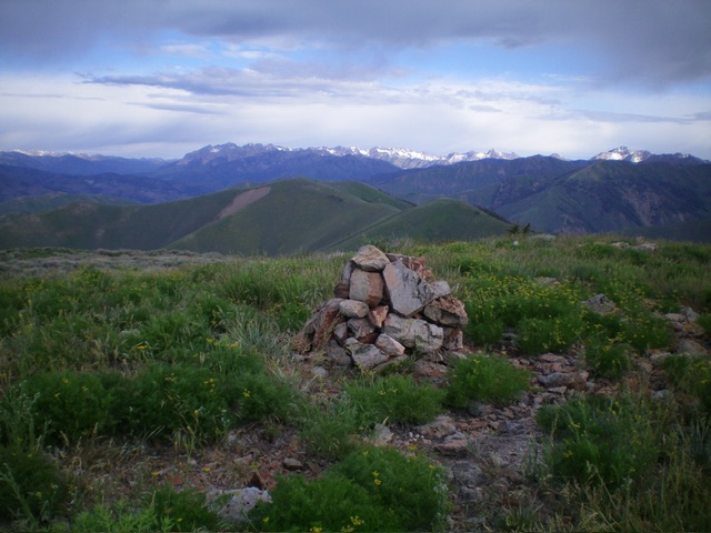
The summit of Peak 8763. Livingston Douglas Photo
Additional Resources
Regions: EASTERN IDAHO->Pioneer Mountains
Mountain Range: Pioneer Mountains
Longitude: -114.8763 Latitude: 43.6960