Elevation: 8,829 ft
Prominence: 769

This peak is not in the book. The names is taken from the peakbagger.com website. Dave Pahlas calls it Beaver Creek Peak. Published December 2024
Peak 8829 is a forested foothill in the White Cloud Mountains. It sits above the Salmon River just above the headwaters of both Beaver Creek and Treon Creek. Peak 8829 is most easily climbed from an old jeep road that goes up the Beaver Creek drainage. USGS Robinson Bar
Access
From ID-75, turn west onto FSR-454 (near Slate Creek) at a bridge crossing of the Salmon River. Drive 0.7 miles west to an unsigned road junction. Go right/west to stay on FSR-454 (left/south is FSR-666/Slate Creek Road). From this junction, drive 1.4 miles west then south then northwest on narrow (but quite drivable) FSR-454 as it follows the Salmon River upstream. Reach the mouth of the Beaver Creek drainage (left) and an old 2-track that heads up the drainage. Park about 50 yards up from FSR-454 on this 2-track road in a pullout area. This pullout is at 5,710 feet and 44⁰15’13”N, 114⁰34’49”W. There is a “Snare Trap Warning” sign just past this pullout at the mouth of the canyon. This old 2-track is closed to motorized vehicles and is shown as FST-410 on the National Forest map.
Map Errors
The USGS topo map fails to show any road or trail heading up Beaver Creek. This is quite surprising. FST-410 is not a trail but is an old, overgrown jeep road. It is good for hiking but is closed to motor vehicles and has not been driven in many years. FST-410 goes up Beaver Creek and abruptly ends at about 7,280 feet, farther up the drainage than the National Forest map and the Sawtooth & White Cloud Mountains Trail Map indicate.
East Face/Northeast Shoulder, Class 2
The Climb
From the parking area (and unsigned trailhead), hike southwest up the overgrown 2-track road for about 2-1/2 miles to a campsite/turnaround (7,100 feet). This campsite is at the toe of the northeast shoulder. The old road continues to the left/east of the shoulder and follows the right/west side of Beaver Creek for another ½ mile. Follow the road to its end at about 7,280 feet. At this point, there is no road or trail anymore. The Beaver Creek drainage is thick with pines and blowdown, so leave the drainage here.
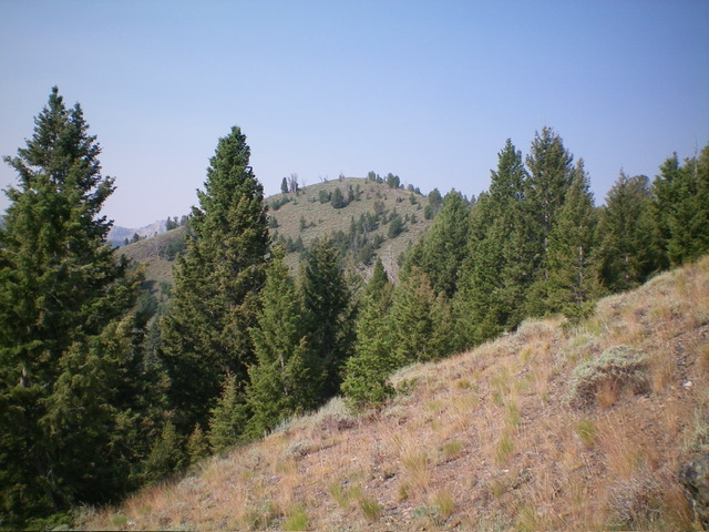
Bushwhack west up a steep hillside of pines, some blowdown, and grass/scrub. Continue uphill to reach the crest of the northeast shoulder at about 8,100 feet. Head northwest up the shoulder and skirt a rocky buttress at about 8,200 feet. Continue northwest up a mix of pines, blowdown, scrub, and angled scree. Reach a juncture with the southeast shoulder at about 8,350 feet. Climb west then west/northwest in semi-open terrain and get your first view of the summit hump of Peak 8829 to the left/southwest.
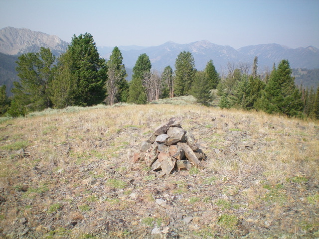
Follow the ridge crest up to 8,620 feet, just below a ridge hump. Contour left/southwest on somewhat-angled terrain in semi-open pine forest to reach a hidden, elusive, small ridge saddle at 8,620 feet. This saddle sits just underneath, and northeast of, the summit hump. From the saddle, scramble southwest up grass/scrub with a scree/gravel base to quickly reach the open summit of Peak 8829. The summit has evidence of surveyors (old cairns, triangulation wiring, surveyor sticks). There was no summit cairn so I built one on the high point using talus from a nearby surveyor’s cairn.

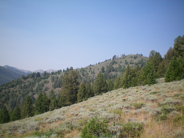
Peak 8829 (summit is right of center) and its long east ridge (skyline left of center). Livingston Douglas Photo
Northeast Shoulder FULL, Class 2
The Descent
From the summit, return northeast to the 8,620-foot saddle. Contour northeast to the upper southeast shoulder and follow it east down to its juncture with the top of the northeast shoulder. Follow the northeast shoulder all the way to its toe at the aforementioned campsite/turnaround area at about 7,100 feet. Hike about 2-1/2 miles northeast down the old, overgrown 2-track road that follows Beaver Creek back to the unsigned trailhead and the small parking area. The northeast shoulder is a bit tedious and is a mix of pines, rocky outcrops (two of them to skirt or downclimb), loose scree, some blowdown, and grass/scrub.
Additional Resources
Regions: EASTERN IDAHO->White Cloud Mountains
Mountain Range: White Cloud Mountains
Longitude: -114.6303 Latitude: 44.2236

