Elevation: 8,883 ft
Prominence: 314

This peak is not in the book. Published November 2024
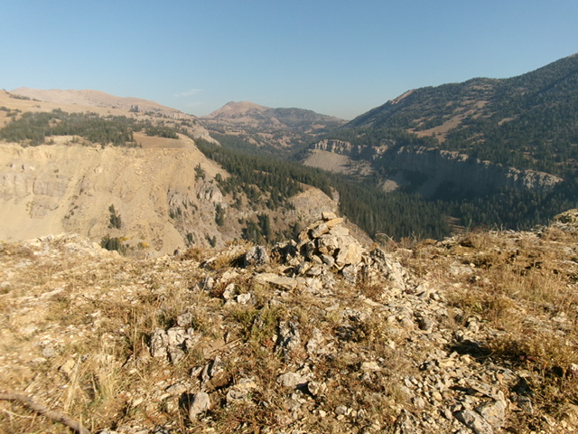
Thanks to LiDAR, Peak 8883 is now a ranked summit. It towers over the convergence of West Targhee Creek and Targhee Creek in the Henrys Lake Mountains. Peak 8883 has a wickedly-steep north face. It is overshadowed by Bald Peak (10,192 feet) to its north-northeast. USGS Targhee Pass

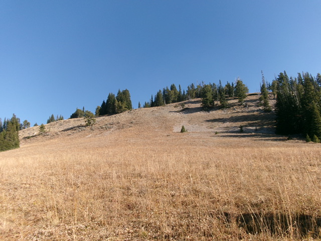
Peak 8883 and its open southwest face. This was my ascent route. The summit hump sits behind the ridge pines in dead center. Livingston Douglas Photo
Access
Poorly-signed FSR-057 is along US-20 northeast of Island Park. This junction is 2.2 miles northeast of the US-20/ID-87 junction and is about 2 miles west of Targhee Pass. Turn north onto FSR-057 and drive 0.8 miles on this rutted dirt road to the signed trailhead for the Targhee Creek Trail/FST-027. Park in the large parking lot at the trailhead (6,950 feet and 44⁰40’14”N, 111⁰18’47”W).
Map Errors
The USGS topo map fails to show the Dry Fork Cutoff Trail/FST-028 and the Dry Fork Trail/FST-028 (yes, they share the same FST number). The Caribou-Targhee National Forest map mislabels Dry Fork as Targhee Creek, while also labeling Targhee Creek as Targhee Creek.
Dry Fork Trail Approach, Class 1
From the Targhee Creek Trailhead, hike north up well-beaten, undulating Targhee Creek Trail/FST-027 for ¾ mile to a signed junction with Dry Fork Cutoff Trail/FST-028. Go left/west onto FST-028 and follow it down across Targhee Creek (ford the creek or cross it on a large downed tree a bit upstream) then up and across several shoulders and dry gullies to cross the dry creek bed of Dry Fork and quickly reach a junction with the official Dry Fork Trail/FST-028. The Dry Fork Cutoff Trail is in mostly open (or semi-open) terrain. It generally heads downhill to reach Dry Fork.
There are numerous forest service trail signs on the Dry Fork Cutoff Trail as well as the initial section of the Dry Creek Trail to help you stay on the narrow foot path, particularly in the grassy, open sections. Head right/north at the signed trail junction. The trail enters a pine forest and crosses Dry Fork (a dry creek bed) several times. The trail is narrow but easy to follow. It rises through a mix of pine forest and open grassy areas. The trail reaches the base of the southwest face at the southeast edge of a broad saddle at 8,560 feet. Leave the trail here.
Southwest Face, Class 2
The Climb
From Dry Fork Trail just below the saddle, bushwhack north across a grassy field. Scramble north up a steep, grass-and-gravel slope to reach a ridge higher up. Once on the ridge, head left/northwest up an open lane/ramp of scrub in between patches of pine forest. At the top of this lane, scramble right/north to reach the summit in open, easy grass and scrub. The summit has some triangulation wiring and cairn. The highest ground boulder had a tiny cairn which I built up considerably. The summit of Peak 8883 is open and offers splendid views. Forested Point 8843 is to the southeast.
Additional Resources
Regions: EASTERN IDAHO->Henrys Lake Range
Mountain Range: Henrys Lake Range
Longitude: -111.35975 Latitude: 44.70366
