Elevation: 8,961 ft
Prominence: 301

This peak is not in the book. Published December 2024
Peak 8961 is a gentle hump on a lengthy north-south ridge that sits due west of Loon Creek Road in the Eastern Salmon River Mountains. In contrast to its northern neighbor (Peak 9483), this peak is an easy walkup via its north ridge. Peak 8961 is most easily climbed from Loon Creek Road to its east. USGS Mount Jordan

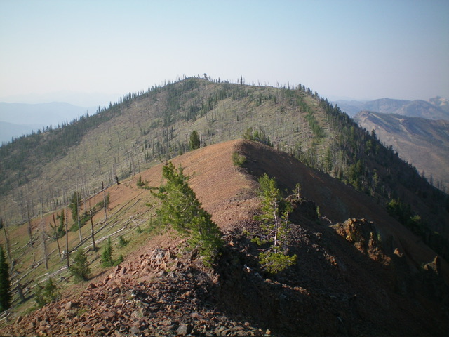
Peak 8961 as viewed from Point 8828 to its north. The north ridge (my ascent route) is right of center. The summit is left of center on the high summit ridge. The upper east ridge (my descent route) is the skyline left of center. Livingston Douglas Photo
Access
Same as for Peak 9483. This is the second leg of a 2-peak adventure that includes Peak 9483 and Peak 8961. It covers 5.5 miles with 3,350 feet of elevation gain round trip.
North Ridge, Class 2
The Climb
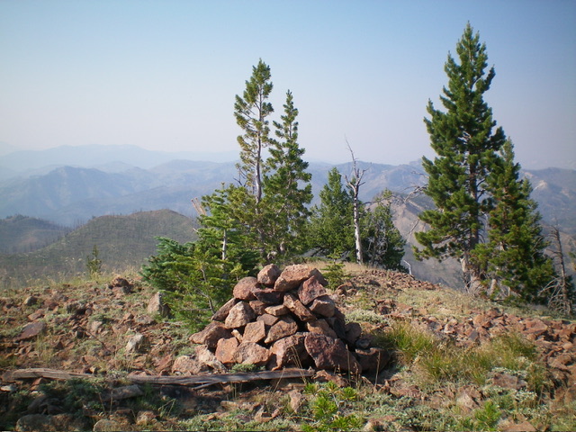
From the 8,660-foot connecting saddle with Peak 9483, head south then southeast up the semi-forested ridge with good gravel underfoot. There are endless ridge trees and downed trees to skirt or climb over to reach the small summit area, but nothing difficult. Just a bit tedious. The small summit has a small survey benchmark in a ground boulder and a triangulation post and wiring laying on the ground. I built a nice summit cairn on the high point.

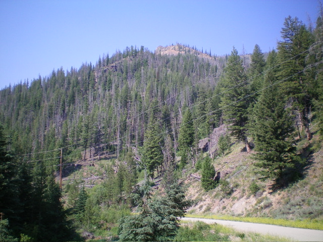
The forested lower section of the east ridge (dead center) as viewed from Loon Creek Road. This area is thick and is an unpleasant bushwhack. Livingston Douglas Photo
East Ridge, Class 3
The Descent
In stark contrast to the easy, gentle north ridge, the east ridge is a bear, though it does lead directly down to Loon Creek Road. From the summit, descend the tedious, thickly forested (initially) east ridge. Work through an endless mix of loose scree/gravel, blowdown (lots), and ridge pines. The ridge bends northeast at Point 8083. Descend a boulder field soon after passing this point then downclimb a rocky ridge buttress (Class 3). Continue to work through the ridge pines, blowdown, and loose scree to reach a final, massive ridge buttress. Downclimb this buttress on its left/north side (Class 3) just before it becomes an impossible Class 5 endeavor.
Once below this massive buttress, bushwhack northeast down to Loon Creek Road at a side creek drainage in absolutely awful blowdown in the semi-open pine forest. This is a most unpleasant experience and I was happy to be going downhill through this mess. Climbing up it would be nearly impossible. Once on Loon Creek Road at the mouth of the side drainage, hike a short distance northeast up the road to the wonderful, flat roadside pullout and your parked vehicle. The east ridge is deceptive. It looks quite easy from high up, but it’s not. It also looks relatively easy from Loon Creek Road, but it’s not. Don’t be fooled by this one.
Additional Resources
Regions: Eastern Salmon River Mountains->Salmon River Mountains->Southeast Corner Peaks->WESTERN IDAHO
Mountain Range: Eastern Salmon River Mountains
First Ascent Information:
- Other First Ascent: East Ridge—Descent
- Year: 2024
- Season: Summer
- Party: Livingston Douglas
Longitude: -114.7574 Latitude: 44.4082
