Elevation: 8,962 ft
Prominence: 662

This peak is not in the book. Published November 2023
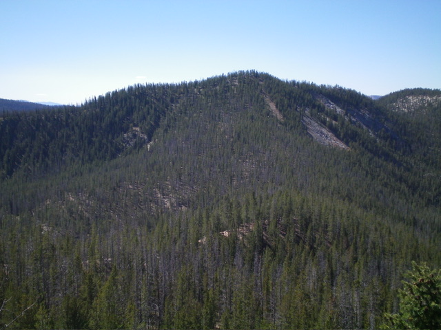
Peak 8962 is the high point on a ridge that is located due east of Hoodoo Meadows and southeast of Yellowjacket Lake. It is most easily climbed from FSR-114/Yellowjacket Lake Road and its west side. Peak 8962 sits above the headwaters of the West Fork Yellowjacket Creek and has a [lower] neighboring peak to its northeast, Peak 8807. USGS Hoodoo Meadows
Access
From Panther Creek Road, drive west up FSR-112/Porphry Creek Road for 6.8 miles to a signed 4-way road junction . From the road junction, head right/north up FSR-113 for a rugged, rutted 8.3 miles to a signed junction with FSR-114/Yellowjacket Lake Road. The road bends west then south along the way. Go straight/south onto FSR-114. At 4.9 miles, reach the [signed] turnoff for the Yellowjacket Lake Campground.
At 5.6 miles, reach a sharp bend in the road at the base of the southeast ridge of Peak 8940. At 5.8 miles, reach a nice pullout on the west side of the road. Park here (8,300 feet; 45⁰03’30”N, 114⁰33’16”W). This pullout is near the upper end of Hoodoo Meadows. This is the first leg of a 2-peak adventure that includes Peak 8962 and Peak 8807. It covers 5.0 miles with 1,830 feet of elevation gain round trip.
Northwest Spur/West Ridge, Class 2
The Climb
From the roadside pullout, walk 0.2 miles north on FSR-114 to the toe of the northwest spur at a sharp bend in the road. Leave the road and scramble south then southeast up the forested spur to reach Point 8900 on the west ridge. The terrain on the northwest spur is reasonable pine forest with almost no ridge rock and little deadfall. Once atop the semi-open, narrow ridge crest of Point 8900, head northeast down the gradual incline in open gravel/scrub with some scattered pines.
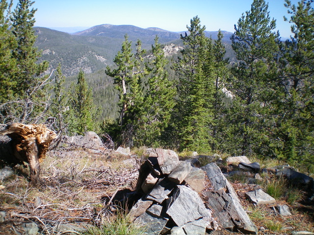
Leave the ridge crest fairly soon to descend east down a forested face/shoulder to reach a hidden saddle with Peak 8962. From the small saddle, scramble up the west ridge of Peak 8962 to the small summit. The west ridge is narrow with rocky outcrops to skirt but, overall, it’s not too bad. There were no signs of previous ascent, so I built a summit cairn.
Northeast Ridge, Class 2
The Descent
From the summit, descend northeast down a forested ridge in easy terrain to reach a forested, elongated saddle at 8,500 feet. The northeast ridge is a mix of ridge pines, some deadfall, and some open patches of short scrub. It goes quickly. The 8,500-foot saddle is the connecting saddle with Peak 8807. It concludes the first leg of today’s 2-peak adventure. Peak 8807 is up next.
Additional Resources
Regions: Eastern Salmon River Mountains->Salmon River Mountains->WESTERN IDAHO->Yellowjacket Mountains
Mountain Range: Eastern Salmon River Mountains
Longitude: -114.5351 Latitude: 45.0548

