Elevation: 8,966 ft
Prominence: 1,266

This peak is not in the book. Published November 2024
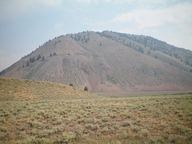
Peak 8966 towers above the convergence of the North Fork Big Lost River and the Big Lost River. It is most easily climbed from Mud Creek on its northeast side. Peak 8966 has steep, rugged (and gravelly) slopes on its south and west sides. The peak has an impressive 1,266 feet of prominence. It is seldom climbed. USGS Herd Peak
Access
North Fork Big Lost River Road/FSR-128 [(B)(2) on Page 242 of the Book]. From Trail Creek Road, drive 1.8 miles northwest up North Fork Big Lost River Road to a small roadside pullout at the base of the steep southwest face. Park here (7,165 feet and 43⁰54’34”N, 114⁰10’29”W). In retrospect, there is a better roadside pullout at the 2.0-mile point. That pullout puts you in a better position to climb southeast up through an easier, more forested face section to reach the crest of the west ridge.
West Ridge, Class 3
The Climb
From the roadside pullout, walk a short distance up FSR-128 to get past the impossibly steep, loose scree/slope on the west face. Once past this very steep section, leave the road and scramble east up the steep face in an area with scattered pines. The scree/gravel is steep and loose. Grab hold of scrub and/or pine trees (or stay in areas of pine duff) to help you advance higher. There are also some areas of embedded solid rock to give you purchase. Aim for a rocky outcrop on the ridge crest to the right/east.
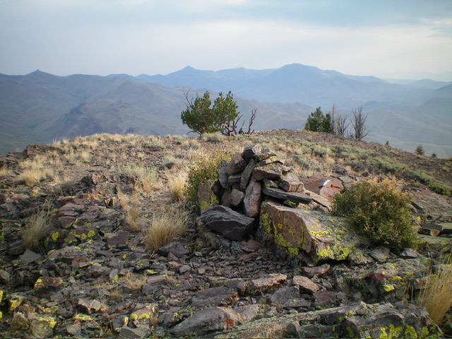
Once above this rocky outcrop, follow the ridge crest up a much easier slope. Scramble across a few rocky ridge outcrops to reach a flat ridge section of easy outcrops and scrub. Climb northeast then east up a sagebrush ridge then face with a prominent gully on the right/south side. Aim to reach a high ridge that heads right/south across the head of the large, dry gully. Once on the ridge crest, bushwhack south up through sagebrush. Higher up, work through several rocky ridge outcrops (Class 2) to reach the surprisingly gentle summit hump. I built up the modest summit cairn.
Just for fun, when you descend to the road, stay on the steep ridge crest then move left onto a very steep face of loose gravel. Plunge-step your way directly down to the roadside pullout in lightning-fast time. This is a treat!
Additional Resources
Regions: Boulder Mountains->EASTERN IDAHO
Mountain Range: Boulder Mountains
First Ascent Information:
- Other First Ascent: West Ridge
- Year: 2024
- Season: Summer
- Party: Livingston Douglas
Longitude: -114.1576 Latitude: 43.9123


