Elevation: 9,176 ft
Prominence: 316
This peak is not in the book. I added two additional routes to Livingston’s narrative, a map and a photo. Update August 2022
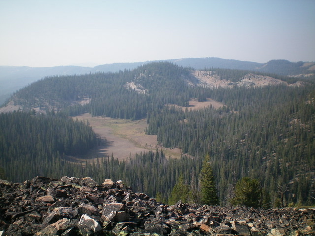
Peak 9176 is located above Little Bayhorse Lake. It is a somewhat complicated mess of forest and rocky outcrops, with multiple ridges and faces. Peak 9176 is most easily climbed via its southeast ridge from Little Bayhorse Lake. USGS Bayhorse Lake
Access
This is the first leg of a 2-peak journey that includes Peak 9176 and Peak 9212. It covers 4.0 miles with 1,475 feet of elevation gain round trip.
Bayhorse Lake Road/FSR-051 is located along ID-75 exactly 7.9 miles south of the junction of US-93 and ID-75 just south of Challis. Turn right/west onto Bayhorse Lake Road and reset your odometer. At 3.2 miles, reach the Bayhorse townsite. At 4.4 miles, reach the Challis National Forest boundary. At 6.7 miles, reach a signed road junction. Go left to stay on BayhorseLake Road. At 8.4 miles, reach the Bayhorse Lake Campground. Park at the campground entrance.
South Gully/South Ridge, Class 2+
The Climb
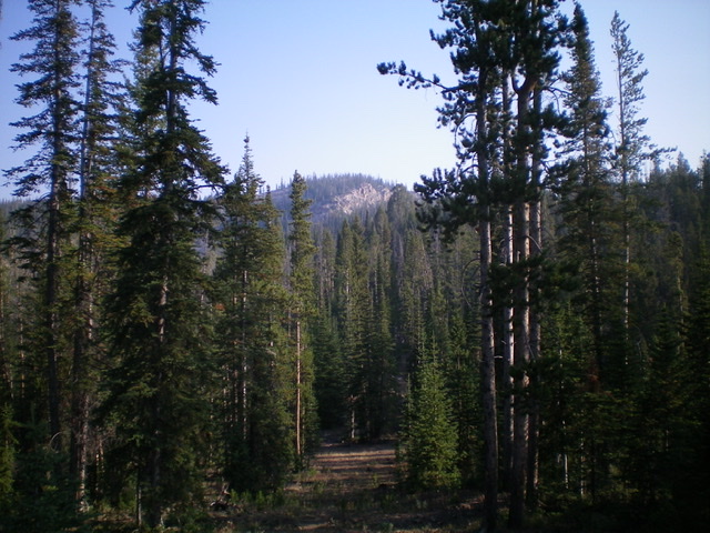
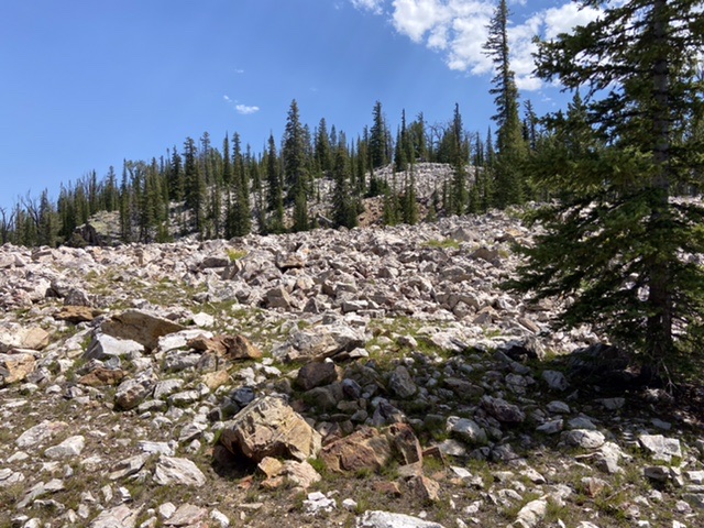
From the campground entrance on Bayhorse Lake Road, hike briefly west on the road toward Bayhorse Lake. Leave the road and head right/north across an open, grassy field on the east side of the lake. This field leads to a forested gully. The forest is thick and has much blowdown to navigate. The pain is short-lived, however, as the gully bends right-ish/northeast and emerges in open boulders/talus on the southwest side of Peak 9176. From here, either climb north up the rocky gully to a ridge saddle and then bushwhack east to the summit (my descent route) OR climb east up a steep face of boulders/talus to reach the crest of the south ridge (my ascent route). Neither option is very pleasant.
I chose to scramble east up onto the south ridge on steep boulders and talus (Class 2+). Once on the crest of the south ridge, follow the easy, narrow ridge north to the summit. The south ridge has ridge trees and deadfall that require navigation. The final push north to the summit is a bushwhack up a gentle face section with much blowdown to work around. The summit high point has no cairn but lots of fallen trees and not much of a view.
North Face, Class 2
The Descent
From the summit, bushwhack north through a thick forest with loose talus and excessive blowdown to reach an open grassy field. Follow this field east down a minor gully to reach a large meadow at the base of the south side of Peak 9212. This is the connecting “saddle” between Peak 9176 and Peak 9212 and concludes the first leg of today’s 2-peak adventure. Peak 9212 is up next.
North Gully, Class 2
The Climb
From the meadow that serves as the connecting “saddle” between Peak 9176 and Peak 9212, return west up the minor gully and stay in an open grassy field and head southwest. Bushwhack through a patch of thick pine forest to reach the narrow, boulder-strewn north gully. Scramble up the boulders and talus/gravel to reach a ridge saddle just west of the summit of Peak 9176. Bushwhack east to the semi-open summit.
South Ridge, Class 2
The south ridge is accessed from the CG. The ridge ascent is a straight forward route. There is a lot of downfall on the ridge and one sharp rocky step roughly halfway up the ridge. Pass the step on its left/west side on a goat trail.
West Slopes, Class 2
FST-201 crosses the peak’s western and northern slopes. This trail begins at the lower Bayhorse Lake and circles the ridges above Bayhorse Lake to a point south of Little Buffalo Hump. I’ve only traveled on the section from the western slopes of Peak 9176 to the Little Buffalo Hump area. This section was maintained in 2022 but still sketchy in places. Additionally, the trail is not located exactly where it is shown on the 2016 FS topo. See the Buffalo Loop map below. Leave the trail and follow the peak’s western slopes to the summit.
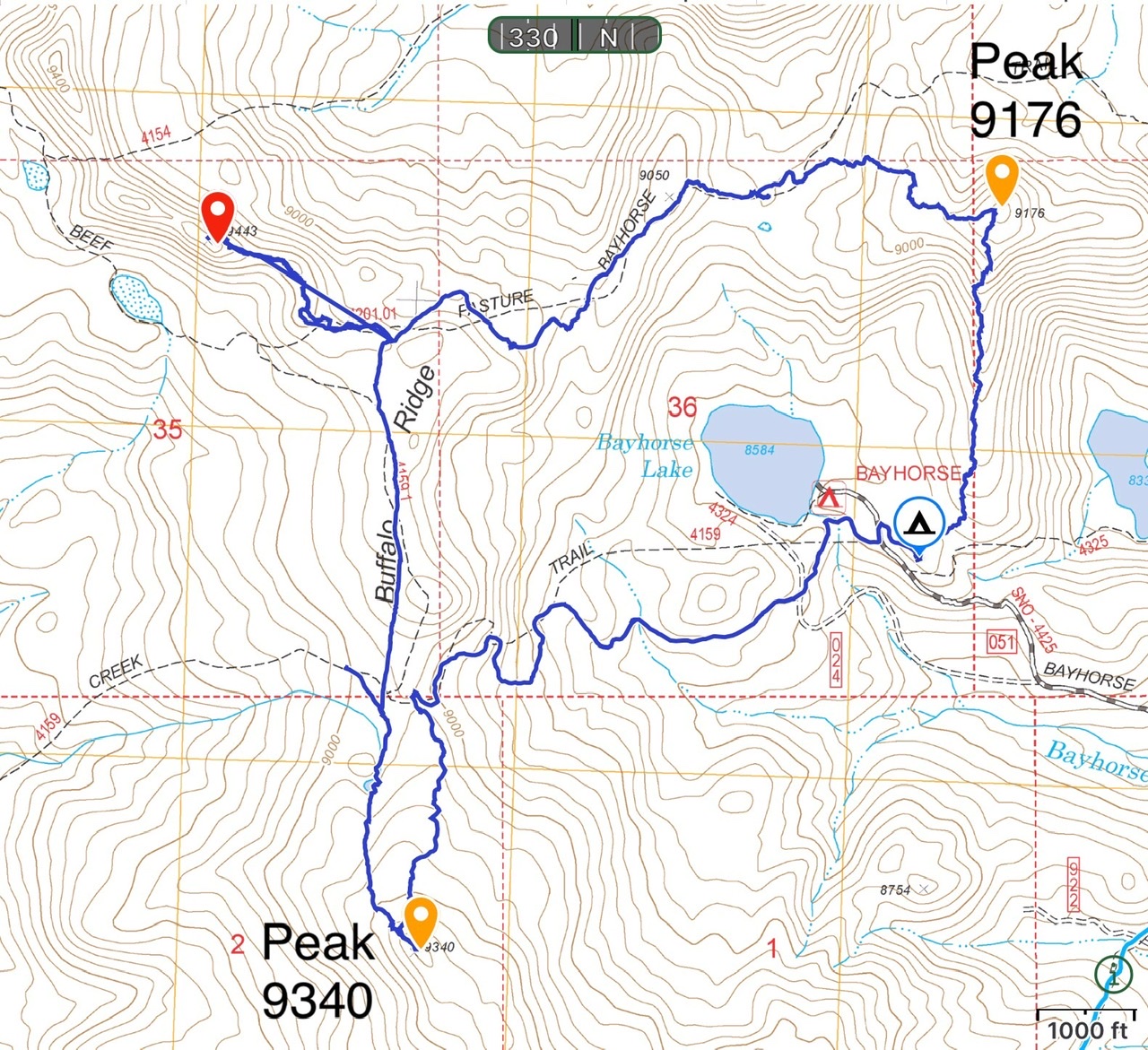
This map shows the Buffalo look that provides access to Peak 9340, Little Buffalo Hump and Peak 9176. The loop utilizes an ATV trail, fence lines, FST-201 and crosscountry travel. Total distance with visits to all three peaks is 7.5 miles with roughly 1,400 feet of elevation gain.
Additional Resources
Regions: Eastern Salmon River Mountains->Salmon River Mountains->Southeast Corner Peaks->WESTERN IDAHO
Mountain Range: Eastern Salmon River Mountains
Longitude: -114.39451 Latitude: 44.41909
