Elevation: 9,195 ft
Prominence: 695

This peak is not in the book. Rick Baugher suggested the unofficial name. Published November 2024
Peak 9195 sits on a ridgeline that separates Ramshorn Canyon from Briggs Canyon in the southern section of the Lost River Range. It can be climbed from either Ramshorn Canyon to its west or Cedarville Canyon to its north. USGS Ramshorn Canyon

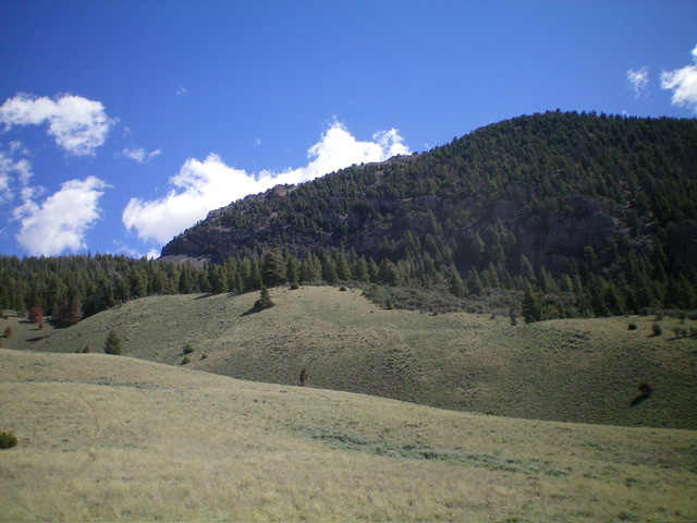
Peak 9195 (summit hump is right of center) and its north ridge (skyline left of center) as viewed from the grassy, rolling hills on its west side. The forested north ridge was my final push to the summit. Livingston Douglas Photo
Access
From US-93 in Darlington, turn east onto [signed] 3700N (at virtual MM96.2). Drive 2.8 miles east on 3700N (a well-maintained county road) to a signed “T” junction with King Mountain Road. Turn right/south onto King Mountain Road and drive 1.5 miles to [unsigned] Ramshorn Canyon Road. Reset your odometer here.
Ramshorn Canyon Road is a decent 2-track road to the National Forest boundary. At 2.4 miles, reach an unsigned junction (Junction 6218 on maps). Continue straight/northeast. At 2.8 miles, park at a small pullout. The road gets much rougher and rockier after this point. This pullout is at 6,310 feet and 43⁰49’04”N, 113⁰18’22”W.
West Face/North Ridge, Class 2
The Climb
From the meager roadside pullout, hike about 1.3 miles northeast up Ramshorn Canyon Road to its end in a meadow at 6,700 feet. From the road’s end, follow a decent foot trail (initially on an old 2-track) that weakens in the open grass higher up. The foot trail ends on the bluff of a grassy shoulder. From the bluff, descend 10-15 feet into a charred scrub and loose gravel/scree gully that is somewhat steep but leads directly into a pine forest.
Bushwhack northeast then north up through this easy (but sometimes very steep) pine forest. There is no mountain mahogany to wrestle with but there are a few patches of sagebrush (early) and talus/scree (higher up). There are some good elk trails in the forest but not always. Work your way right-ish toward the forest’s edge and the base of the talus/scree slopes of the west-facing cliffs of Peak 9195. Follow an elk trail northeast then east to gain the crest of the north ridge.
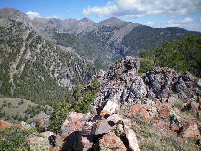
Climb south up the ridge crest with the help of an on-and-off game trail. Weave around ridge pines and downed timber as you gain elevation. The north ridge is steep and loose early on (scree/gravel/pine duff). Higher up, the ridge gets rockier but the slope eases. Skirt two or three rocky outcrops (false summits) to reach the high point of Peak 9195. The rocky high point had a modest cairn which I rebuilt and enlarged.

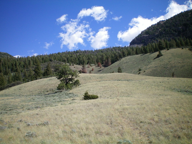
Looking up the rolling hills on the west side of Peak 9195 with some trail hiking still left. This was my ascent route. Livingston Douglas Photo
Additional Resources
Regions: EASTERN IDAHO->Lost River Range
Mountain Range: Lost River Range
Longitude: -113.2705 Latitude: 43.8465
