Elevation: 9,287 ft
Prominence: 427

This peak is not in the book. Published November 2024
Peak 9287 is located west of Donkey Hills HP and east of Burnt Creek. It is most easily climbed from Donkey Hills Road to its west. This area is a mix of private and public land, so be careful. This climb is entirely on BLM land. USGS Burnt Creek
Access
Burnt Creek Road (BLM-140) is located along Donkey Hills Road exactly 1.5 miles northwest of Short Creek Road (see Access Section for Pia Soko Katete). The signed junction of Burnt Creek Road and Donkey Hills Road is at 44⁰13’32”N and 113⁰38’18”W. Drive southwest then south on [signed] Burnt Creek Road (a decent 2-track road) to a stream crossing and a side drainage at 3.7 miles. Turn right/west and drive 0.1 miles up the 2-track side road to its end at the Burnt Creek WSA Boundary (7,720 feet and 44⁰10’26”N, 113⁰39’06”W). This is the first leg of a 2-peak adventure that includes Peak 9287 and Peak 9597. It covers 4.5 miles with 2,325 feet of elevation gain round trip.
Southeast Shoulder/East Ridge, Class 2+
The Climb
From the road’s end, bushwhack north across a small stream and through a narrow strip of aspens (easy). Scramble north up onto a shoulder of gapped sagebrush. The scrub is thick-ish initially but is mostly short grass/scrub after that. Head left/northwest then west up the ridge toward the rocky summit of Peak 9287. Skirt the left/south side of a rocky ridge outcrop early on. The shoulder merges into the rounded east ridge at about 8,700 feet. The ominous, steep slope/ridge of talus and scree now awaits you. It requires about 400 vertical feet of Class 2+ scrambling.
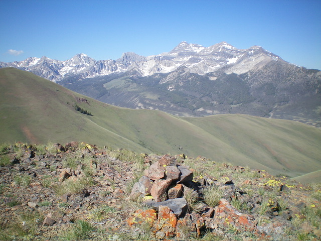
Climb right-ish up the shale to an initial ridge outcrop then bend left/west to climb the steep face/ridge talus and scree with some ground boulders mixed in. Reach the right/north side of a major rocky outcrop. There is a goat trail on the ridge in this area. Once past this massive rocky outcrop, it is an easy grass/scrub scramble on less-steep terrain to the summit. The ridge bends right-ish/northwest for the final push to the summit. The summit of Peak 9287 has a decent summit cairn.

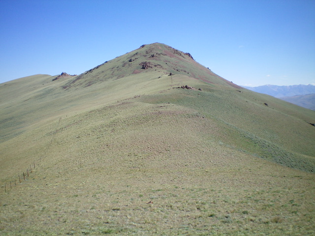
Peak 9287 and its south ridge (dead center, coming at the camera). This was my descent route. Livingston Douglas Photo
South Ridge, Class 2
The Descent
From the summit, descend south down a mix of shale, rocky outcrops, and short grass/scrub to find an old, dilapidated fence row on the ridge crest. Reach the 8,860-foot connecting saddle with Peak 9597 with relative ease. This concludes the first leg of today’s 2-peak journey. Peak 9597 is up next.
Additional Resources
Regions: EASTERN IDAHO->Lost River Range
Mountain Range: Lost River Range
Longitude: -113.6716 Latitude: 44.1789

