Elevation: 9,375 ft
Prominence: 766
This peak is not in the book. Livingston Douglas added new routes and photos. Updated November 2024
This peak is one five ranked peaks located at the southern end of the Donkey Hills. These peaks all rise nearly 2,500 feet above the surrounding valley floors. These seldom-visited peaks are splendid destinations. USGS Short Creek
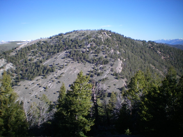
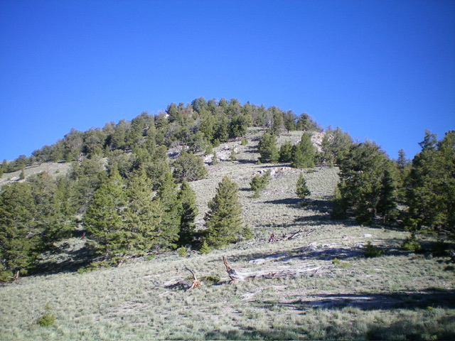
Peak 9375 as viewed from the north
Access
The best access to the southern Donkey Hills is from the Dry Creek Road [(A)(6.1) Page 290]. Follow the Dry Creek Road west to its junction with the Burnt Creek/Long Creek Road (partially signed in 2020). Turn north onto the Burnt Creek/Long Creek, cross Dry Creek and almost immediately turn right/east on to a two track. Follow the two track east to a junction with a 4WD road/ATV track that climbs up the unnamed drainage that descends from the Donkey Hills crest to Dry Creek. See map below. This road is one of the most difficult routes to drive in the area. The higher you drive, the more difficult the terrain. Full size 4WDs will find it too narrow in spots.
Northeast Ridge, Class 2
Follow the access road to a junction at approximately 8,200 feet. Go right. After climbing roughly another 160 feet the main road turns north in a large, sloping meadow. Park here. Hike east up the obvious ATV track. When the ATV track ends continue climbing southeast toward the peak’s northeast ridge. Once on the ridge top, turn southwest and follow it to the peak’s broad summit.
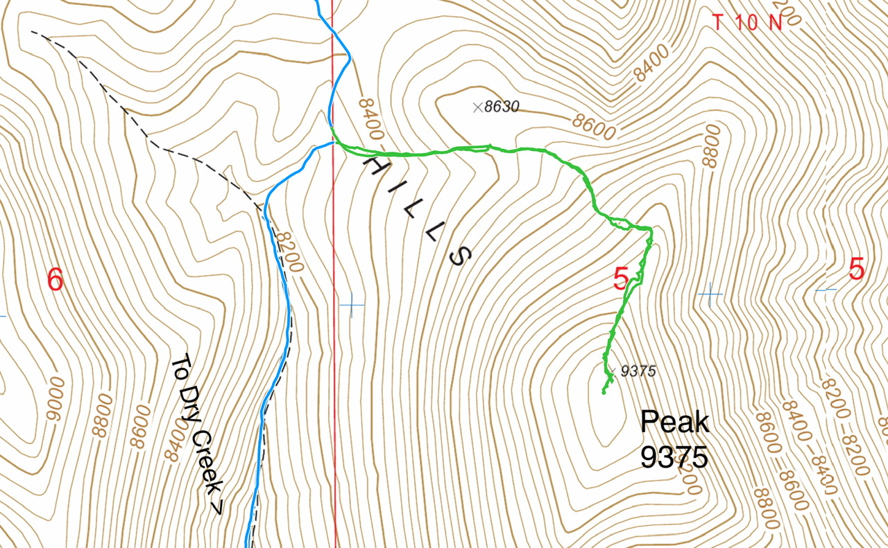
My GPS track in green. This route covers 2.0 miles with 900 feet of gain round trip.
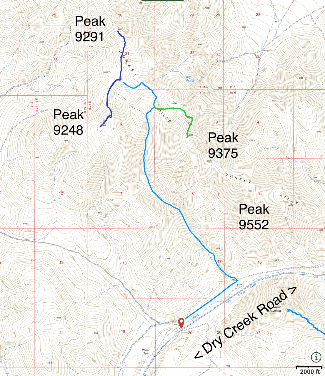
Southern Donkey Hills access. The 4WD road is shown in light blue.
South Ridge and Southeast Ridge by Livingston Douglas
Peak 9375 as viewed from the southeast. Livingston Douglas Photo
Access
Park at the junction of the 4WD road and the ATV/Jeep Road at the mouth of the unnamed drainage (Lopez Access). This junction has a parking area and is at 7,072 feet and 44⁰11’37”N, 113⁰29’35”W. You can safely drive about 0.1 miles northwest up the ATV/Jeep Road and park in a grassy area if you wish. Beyond that, the road becomes very narrow and rocky and is only suitable for ATVs and Jeeps. Do not attempt to drive it. This is the first leg of a 2-peak adventure that includes Peak 9375 and Peak 9552. It covers 6.0 miles with 3,350 feet of elevation gain round trip.
South Ridge, Class 2
The Climb
From the road junction, hike northwest up the rocky, narrow ATV/Jeep Road for about 1.5 miles to a meadow at a fork in the drainage. This meadow sits at the base of the south ridge of Peak 9375 and is at about 7,500 feet. Leave the ATV/Jeep Road and scramble north then northwest up through ridge rock and scrub to reach a mix of scrub and pines (not difficult). The ridge bends right-ish (north) then right-ish again (northeast) higher up.
The final push to the summit plateau is in a pine forest with blowdown and short grass/scrub. There are a few rocky ridge outcrops as well, but nothing serious. Once on the summit crest, head north up the tilted ridge crest/plateau to the north end, where there is a summit cairn. The actual high point may be just left/west of the cairn in a small open spot next to some pine trees. The summit plateau is an endless mess of downed timber and is somewhat tedious.
Looking back up the southeast ridge, my descent route. Livingston Douglas Photo
Southeast Ridge, Class 2
The Descent
From the summit, descend south along the flattish, tedious summit plateau then head left-ish/southeast down the [initially] rounded, forested southeast ridge. Skirt ridge rock on its right/southwest side to reach open terrain above the connecting saddle with Peak 9552. Work around downed timber as necessary. The scrub is not too bad and is more prevalent as you descend. The connecting saddle is at 8,609 feet and concludes the first leg of today’s 2-peak journey. Peak 9552 is up next.
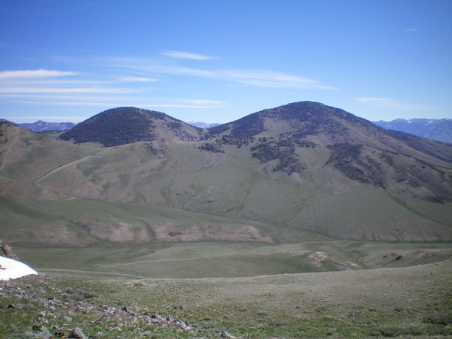
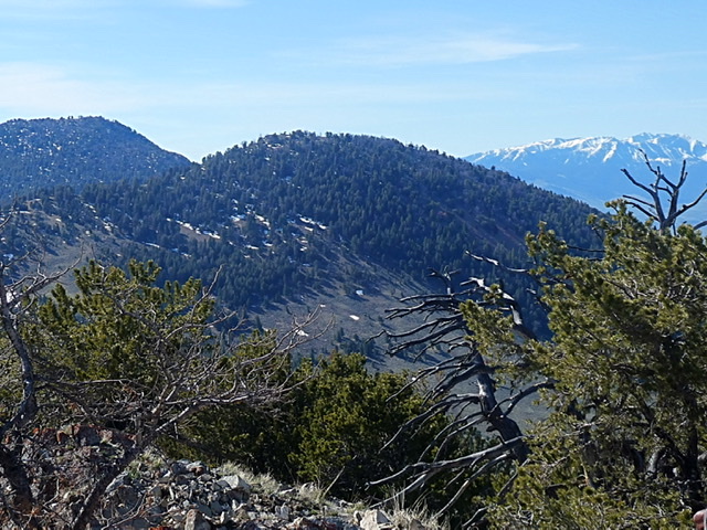
Peak 9375 (left) and Peak 9552 (right) as viewed from Peak 8604 to the southeast. Livingston Douglas Photo
Additional Resources
Regions: Donkey Hills->EASTERN IDAHO->Lost River Range
Mountain Range: Lost River Range
Year Climbed: 2020
Longitude: -113.50769 Latitude: 44.22379