Elevation: 9,380 ft
Prominence: 880

This peak is not in the book. Published December 2024
Peak 9380 and its neighbor (Peak 9209) sit on a high ridgeline that separates Twelvemile Creek from the headwaters of the Yankee Fork of the Salmon River. It is most easily climbed from Yankee Fork Road to its southeast. Peak 9380 sees few visitors. USGS Challis Creek Lakes
Access
From ID-75 at Sunbeam, drive north up [signed] Yankee Fork Road/FSR-070. At 8.3 miles, reach a signed junction with Loon Creek Road/FSR-172. Continue northeast on Yankee Fork Road. Reset your odometer at this junction. At 2.9 miles, reach the signed junction with Fourth of July Creek Road/FSR-073. At 3.2 miles, reach the Custer Campground (left). At 4.0 miles, reach the [signed] Fivemile Creek trailhead (FST-161). At 4.6 miles, cross the to the west side of the Yankee Fork of the Salmon River on a bridge. At 4.9 miles, cross Greylock Creek on a bridge.
At 7.9 miles, cross to the east side of the Yankee Fork of the Salmon River on a bridge. At 9.1 miles, cross to the north side of the Yankee Fork of the Salmon River on a bridge. At 11.4miles, park at a roadside pullout along Yankee Fork Road just before a bridge crossing of the Yankee Fork of the Salmon River. This pullout is at 7,430 feet and 44⁰28’59”N, 114⁰33’42”W. This is the first leg of a 3-peak adventure that includes Peak 9380, Peak 9209, and Peak 9323. It covers 11.0 miles with 4,075 feet of elevation gain round trip. This is a burn area so take appropriate precautions.
Southeast Ridge, Class 2
The Climb
From the roadside pullout, cross the road and scramble northwest then diagonally right/north up through a mix of steep, loose talus/scree, deadfall, and some vegetation to reach the east spur of the southeast ridge of Peak 9380. There are some diagonal game trails to help in this bushwhack. Stay in areas of vegetation for the best footing. Once on the ridge crest, scramble west up a rounded ridge of steep talus and scattered pines/blowdown to reach Point 8730. This is a forested hump with live pines on its top.
From Point 8730, descend northwest for 150-160 vertical feet to a saddle through a burn area and battle with heavy blowdown. The terrain is a mix of live pines and snags, so the narrow saddle below is not visible. The saddle area is thick with live pines and copious blowdown. From the saddle (8560+), head north-northwest to reach a flattish ridge area at 8,800-8,900 feet. This area is a mix of live pines and snags and has some blowdown, but it’s not as awful as the saddle. Bushwhack north-northwest then left-ish/northwest higher up to reach rockier terrain at about 9,000 feet in a burn area.
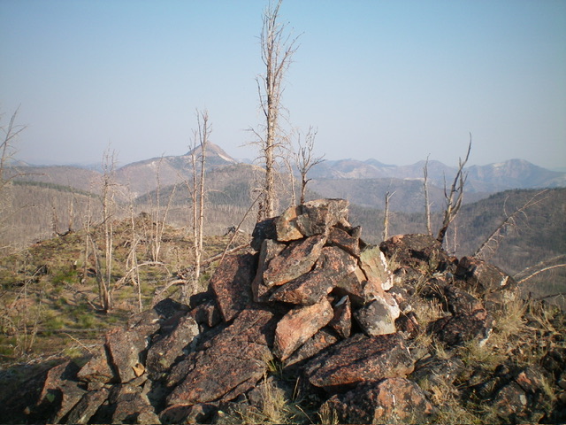
Continue northwest up the ridge crest of rocky outcrops, underlying shale, and snags to reach a few rocky outcrops/boulders and a high point on the ridge crest. Continue northwest on the semi-open crest of snags and rocky outcrops. Descend a bit then bend right-ish/north to drop to a semi-forested saddle without much blowdown. From this saddle, scramble right-ish/northeast up a side ridge of snags and rocky outcrops to reach the double-humped summit of Peak 9380. The rocky northeast summit is clearly the high point. There were no signs of previous ascent so I built a nice cairn with the ample loose talus available.

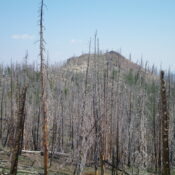
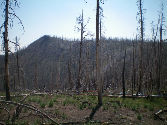
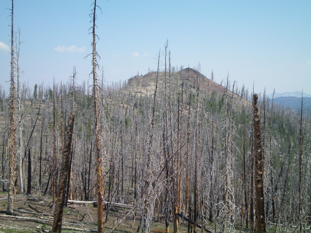
Peak 9380 (summit is left of center) and its southwest ridge (skyline in center and right of center). This was my ascent route. Livingston Douglas Photo
Northwest Ridge, Class 2
The Descent (then Ascent)
From the summit, descend southwest past the rocky southwest summit then bend right-ish/west to return to the main ridge crest through the charred pine forest. Follow the main ridge northwest to a nice, grassy, semi-forested saddle underneath Point 9155. From there, scramble 55 vertical feet up an easy grassy slope to the top of rocky Point 9155. From Point 9155, descend northwest down a narrower, steeper ridge crest of snags and underlying loose scree (not too bad) and work around some downed timber. Come up over a minor ridge bump then descend a short, steep, grassy ridge section to reach a ridge notch (Saddle #1). This 8,780-foot notch is the low point between Peak 9380 and Peak 9209. It concludes the first leg of today’s 3-peak journey. Peak 9209 is up next.
Additional Resources
Regions: Eastern Salmon River Mountains->Salmon River Mountains->Southeast Corner Peaks->WESTERN IDAHO
Mountain Range: Eastern Salmon River Mountains
First Ascent Information:
- Other First Ascent: Northwest Ridge—Descent then Ascent
- Year: 2024
- Season: Summer
- Party: Livingston Douglas
Longitude: -114.5843 Latitude: 44.5083

