Elevation: 9,408 ft
Prominence: 348

This peak is not in the book. Published December 2024
Peak 9408 and its neighbor to the southeast (Peak 9347) sit on a high ridgeline that separates Twelvemile Creek from Tenmile Creek in the Eastern Salmon River Mountains. It is most easily climbed from Yankee Fork Road to its southeast. Peak 9408 sees few visitors. USGS Elevenmile Creek

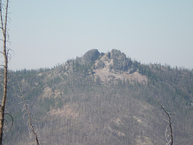
Peak 9408 as viewed from the northeast. The left (southeast) summit is the high point. Livingston Douglas Photo
Access
Same as for Peak 9347. This is the second leg of a 3-peak adventure that includes Peak 9347, Peak 9408, and Peak 9539. It covers 10.5 miles with 4,475 feet of elevation gain round trip.
Southeast Ridge, Class 3
The Climb
From the 9,020-foot connecting saddle (Saddle #2), scramble up over an easy ridge point (9200+) and drop 35 vertical feet to a saddle. Continue right-ish/north-northwest up the ridge crest to the two, almost identical in height, summit blocks/towers of Peak 9408. To reach the top of the northwest tower, find a narrow ledge that goes around the left/west side of the tower to quickly reach the steep-ish (Class 3) crest of the west ridge. Scramble up it to the gentle, flat top of the tower.
There were no signs of previous ascent. To climb the southeast tower, descend to a minor notch between the towers. Find an easy rock gully on the northwest side of the southeast tower and scramble up it (Class 3). Climb a final chute (Class 2) to reach the flat, rocky summit of the southeast tower. There were no signs of previous ascent. I built a modest cairn atop the southeast tower. I’m still not sure which tower is highest, so stand atop both towers “just to be sure.”

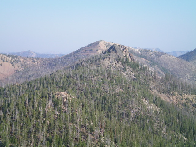
Peak 9408 (block just right of center) and its southeast ridge (mid-ground, left of center). Livingston Douglas Photo

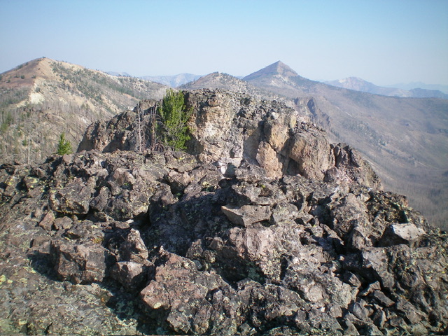
The rocky southeast summit of Peak 9408, looking at the [lower] northwest summit block. Livingston Douglas Photo
Northwest Ridge, Class 3
The Descent (then Ascent)
From the notch between the two summit towers, skirt the west side of the northwest summit tower and descend northwest on a narrow ridge of pines and easy rock to reach a saddle. Scramble northwest 80 vertical feet up over a rock-and-pine ridgeline point. From that point, descend to a ridge notch then climb up over Point 9250. From there, descend west-northwest to reach the low point between Peak 9408 and Peak 9539 at 9,060 feet. This is the connecting saddle. It concludes the second leg of today’s 3-peak journey. Peak 9539 is up next.
Additional Resources
Regions: Eastern Salmon River Mountains->Salmon River Mountains->Southeast Corner Peaks->WESTERN IDAHO
Mountain Range: Eastern Salmon River Mountains
First Ascent Information:
- First Ascent Year: 2024
- Season: Spring
- Route: Southeast Ridge
- Party: Livingston Douglas
- Other First Ascent: Northwest Ridge—Descent and Ascent
- Year: 2024
- Season: Summer
- Party: Livingston Douglas
Longitude: -114.6150 Latitude: 44.4933