Elevation: 9,456 ft
Prominence: 356

This peak is not in the book. Published December 2024
Peak 9456 is a ranked hump on the north ridge of Peak 9690. It is located northwest of Loon Creek Summit and west of the West Fork Mayfield Creek. Peak 9456 is most easily climbed from Loon Creek Road to its east. USGS Custer
Access
From Yankee Fork Road/FSR-070, drive north up Loon Creek Road/FSR-172. At 6.0 miles, reach a signed junction with FSR-356. Go right to stay on Loon Creek Road. Drive up the steep switchbacks to reach Loon Creek Summit at 9.0 miles. Continue north on the road as it descends into the West Fork Mayfield Creek Valley. At 9.7 miles, reach a sharp right/east bend in the road. Park here (8,440 feet and 44⁰28’24”N, 114⁰44’15”W). This is the first leg of a 2-peak adventure that includes Peak 9456 and Peak 9690. It covers 3.5 miles with 1,625 feet of elevation gain round trip.
Southwest Ridge, Class 2
The Climb
From the sharp bend in the road, bushwhack southwest up a forested shoulder to quickly find a dried, rocky creek bed. Follow this creek bed upstream a ways then leave it to head right/west to find the largest of several ponds at just under 8,600 feet. Skirt around the right/north side of the large pond and cross a marshy outlet stream. Continue west past another pond to reach a shoulder that is thick with pines and blowdown. This ridge has significant avalanche debris (sheared-off pine trees mostly).
Cross into a gully on the right/north side of this shoulder and follow it west (upstream) to reach a massive open bowl of talus and scree. Head west up the right/north edge of a wide gully of talus/scree. Leave the gully higher up to angle diagonally right and bushwhack west then northwest up through a pine forest. When you emerge from the forest, head right/north and scramble across a short patch of loose, angled gravel to reach the hidden, small ridge saddle that connects Peak 9456 and Peak 9690 at 9,100 feet.
From the saddle, scramble northeast the north up the narrow ridge crest in a mix of ridge pines, blowdown, and some easy ridge outcrops to reach the summit. The sides of the ridge crest are covered with loose, angled gravel. Overall, the climb up the southwest ridge is not difficult or tedious. The summit of Peak 9456 has a modest cairn. Return down to the 9,100-foot connecting saddle with Peak 9690. This concludes the first leg of today’s 2-peak journey. Peak 9690 is up next.

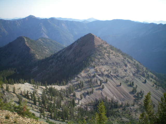
Peak 9456 (dead center) and its southwest ridge (in center, coming at the camera). The southwest ridge was my ascent route. Livingston Douglas Photo
Additional Resources
Regions: Eastern Salmon River Mountains->Salmon River Mountains->Southeast Corner Peaks->WESTERN IDAHO
Mountain Range: Eastern Salmon River Mountains
Longitude: -114.7474 Latitude: 44.4764

