Elevation: 9,474 ft
Prominence: 374
This peak is not in the book. Published November 2022
Peak 9474 sits on a high ridgeline that overlooks the Baker Creek drainage. It is at the head of Alden Gulch. It is most easily climbed from the nearby Osberg Ridge Trail/FST-147. But there is no nearby trailhead, so an off-trail scramble is required for any feasible day hike of Peak 9474. USGS Boyle Mountain
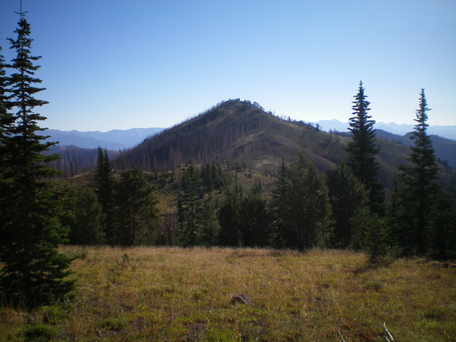
Peak 9474 as viewed from the west. Livingston Douglas Photo
Access
Same as for Peak 9660. This is the second leg of a 2-peak adventure that includes Peak 9660 and Peak 9474.
West Ridge, Class 2
The Climb
From the 9,100-foot connecting saddle at the base of the west ridge, leave FST-147 and scramble northeast up the semi-forested ridge to Point 9344. From Point 9344, descend 50 feet to a forested saddle (there is much more pine forest on this ridge than the USGS map indicates). From the saddle, continue east up through more scrub and pines to reach a rocky, open high point (which measures at equal height to the true summit to its east). From this high point (the west summit), drop slightly and go through a patch of forest to quickly reach the cairned, official high point of Peak 9474 (the east summit) in semi-open forest.
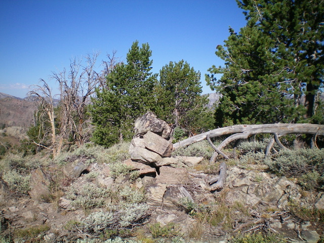
The summit of Peak 9474. Livingston Douglas Photo
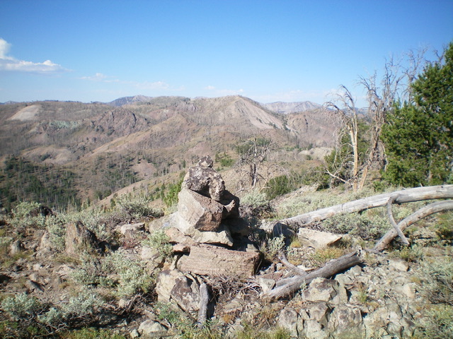
The summit cairn atop Peak 9474 with Peak 9660 in the distance (dead center). Livingston Douglas Photo
South Face, Class 2
The Descent
From the east summit, return to the rocky west summit. From there, descend southwest down the scrub-and-gravel, steepish face to intercept FST-147. Follow the trail west for ¾ mile to a gentle scrub hump (Point 9215), which is to the right/north of the trail.
Descent to Baker Creek Road, Class 2
Leave the trail and scramble up easy scrub to Point 9215, a gentle hump. Follow the relatively easy ridge north along the east side of Badger Gulch. The ridge is a combination of veg and burnt forest. It weaves a bit and has several ups and downs, which can be a bit tedious and frustrating. The ridge humps are all rocky affairs. After the final ridge hump (Point 8506), descend to a flattish ridge area and a ridge junction at about 8,250 feet.
Go hard left/west here and follow a forested shoulder down toward Badger Gulch. This shoulder becomes rockier and steeper as you descend. Angle right-ish/north and finish the descent in a flat, forested area (lots of blowdown to go around) and aim to reach the [visible] Baker Creek Road just east of the small creek in Badger Gulch. Once on Baker Creek Road, walk ½ mile southwest then west to return to the campsite where today’s climb began.
Additional Resources
Regions: Smoky Mountains->WESTERN IDAHO
Mountain Range: Smoky Mountains
Longitude: -114.55829 Latitude: 43.70979