Elevation: 9,539 ft
Prominence: 599

This peak is not in the book. Published December 2024
Peak 9539 is located at the headwaters of both Trapper Creek and the East Fork Mayfield Creek in the Eastern Salmon River Mountains. It sits atop a ridgeline due south-southeast of Sherman Peak (9,892 feet), the highest peak of many ranked summits in the immediate vicinity. USGS Sherman Peak

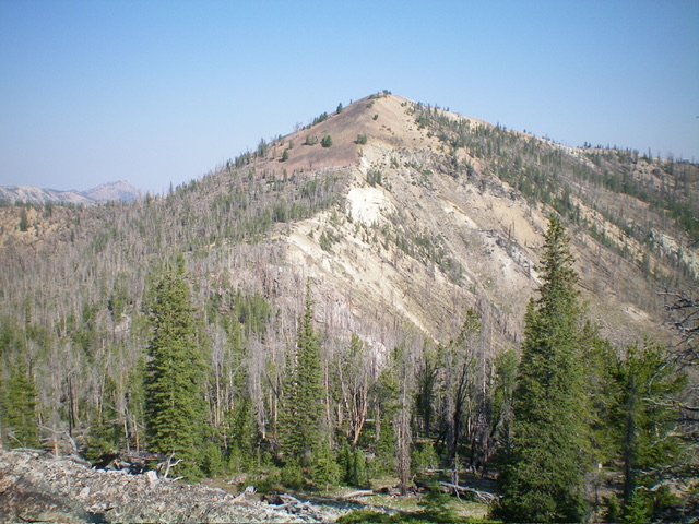
Peak 9539 (dead center) and its southeast ridge (left of center then dead center). This was my ascent route. Livingston Douglas Photo
Access
Same as for Peak 9347. This is the third leg of a 3-peak adventure that includes Peak 9347, Peak 9408, and Peak 9539. It covers 10.5 miles with 4,475 feet of elevation gain round trip.
Southeast Ridge, Class 2+
The Climb
From the 9,060-foot connecting saddle with Peak 9408, scramble west-northwest in a flattish pine forest area to reach the base of steep pile of talus/scree/gravel that is the summit hump of Peak 9539. Grind your way up through this mess, with a few scattered pines for use as handholds) to reach a flatter area just before reaching the ridgeline summit. The ridge heads northwest up this steep, loose, rocky mess. The summit had no signs of previous ascent. I built a cairn atop the obvious high point, which sits on a ridgeline.
From the summit, descend southeast back over Peak 9408 then back over Peak 9347 and down its southeast ridge to return to Yankee Fork Road. There are many ups and downs along this lengthy ridge, which adds to the elevation gain for this 3-peak adventure.
Additional Resources
Regions: Eastern Salmon River Mountains->Salmon River Mountains->Southeast Corner Peaks->WESTERN IDAHO
Mountain Range: Eastern Salmon River Mountains
Longitude: -114.6311 Latitude: 44.5022

