Elevation: 9,559 ft
Prominence: 339

This peak is not in the book. Published December 2024
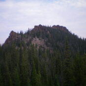
Peak 9559 is a rocky, rugged peak that is seldom climbed. Peak 9559 and its sister peak (Peak 9642) sit atop a forested ridge that separates Fivemile Creek from Sixmile Creek in the Eastern Salmon River Mountains. Peak 9559 is most easily climbed from the Fivemile Creek Trail to its west. USGS Elevenmile Creek
Access
From ID-75 at Sunbeam, drive north up [signed] Yankee Fork Road/FSR-070. At 8.3 miles, reach a signed junction with Loon Creek Road/FSR-172. Continue northeast on Yankee Fork Road. Reset your odometer at this junction. At 2.9 miles, reach the signed junction with Fourth of July Creek Road/FSR-073. At 3.2 miles, reach the Custer Campground (left). At 4.0 miles, reach the [signed] Fivemile Creek trailhead (FST-161). The trailhead has ample parking and an information posterboard plus area to disperse camp.
The trailhead is NOT at a sharp bend in the road at the mouth of the Fivemile Creek drainage. It is 0.1 miles north of that bend (the USGS map misplaces the trailhead location). Park at the Fivemile Creek trailhead (6,725 feet and 44⁰24’18”N, 114⁰39’16”W). This is the first leg of a 2-peak adventure that includes Peak 9559 and Peak 9642. It covers 10.0 miles with 3,500 feet of elevation gain round trip.
West Ridge, Class 3
The Climb
From the trailhead parking area, cross to the east side of the road and hike up the meandering, up-and-down, narrow footpath/MC trail for about 2-1/2 miles to a major crossing of a dry creek drainage. This is the first major drainage crossing up to this point. The trail drops a few feet to cross the dry drainage. Leave the trail here and bushwhack east up the wide, rocky bed of the drainage (easy). The drainage soon becomes wet with a small stream.
The rocky creek bed is an easier bushwhack than the flattish, blowdown-clogged forest on its sides. There is very little downed timber in the creek bed, at least early on. Leave the rocky creek drainage at the base of a waterfall. Scramble up the forested, angled left/north side of the drainage (not difficult) to reach a prominent fork in the drainage. Drop about 20 vertical feet to cross the left/northeast fork and reach the ridge that separates the two forks. Climb this magnificent ridge east-northeast then northeast to reach a high ridge heading right-ish/east directly to the summit of Peak 9559.
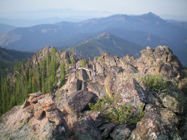
The west ridge is a mix of scattered pines, some blowdown (not too bad), ground firs to avoid/skirt, a few rocky ridge outcrops, and open areas of gravel/dirt (especially on the right/south side of the ridge crest). Higher up, the pine forest gets thick, so look for lanes through the trees and use the open right/south edge of the ridge crest when possible. A few areas got pretty steep. There were no game trails. The ridge climb has one Class 3 ridge outcrop to surmount and some easy Class 3 scrambling up to the summit boulders. The summit cap is entirely rock and is a mix of boulders, talus, and face rock (easy Class 3 work). There were no signs of previous ascent so I built a small cairn atop the highest boulder.

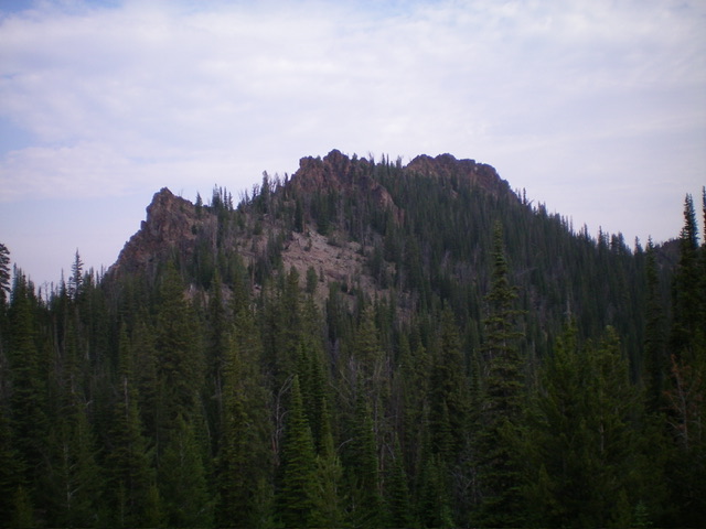
The rocky summit of Peak 9559 and the rocky towers on its south ridge. This was my descent route. Livingston Douglas Photo
South Ridge, Class 3
The Descent
From the summit, things look grim. The south ridge is much rockier and narrower than I expected and there is an impossible ridge tower to skirt past. Descend the narrow, rocky ridge crest of the south ridge (full-on Class 3) then leave the ridge to descend a steep, loose gully (to the left/east of the rocky ridge tower) and downclimb face rock on ledges and in chutes to skirt past the tower. Descend into a pine forest and contour south toward the hidden connecting saddle with Peak 9642.
The pine forest is thick and has copious blowdown to navigate. Lower down, contour right/west back to the ridge crest and descend to a forested, semi-open ridge hump. Bushwhack left-ish/southeast from this easy, elongated hump to reach the semi-open, forested connecting saddle. This saddle is at 9,220 feet. It concludes the first leg of today’s 2-peak journey. Peak 9642 is up next.
West Shoulder, Class 2+
The Descent
From the elongated ridge hump just above the 9,220-foot connecting saddle with Peak 9642, make a rather torturous, back-and-forth bushwhack down the west face of Peak 9559. Search for a shoulder just south of the large gully that separates the west ridge (ascent ridge) from the west shoulder (descent ridge). Follow this forested shoulder northwest then west then southwest then northwest then west as it meanders its way down to the valley floor.
On this descent, avoid any minor gullies (which are thick with brush) and find some grassy, open areas midway and lower down. This route has only modest blowdown but still requires a fair amount of weaving. There are a few hidden rocky ridge outcrops to skirt. Pop out onto Fivemile Creek Trail at a minor wet stream crossing about 40 vertical feet above the dry, rocky departure gully for the West Ridge Route [ascent route] earlier in the day. Walk down Fivemile Creek Trail for 2-3 minutes to reach the rocky creek bed crossing. Hike northwest down Fivemile Creek Trail for about 2-1/2 miles to the trailhead to end this challenging, 2-peak adventure.
Additional Resources
Regions: Eastern Salmon River Mountains->Salmon River Mountains->Southeast Corner Peaks->WESTERN IDAHO
Mountain Range: Eastern Salmon River Mountains
First Ascent Information:
- First Ascent Year: 2024
- Season: Summer
- Route: West Ridge
- Party: Livingston Douglas
- Other First Ascent: South Ridge—Descent
- Year: 2024
- Season: Summer
- Party: Livingston Douglas
Longitude: -114.5986 Latitude: 44.3883

