Elevation: 9,674 ft
Prominence: 918

This peak is not in the book. The unofficial name was used by T.M. Bannon of the USGS in 1915. Use the link below to read Rick Baugher’s trip report that discusses the name. Published November 2024
Peak 9674 is one of several foothills on the southwest side of the Pahsimeroi Mountains south of Challis. Its west face is a steep, ugly, forest-and-rock proposition. Peak 9674 is most easily climbed via its [mostly-open] south ridge from the McGowan Creek drainage. USGS Antelope Flat

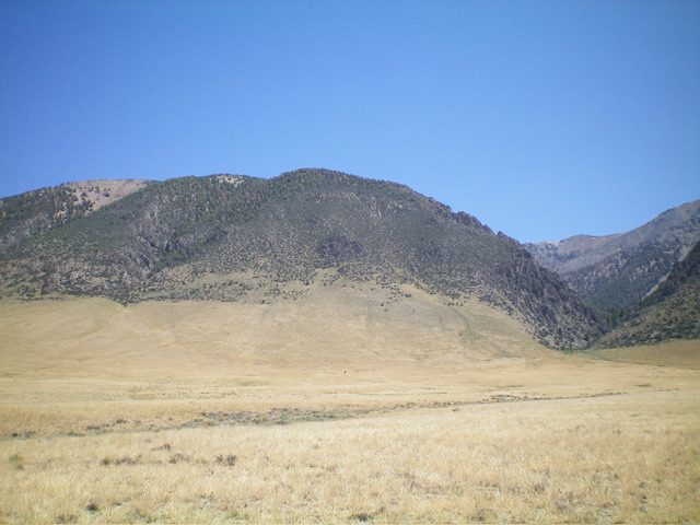
Peak 9674 as viewed from the southwest. The McGowan Creek drainage is at far right. Livingston Douglas Photo
Access
McGowan Creek Road/BLM-120 is located along US-93 south of Challis at virtual MM147.1. It is 1.1 miles northwest of [signed] Gooseberry Creek Road. There is a small BLM road sign at the base of McGowan Creek Road. From US-93, turn northeast onto McGowan Creek Road and reset your odometer. At 0.6 miles, bear left at an unsigned road junction. At 2.1 miles, stop in a flattish area just before the road climbs to cross a narrow drainage. Park here (6,800 feet and 44⁰20’38”N, 114⁰00’41”W). McGowan Creek Road gets much steeper and rockier in its final mile. It ends at the mouth of the McGowan Creek Canyon. You will certainly need a 4WD vehicle with high clearance and good tires.
South Ridge, Class 2
The Climb
From the improvised parking spot along McGowan Creek Road, hike about 0.2 miles up steep, rocky McGowan Creek Road. Leave the road at 6,960 feet (about 30-40 yards below its terminus) to bushwhack left/north across an easy section of McGowan Creek where it is underground and the creek bed is dry. Bushwhack east-northeast up the [mostly dry] McGowan Creek drainage using a game/use trail initially through a section of steeply angled talus/scree. The creek drainage is thick with brush, mountain mahogany, and pines in this early section.
The helpful trail soon ends but the drainage is easier now. It is a mix of pines with less brush and rock. Higher up, find another game trail and follow it up the center then left side of the drainage to reach a crossing of the south ridge. The south ridge is forested and is somewhat indistinct. It is crossed just prior to reaching an open, grassy, marshy meadow in the McGowan Creek drainage. Leave the good elk trail here and bushwhack north then northwest up the forested ridge to reach semi-open Point 9489.
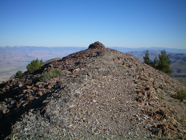
The ridge terrain up to this point is steep-ish, broken shale and is not very loose. Skirt ridge pines and downed trees as necessary (often). The ridge is better defined than the USGS topo map suggests. From Point 9489, follow the ridge crest of broken shale and scattered pines all the way to the high point. The summit of Peak 9674 is open and is on a narrow ridge.

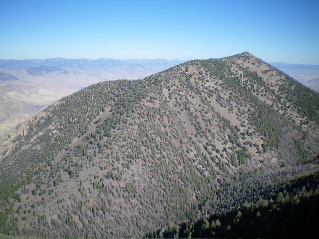
Peak 9674 as viewed from the southeast. My ascent route climbs the ridge from lower left to upper right. Livingston Douglas Photo
Additional Resources
Regions: EASTERN IDAHO->Lost River Range->Pahsimeroi Range
Mountain Range: Lost River Range
Longitude: -114.0014 Latitude: 44.3635
