Elevation: 9,734 ft
Prominence: 514

This peak is not in the book. Published December 2024
Peak 9734 is a ranked bump on the lengthy south ridge of Mount Jordan (10,063 feet). It is most easily climbed from Jordan Creek Road to its east. Peak 9734 sees very few visitors and requires a lengthy bushwhack to reach its lonely summit. USGS Mount Jordan

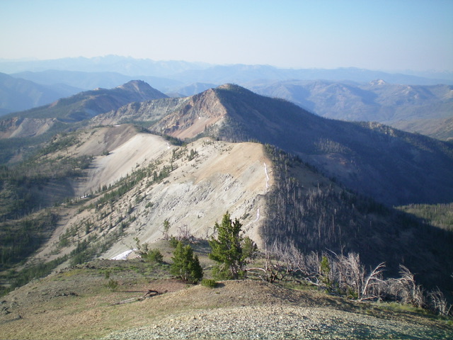
Double-humped Peak 9734 (dead center, the second ridgeline humps) as viewed from Mount Jordan to its north. Livingston Douglas Photo
Access
Same as for Mount Jordan. This is the third leg of a 3-peak adventure that includes Mount Jordan, Peak 9628, and Peak 9734. It covers 9.5 miles with 3,900 feet of elevation gain round trip.
North Ridge, Class 2
The Climb
From the 9,220-foot ridge saddle to its north, scramble south then southeast up to Point 9680+, the north summit hump. The ridge is mostly a steep, talus/scree and gravel scramble. There are some goat trails (and goat beds) along the way. The ridge becomes quite steep high up. The north summit is cairned and has surveyor posts laying on the ground. However, it is not the high point of Peak 9734. From the north summit, bushwhack south through ridge pines and blowdown, dropping 40 vertical feet to a saddle.
Continue south a short distance to reach the south summit, which is the high point of Peak 9734. The summit area showed no signs of previous ascent. The high point appears to be in a semi-open area of grass and scattered pines. I built a summit cairn in the open rock at the north end of the modest-sized summit cap. I stood on every possible high point. There are two pine trees that are most likely to be the winners of this high-point competition.

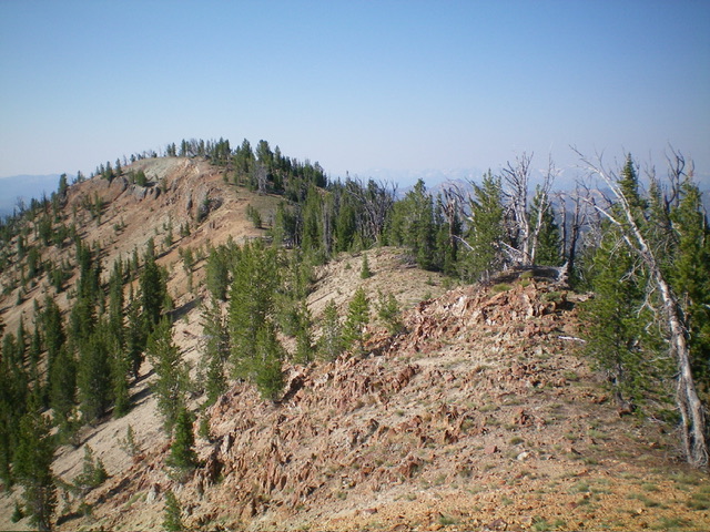
The summit hump of Peak 9734 (left of center) finally comes into view from the [lower] north summit. Livingston Douglas Photo
North Ridge/East Gully, Class 2
The Descent
From the south/true summit, return to the north summit and descend the north ridge to the open, gravelly saddle at 9,220 feet. From the saddle, leave the ridge and descend east-southeast then east in a pine forest (some blowdown to navigate). This descent is in a mix of open grass and pine forest. The terrain is an undulating mix of faces, shoulders, and minor gullies. The initial steepness of the descent moderates as you lose elevation. Your goal is to reach a drainage that heads east-northeast to Jordan Creek and Jordan Creek Road.
Follow the drainage (which gets increasingly wet) east-northeast. It is wide, grassy, and semi-forested. It is a relatively easy bushwhack initially but the drainage narrows and gets wetter as you descend. Stay on the stream’s left/north side as it bends northeast then east toward Jordan Creek Road. Scramble down open shoulders of angled, open scrub to make the best progress. The USGS topo map makes the north side of the feeder stream look like a smooth face, but it is not. It is a series of steep-sided shoulders.
Lower down, you can see Jordan Creek Road. Aim to intercept the road just above the first creek crossing. Jordan Creek is small here. The feeder stream that you are following is the primary contributor to the flow of Jordan Creek and it gets larger and larger as you descend. Bushwhack through a few sections of thick-ish pine forest and move northeast away from the feeder stream to intercept Jordan Creek Road just above the primary (easy) creek road crossing. Bash through a short patch of willows to reach the road then hike about ½ mile down the road to the spur road and your parked vehicle.

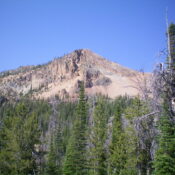
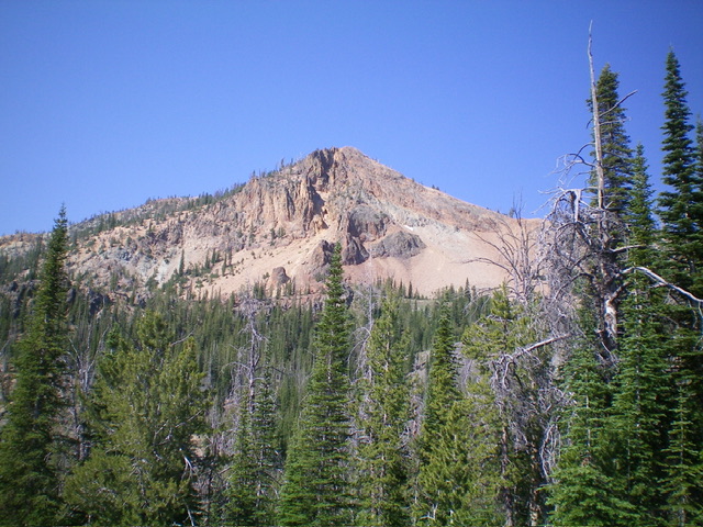
The rugged northeast face of Peak 9734. The north ridge is the right skyline. This was my ascent route. Livingston Douglas Photo
Additional Resources
Mountain Range: Eastern Salmon River Mountains
Longitude: -114.7762 Latitude: 44.4467