Elevation: 9,740 ft
Prominence: 320

This peak is not in the book. Published November 2024
Peak 9740 is a rugged, rocky peak that sits east-southeast of [slightly-higher] Baldy Mountain (9,835 feet) in the Snake River Range. Both peaks tower over Palisades Creek to the southeast and both require a significant amount of elevation gain to reach them from Palisades Creek. The ridge traverse between them looks difficult is of at least Class 3 difficulty. USGS Thompson Peak

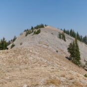
Peak 9740 as viewed from midway up the south ridge (my ascent route). The summit is in dead center on the high ridgeline. Livingston Douglas Photo
Access
Palisades Creek Road is located along US-26 exactly 7.0 miles south of the junction of ID-31/US-26 in Swan Valley. Turn left/northeast onto [signed] paved Palisades Creek Road and drive 2.0 miles up to the Palisades Creek Campground. Continue another 0.2 miles to the large trailhead parking area for the Palisades Creek Trail/FST-084.
South Ridge, Class 3
The Climb
From the trailhead parking area, follow well-beaten FST-084 across a footbridge to the east side of raging Palisades Creek. Hike northeast up the trail for about a mile to a second footbridge crossing. After crossing this nice footbridge to the north side of Palisades Creek, leave the trail. Follow a brief, but handy, use trail left/west as it heads to a minor shoulder. Scramble right-ish/northwest up this steep shoulder in mostly open or mixed terrain. This shoulder heads up toward the crest of the south ridge.
The shoulder flames out and becomes a steeply-forested face with a fair amount of brush and very steep, loose scree/gravel. You will be on all fours in sections of this face climb (Class 3). Head left/west to intercept the open ridge crest above you. Once on the south ridge, follow it right/north up through an initial mix of scrub and mountain mahogany. Higher up, the ridge terrain includes a series of rocky outcrops amidst pine forest and brush. Skirt most of the outcrops on either side of the ridge crest. Reach a flattish, semi-open ridge hump at about 7,500 feet. Drop 15 vertical feet to a minor ridge notch with thick brush and deadfall. From this notch, the ridge bends left-ish/northwest and climbs up to Point 7642.
From Point 7642, descend 15 vertical feet to another notch of thick brush and deadfall. Scramble northwest from this notch to a critical ridge juncture at about 7,800 feet. On the descent, be sure to head southeast here, not southwest onto a ridge that dead-ends at a massive cliff face. There is open grass/scrub on the right/east side of the ridge here and visibility is good. You can now see the multiple ridges heading up the south side of Peak 9740. You can also see Baldy Mountain to the left/northwest.
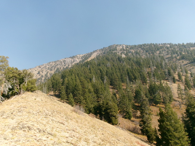
The ridge bends right-ish/north at the 7,800-foot ridge juncture. Follow the ridge crest north in semi-open terrain. The ridge separates two massive, rocky gullies on the south face. Avoid those gullies at all cost. Higher up, the ridge bends right-ish again and is now heading northeast. It climbs up through a pine forest with an increasingly rocky base (mostly scree/gravel) with a few ridge outcrops to scramble up over (Class 3).
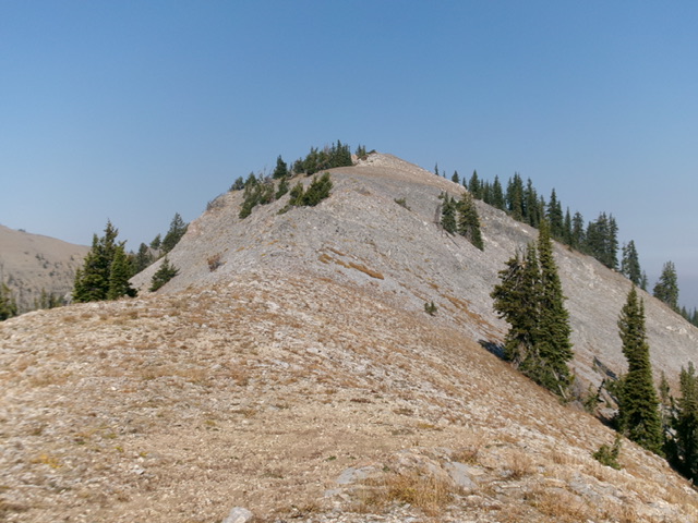
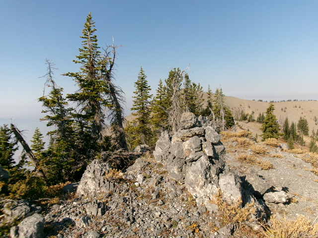
Higher up, the terrain steepens and opens up. A final steep climb up scrub and gravel puts you on the southeast ridge at a juncture that has a noticeable ridge hump. This hump is more noticeable than the USGS topo map suggests. Go left/northwest here onto the southeast ridge. Skirt the left/southwest side of this rocky pile of scree to reach a high saddle, dropping 15 vertical feet to reach the saddle. From the saddle, scramble northwest up a narrow, rocky ridge crest (Class 2+) to reach the mostly-open, obvious high point of Peak 9740. There was no summit cairn so I built a decent cairn on the highest boulder/outcrop on the ridge-crest summit.
Descend this ascent route. It is difficult to find the initial ascent shoulder in the thick forest lower down. When you climb up from Palisades Creek, turn around in open areas and get a good look at the position of the footbridge (which is blocked by the pine forest) and Palisades Creek as well as rock formations on the far side of the creek so that when you descend this route, you can find your way back to the hidden footbridge. You do NOT want to have to ford raging Palisades Creek. You simply MUST find the footbridge and FST-084.
Alternative Routes
Longer, easier routes are commonly used to climb Peak 9740. From the north, hike up Rainey Creek Trail/FST-115 then Spring Canyon Trail/FST-116 (briefly) then Water Canyon Trail/FST-092 then FST-143 up a high ridge (the Baugher Route). If you lack a MC, this will be a very long climb. You can also reach FST-143 from the Palisades Creek Trail/FST-084 between Lower Palisades Lake and Upper Palisades Lake. Leave FST-084 and follow Spring Canyon Trail/FST-153 (yes, the trail number is different here) up to the ridge trail (FST-143). This is another very long climb but it is mostly on trails. FST-143 gets you pretty close to the top of Peak 9740 (see Baugher trip report linked below). You will wish you climbed my shorter, steeper route to the summit.
Additional Resources
Mountain Range: Big Hole and Snake River Mountains
First Ascent Information:
- Other First Ascent: South Ridge
- Year: 2024
- Season: Summer
- Party: Livingston Douglas
Longitude: -111.1973 Latitude: 43.4285

