Elevation: 9,758 ft
Prominence: 738

This peak is not in the book. Published December 2024
Peak 9758 is a ranked summit that sits on a high ridge that separates the Eightmile Creek drainage from the Mayfield Creek drainages. This ridge begins at Loon Creek Summit and extends northeast to Peak 9539 and includes six ranked summits. Peak 9758 is most easily climbed from Loon Creek Road to its west. USGS Custer

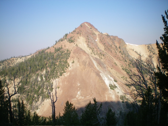
Peak 9758 and its steep, rocky east ridge (center). This was my descent route. Livingston Douglas Photo
Access
From Yankee Fork Road/FSR-070, drive north up Loon Creek Road/FSR-172. At 6.0 miles, reach a signed junction with FSR-356. Go right to stay on Loon Creek Road. Drive up the steep switchbacks to reach Loon Creek Summit at 9.0 miles. Continue north on the road as it descends into the West Fork Mayfield Creek Valley. At 10.3 miles, reach a roadside pullout just before the road makes a sharp left/north turn to follow the West Fork Mayfield Creek. Park here (8,170 feet and 44⁰28’02”N, 114⁰43’49”W). This is the first leg of a 3-peak adventure that includes Peak 9758, Peak 9593, and Peak 9785. It covers 7.5 miles with 4,125 feet of elevation gain round trip.
West Face/South Ridge, Class 2-3
The Climb
From the roadside pullout, walk a short distance down the road to the sharp left/north bend (no pullouts at the bend). Leave the road and stay left/north of a mess of downed pines (avalanche debris) on the south/southeast side of the road bend. Bushwhack up the left/north side of a dry drainage on a forested shoulder (of sorts) that becomes a face. Head east up the steep, forested west face of Peak 9758 in between a massive white scree field to the left/north and a light brown scree field to the right/south. The forested bushwhack up the face is on firm grave/duff initially but about midway up it becomes pretty steep. The underlying gravel is relatively firm but there are a few loose sections.
Angle diagonally left/northeast high up to intercept the ridge saddle (9,220 feet). The ascent up the west face has its share of downed timber but there is no understory to contend with. From the ridge saddle, bushwhack north then northwest then northeast to the rocky summit. The ridge looks intimidating but it’s not bad. Stay on the narrow, rocky ridge crest (initially it is easy pine forest). There are a few Class 3 moves (especially higher up), but they can be avoided on the steep, loose scree on the sides of the ridge. The summit of Peak 9758 has a decent summit cairn.

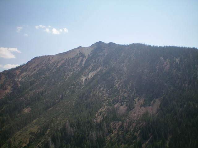
Peak 9758 (summit is right of center) and its rocky south ridge (center and left of center). The south ridge was my ascent route. Livingston Douglas Photo
East Ridge, Class 3
The Descent
From the summit, descend east then east-northeast on a steep, loose mess of rocky ridge outcrops and rock strata with very loose scree/gravel in chutes amongst the ridge rock. Stay right/south of any ridge breaks. You can use a gapped pine forest to the right/south of the ridge crest midway down as an alternative but it’s no picnic either. It has steep, loose scree for much of its base. Downclimb a final slope of steep-ish talus/scree to reach a forested, flat saddle with no talus/scree. This 8,980-foot saddle is the connecting saddle between Peak 9758 and Peak 9593. It concludes the first leg of today’s 3-peak journey. Peak 9593 is up next.
Additional Resources
Regions: Eastern Salmon River Mountains->Salmon River Mountains->Southeast Corner Peaks->WESTERN IDAHO
Mountain Range: Eastern Salmon River Mountains
Longitude: -114.7187 Latitude: 44.4758
