Elevation: 9,785 ft
Prominence: 805

This peak is not in the book. Published December 2024
Peak 9785 is the middle peak of five ranked summits on a high ridge that extends northeast from Loon Creek Summit and separates the Eightmile Creek drainage from the Mayfield Creek drainages. It is most easily climbed from EightmileCreek Road if you have an ATV or MC to navigate FST-4351. Lacking that, this is a remote peak that requires quite a bit of ridge traversing to reach it. USGS Custer
Access
Same as for Peak 9758. This is the third leg of a 3-peak adventure that includes Peak 9758, Peak 9593, and Peak 9785. It covers 7.5 miles with 4,125 feet of elevation gain round trip.
South Ridge, Class 2
The Climb
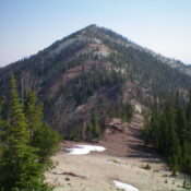
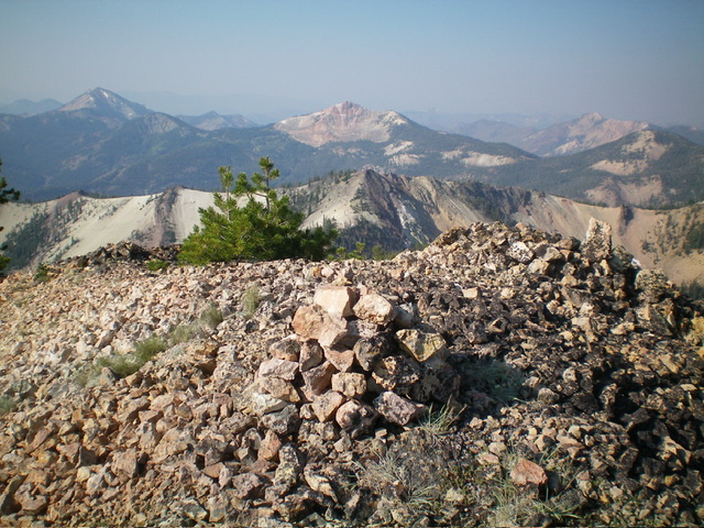
From the 9,260-foot connecting saddle with Peak 9593, head southeast then east-northeast up the ridge crest to Point 9502. The terrain is open and presents no difficulties. From Point 9502, the ridge turns left/north-northeast and descends to a saddle at 9,300 feet. From that saddle, climb north in semi-open ridge terrain with numerous ridge pines and blowdown to work around. The sides the narrowing ridge crest are angled scree/gravel. You must cross one or two patches of relatively easy talus/scree. High up, the ridge crest narrows and steepens. The summit of Peak 9785 is small and showed no signs of previous ascent. I built a nice summit cairn atop the ridge crest high point.
Descent Back to Loon Creek Road, Class 2+
From the summit, retrace the ascent route back to Peak 9593. Descend the west face of Peak 9593 down to the 8,980-foot connecting saddle with Peak 9758. Do not re-climb Peak 9758. Instead, do a somewhat tedious, angled face traverse at or near the saddle elevation through pine forest heading south then southwest then west. Cross a few minor shoulders and gullies to reach a flat, semi-forested bowl at the base of the east side of the south ridge of Peak 9758. You must descend about 30 vertical feet to cross this bowl.
From the flat gravel in the bowl, scramble southwest directly at the forested, 9,220-foot saddle at the base of the south ridge. The terrain is open here so pinpointing it is easy. Getting up to the saddle is another story. Climb southwest, staying left of a forested section that ends at a higher ridge spot than the saddle. Midway up, the face steepens considerably and it is a battle (on all fours) to advance up the steep, loose white gravel. Once on the forest saddle, retrace the ascent route back down to Loon Creek Road and the parking pullout just above the road bend.
Additional Resources
Regions: Eastern Salmon River Mountains->Salmon River Mountains->Southeast Corner Peaks->WESTERN IDAHO
Mountain Range: Eastern Salmon River Mountains
Longitude: -114.6880 Latitude: 44.4846

